


This weekend's weather has been a perfect 10/10 with abundant sunshine, comfortable humidity levels, and temperatures either side of 80 degrees. After a rather comfortable weekend, temps will be on the rise heading into the work week with mid 80s returning on Monday and upper 80s possible on Tuesday.
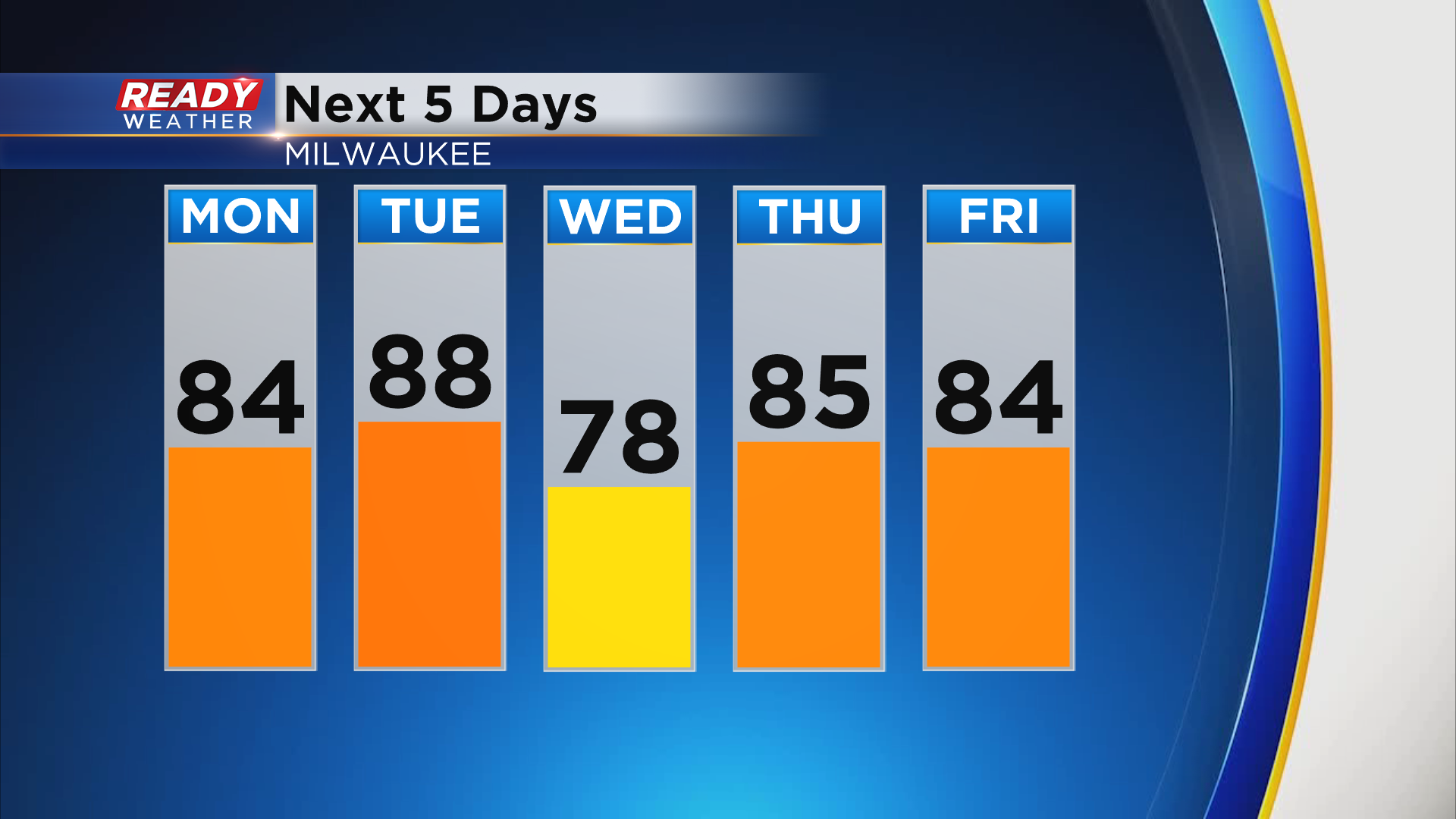
However, a backdoor cold front looks to race down the lakeshore late Tuesday afternoon, which will quickly drop temps into the low to mid 70s.
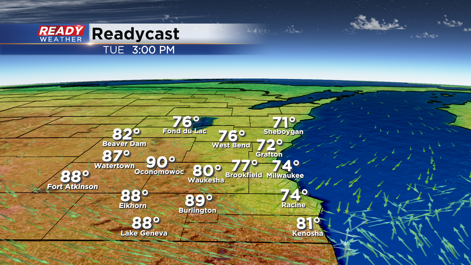
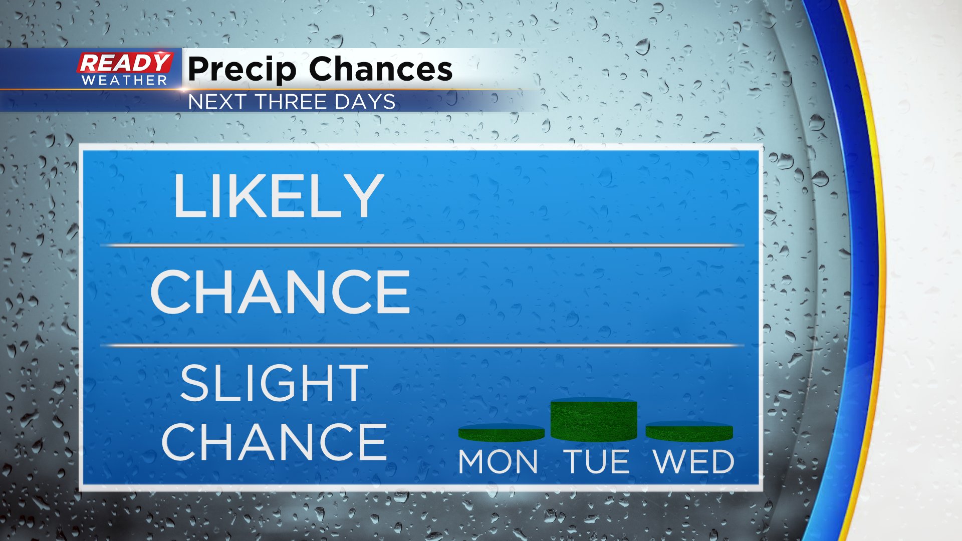
There is a small chance (20%) a shower or storm pops along this front, but we aren't expecting widespread showers and storms. Keep up with the forecast timing if you plan on watching game 6 from the Deer District! This will be our best chance for rain through the first half of the week.
While humidity will remain in check again on Monday, you'll notice it more on Tuesday ahead of the cold front. An onshore wind should keep us comfortable on Wednesday before we turn humid on Thursday.
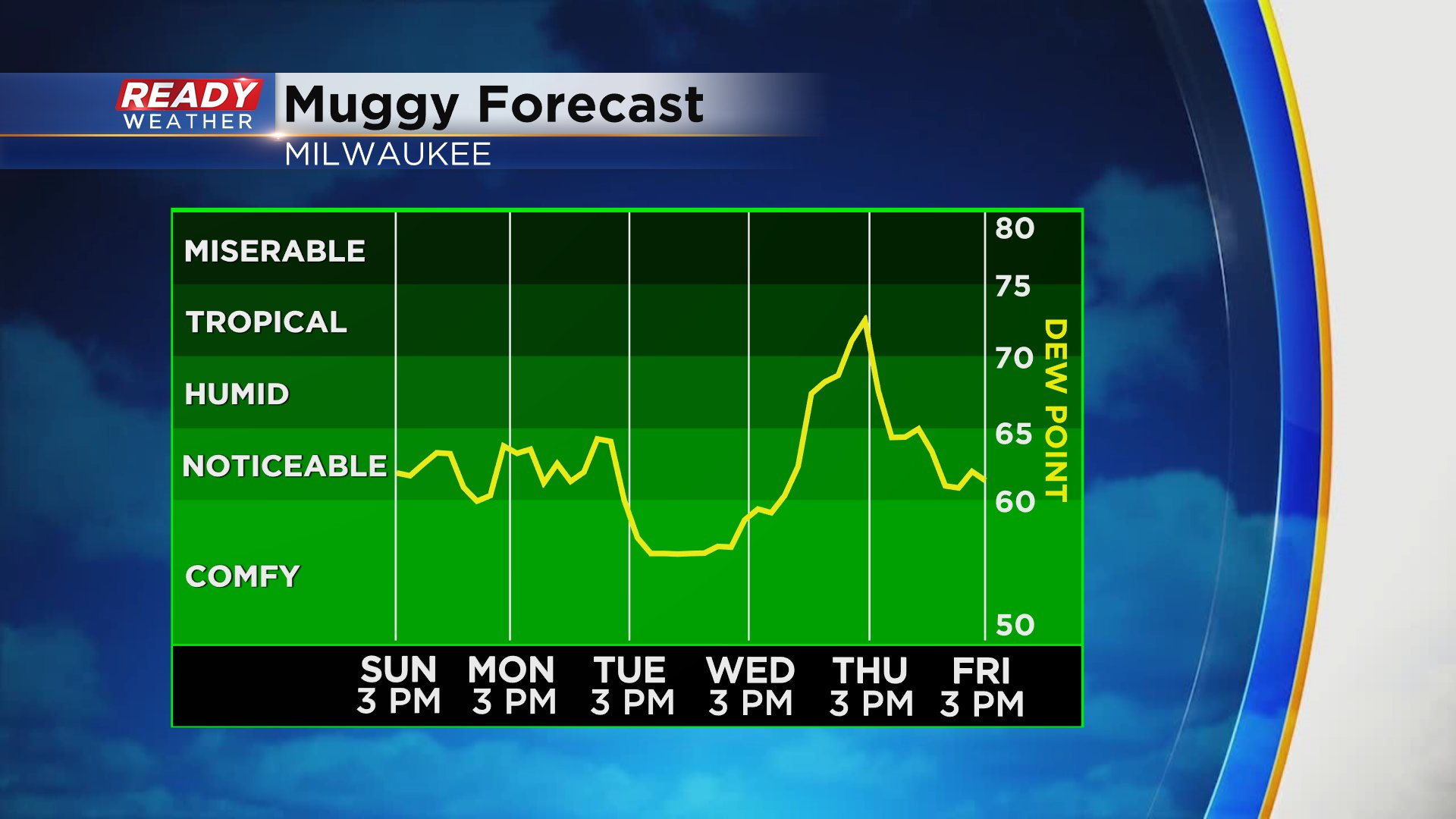
That humidity will lead to a chance of storms on Thursday, with another chance next Saturday. With the humidity around, we'll keep an eye out on stronger storm potential, but it's too early to tell if storms would be severe. Speaking of severe storms, today is the 25th anniversary of the F5 Oakfield tornado.
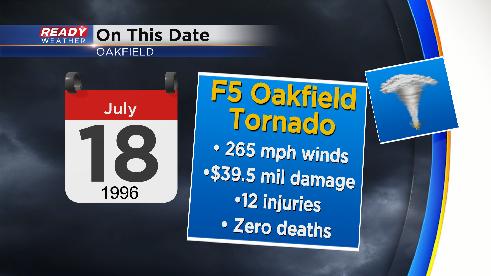
It's still hard to believe nobody died in this tornado that had estimated 265 mph winds. More in depth write up from the National Weather Service in Milwaukee: https://noaa.maps.arcgis.com/apps/MapSeries/index.html?appid=120366c1fd364e8db8cc9ae80d43b845