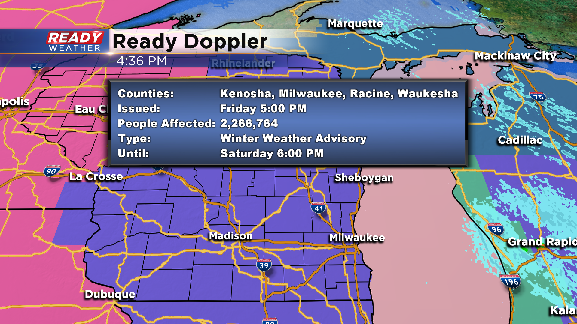
Another weekend storm is on the way!
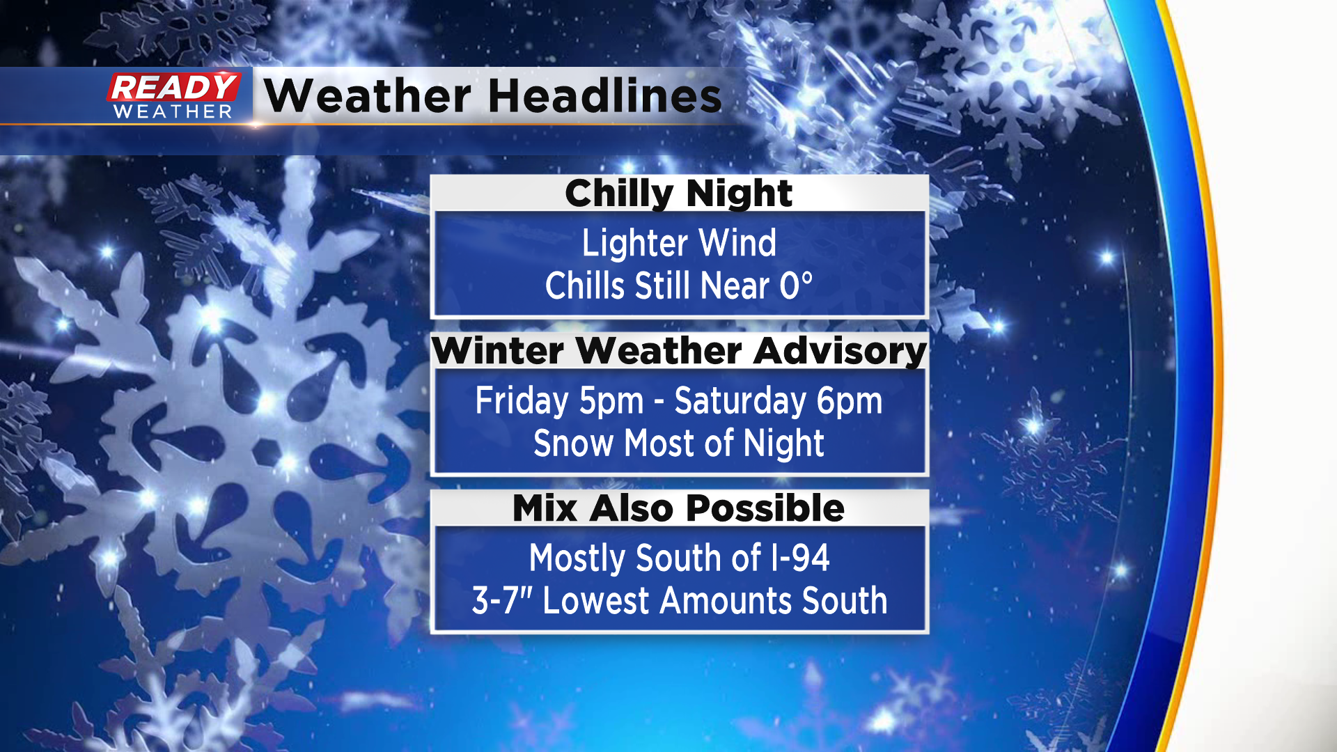
This time around we are calling for snow as we get into Friday evening. The Advisory officially gets underway at 5pm. As the evening unfolds, southeast wind will begin to pick up and gusts could be as highs as 35mph into Saturday morning. While that will provide some reduced visbility and brisk chills, we do not expect the impacts to Lake Michigan like last weekend's storm. That said, there are similarities with this system coming up from the southwest tapping into Gulf moisture so this storm will also have ample juice to work with. But we do expect mostly snow through the night as temps hover near or under the freezing mark. With a continued southeast fetch, temps will rise to the low to middle 30s for a brief time Saturday morning.
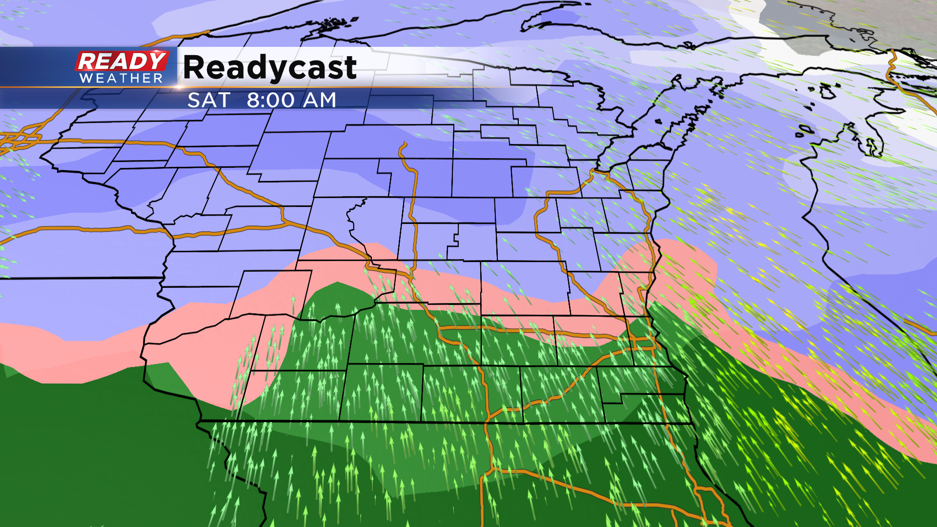
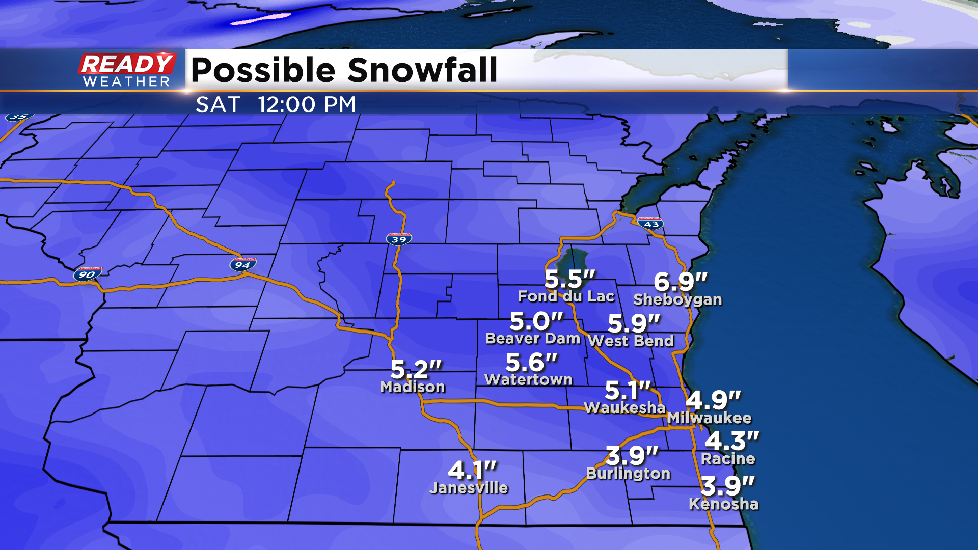
That could change precipitation to a mix of sleet, rain and freezing rain. This scenario looks most likely for places along and south of I-94. While some models keep it all snow, if the mix occurs, expect lower snow totals for southern parts of the viewing area. Right now total snowfall is in the 3-7" range. Check it out:
Here's the bottom line over the next 48 hours.
Download the CBS58 Ready Weather App to stay up to date with this storm.
I'm meteorologist Rebecca Schuld