Winter Weather Advisory Issued. Snow totals adjusted down slightly.


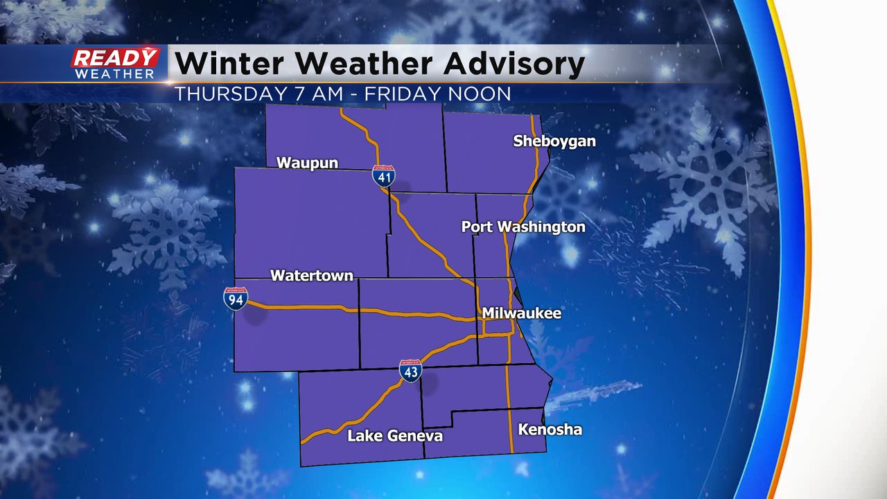
The winter storm watch has been replaced by a winter weather advisory. Model runs haven't been as high with snow totals, so winter storm criteria wasn't likely for our western areas. The advisory starts at 7 am Thursday and goes into Friday morning.
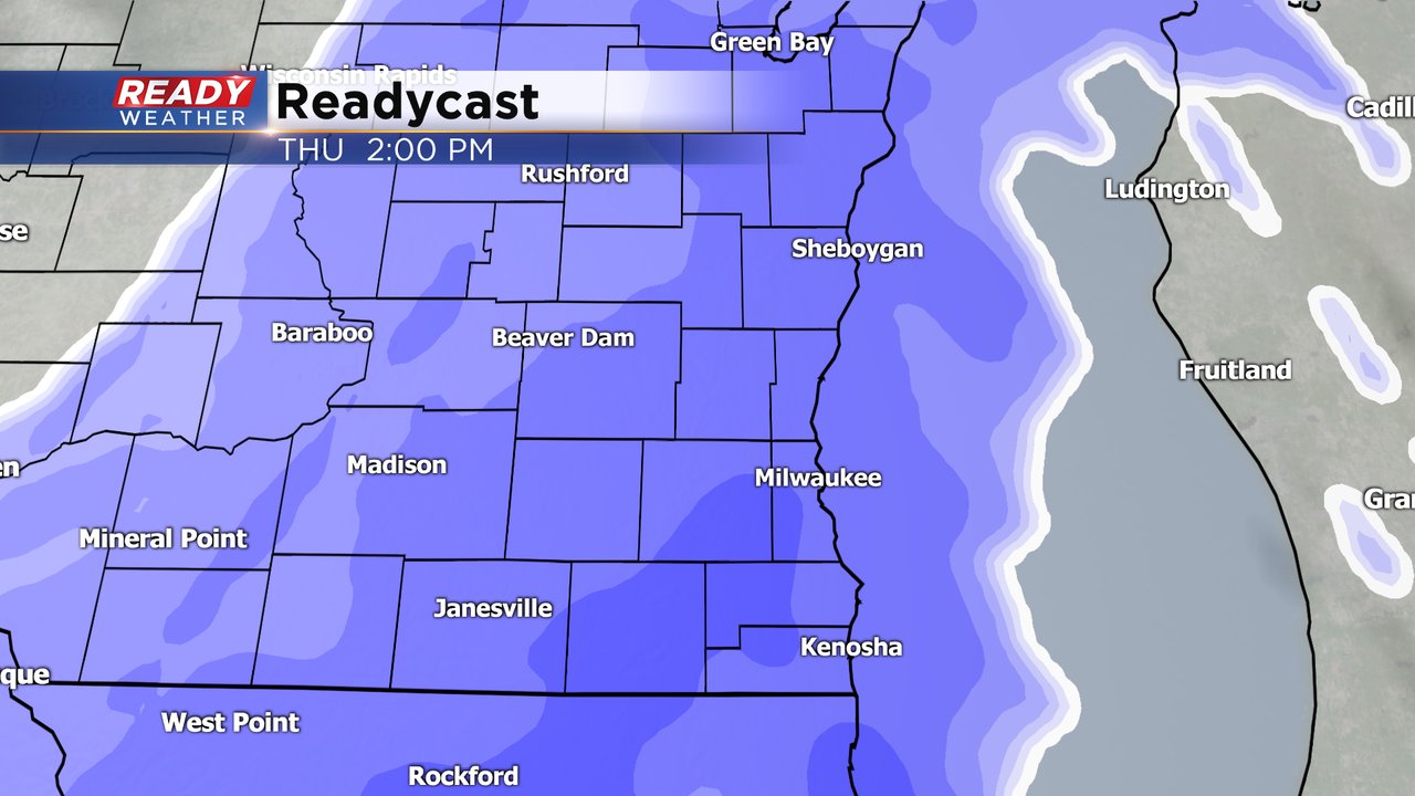
Thursday morning expect a light mix of freezing rain or sleet from 6 am until 11 am. That precipitation will quickly turn over to snow around lunchtime. Snow is likely Thursday afternoon into the evening before tapering off closer to midnight.
2" to 3" are possible near the lakefront. Western areas will have a better chance for 3" to 6" of snow.
_____________________________________________________________________________________________________________
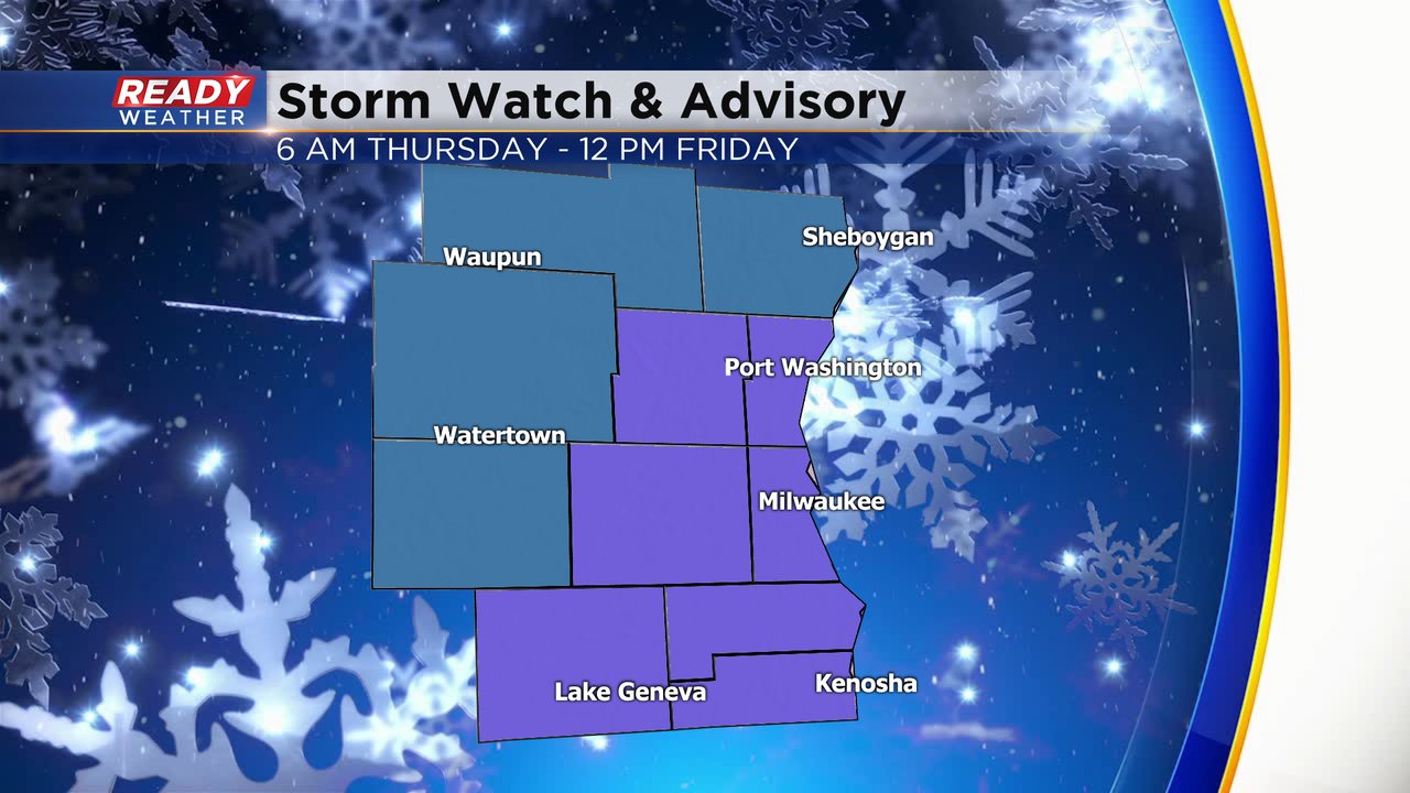
Our snowy stretch of weather continues Thursday with another round of snow this time starting out as a wintry mix. A winter weather advisory and winter storm watch have already been issued ahead of the storm. The advisory is for our eastern and southern counties: Ozaukee, Washington, Milwaukee, Waukesha, Walworth, Racine and Kenosha. The winter storm watch is for our northern and western counties where snow totals may be a bit higher: Sheboygan, Fond du Lac, Dodge and Jefferson Counties. The counties under a winter storm watch could be upgraded to a Winter Storm Warning Wednesday afternoon.
The precipitation starts as a light wintry mix Thursday morning. A few roads could have some slick spots for the morning commute but widespread issues are not expected. Some freezing rain, drizzle, sleet, rain and snow are all possible.

Any wintry mix will switch to just snow by late morning or noon at the latest with heavy snow expected most of Thursday afternoon and evening. The Thursday evening will likely be pretty rough with at least a couple inches on the ground in many spots.
ecome a little bit lighter Thursday night into Friday morning but some snow showers could last through the Friday morning commute. Snow totals will be a little less lakeside and south so the areas that got walloped last weekend won't get as much with 2-4" expected. Inland, western and northern counties will see a bit more with 4-7" there. Central and Northern Wisconsin will get there first decent storm of the season with 7-10" in the forecast there.

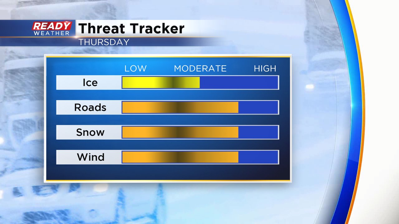
The threats for this storm will change as the storm develops. A little bit of ice will be the biggest threat for Thursday morning. As the snow really starts coming down in the afternoon and evening the impact on the roads will be the biggest concern. The wind will increase throughout Thursday then really get strong Thursday night into Friday so blowing snow and bitter wind chills will become the big threat as the storm wraps up.
Download the CBS 58 Ready Weather app to track the radar and see the changes in the forecast.