


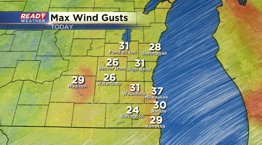
The sunshine felt great across the Badger state today, but the blustery wind gusting between 25-30 mph made it feel like the teens all day despite temps in the low 30s. Milwaukee had the strongest wind gust today at 37 mph.
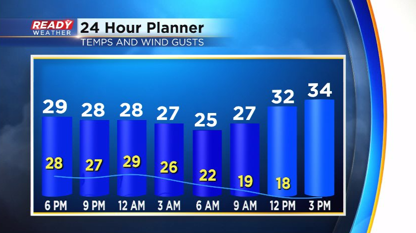
That southwest wind will continue to gust between 20-30 mph through tonight, tapering off Sunday morning behind a cold front.
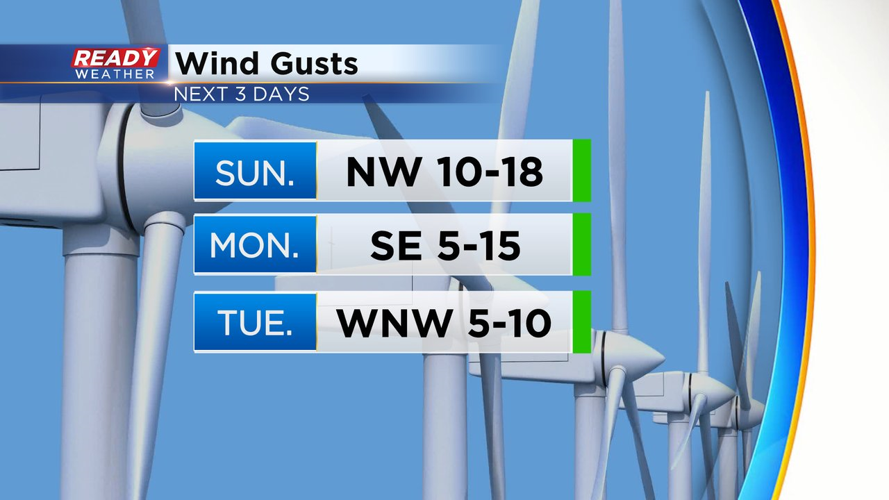
Thankfully we'll get a break from the gusty winds for a few days with winds generally between 5-15 mph to start the new week.
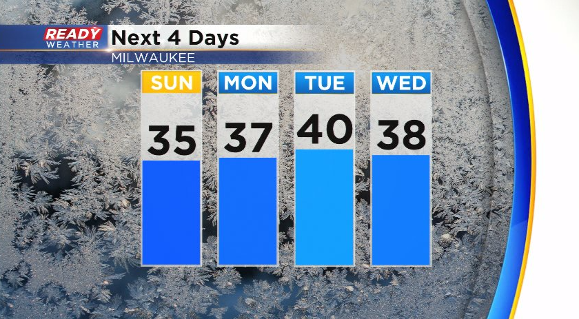
Despite the cold front moving through early Sunday, temps are expected to be a couple degrees warmer than today, warming back into the 30s area-wide. Temps will continue to rise into the mid 30s to around 40 during the first half of the week.
There will be a few very weak clippers moving through during the first half of the week, which may trigger a few flurries at times, but no accumulation is expected. Download the CBS 58 Ready Weather App to see if temps will continue to warm through the second half of the week.