Wind Dies Down but Warmth Continues
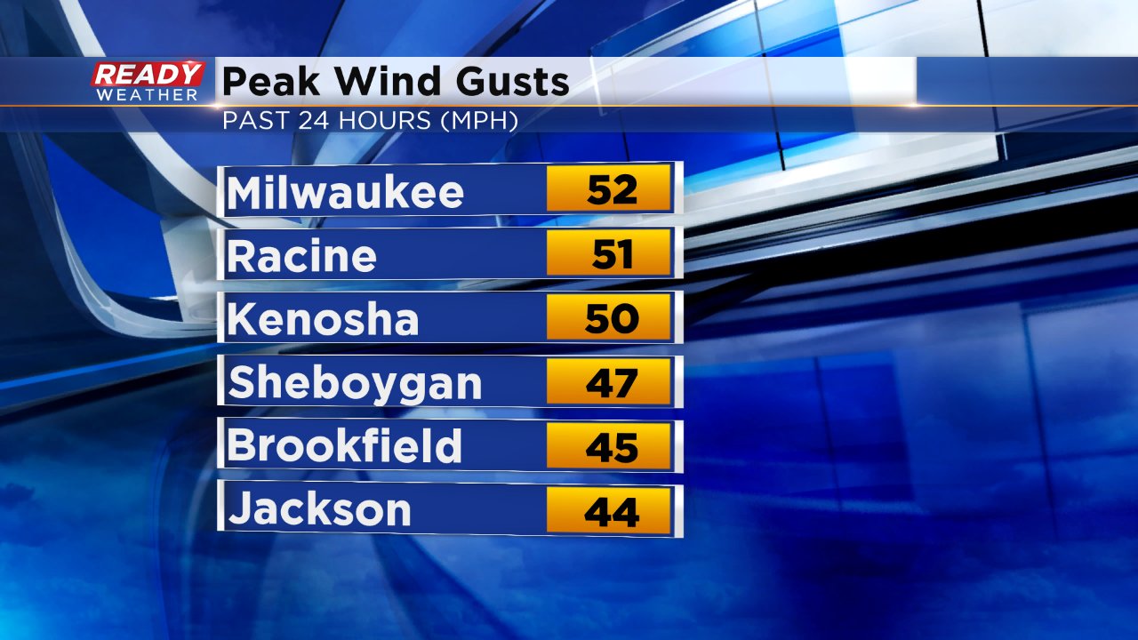
Although some woke up to slick roads Sunday morning the big story was the wind. A northwest breeze gusted above 50 mph in some spots Sunday afternoon and everyone had wind gusts of at least 35 mph.
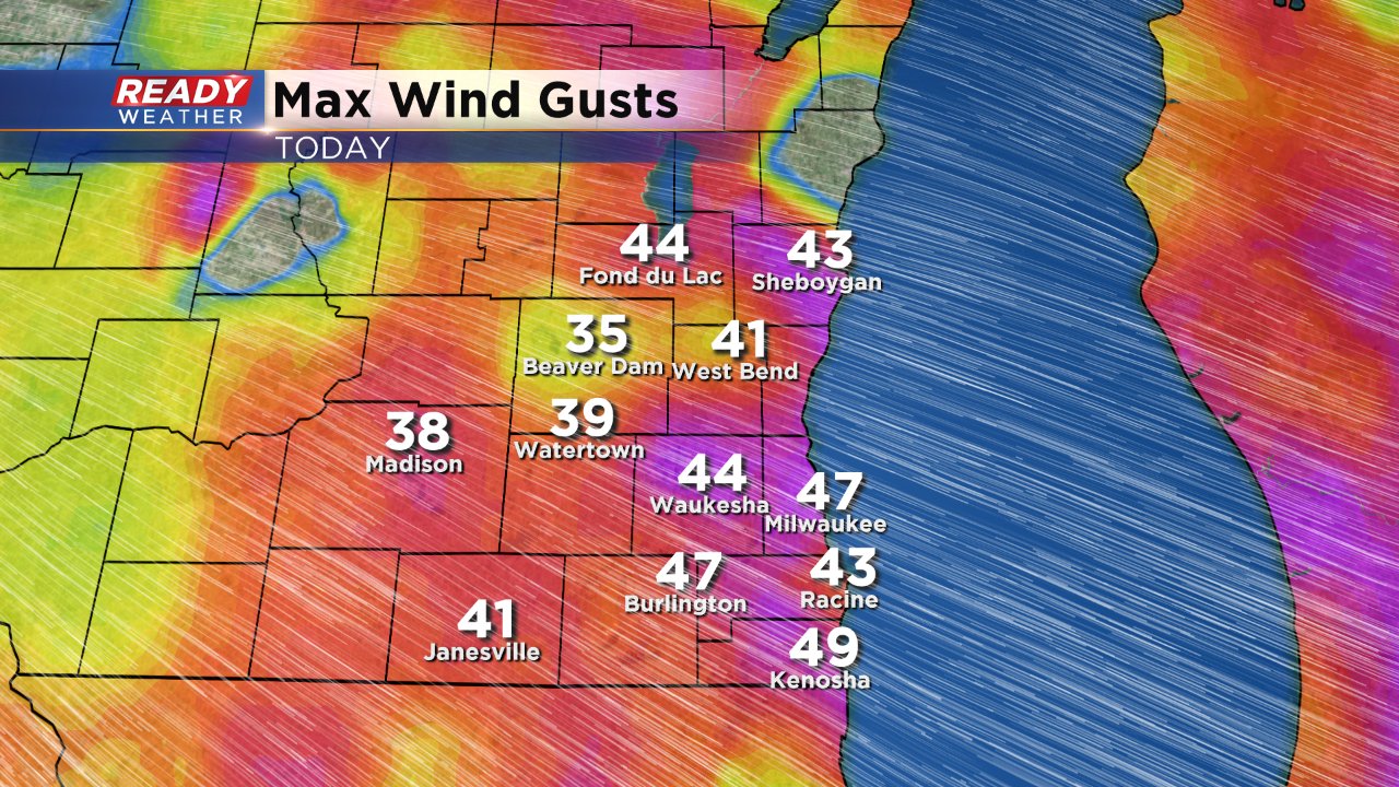
The reason for Sunday's strong wind was the combination of a strong low pressure to our north (which brought us the morning wintry mix) and a strong high pressure to our southwest (which brought us the afternoon sunshine). When you have such strong high and low pressure so close together it creates what's called a "tight pressure gradient" forcing the wind to become very breezy. The wind is going to stay breezy Sunday night before becoming light during the day on Monday as high pressure arrives overhead. Another breezy day may be on tap on Tuesday.
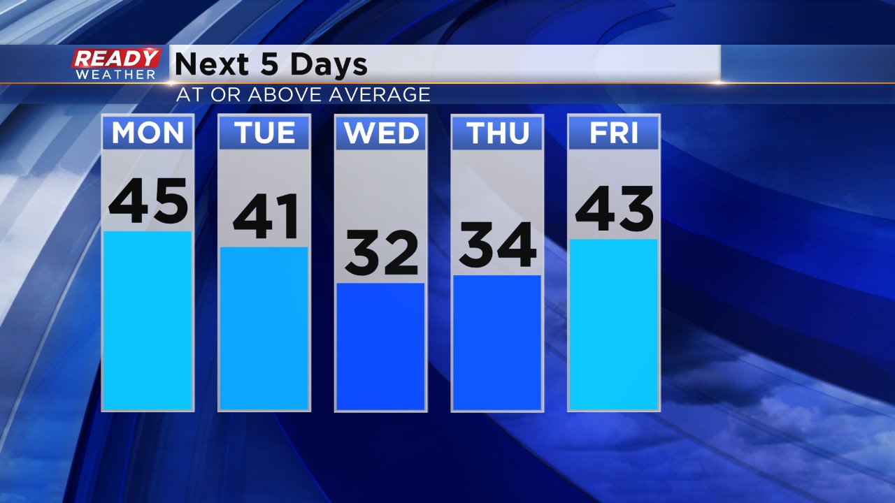
Temperatures have also been very mild lately with a lot of upper 30s and 40s instead of the typical upper 20s and lower 30s. Every day in the upcoming forecast is at or above-average. Wednesday's high of 32 is right at average but everything else is well above.
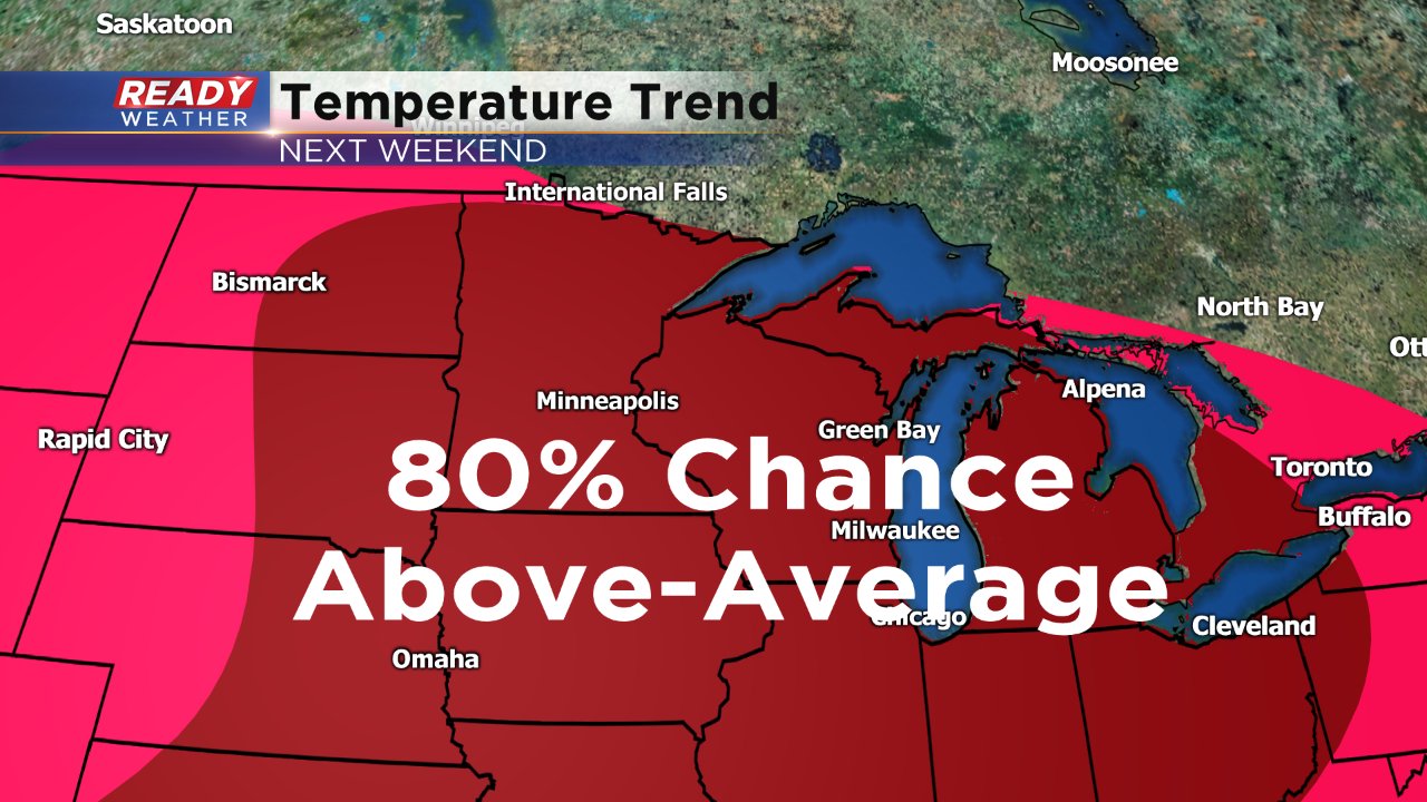
The mild air isn't confined to the next five days shown above. Next weekend may be the warmest temperatures since a rogue 56° in the middle of January. Right now, the Climate Prediction Center has all of Wisconsin and pretty much the entire Midwest in an area where there is an 80% chance of above-average temperatures. 50s may be possible.
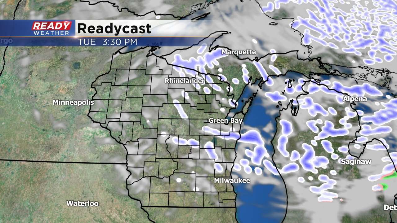
PS. If you are looking for some snow we have one chance in the whole 10-day forecast and it comes in the form of flurries on Valentine's Day.