Wind Chill Warning starts at 6 p.m., the coldest air since 1996 arrives tonight

-
2:08

Natalie’s Everyday Heroes update: Tosa teen introduces bill...
-
1:49

’Glad it didn’t hit the house’: Blizzard causes downed...
-
4:18

Shoveling and heart health: Who’s at risk and what to look...
-
1:54

Kewaskum’s Jordan Stolz returns home after historic Winter...
-
1:29

Snow covers roads as Milwaukee’s DPW crews battle high winds
-
2:44

The Gathering returns to Potawatomi Casino Hotel March 21
-
2:21

Thousands of We Energies customers remain without power after...
-
2:23

Travelers to and from Milwaukee face cancellations and delays...
-
4:10

Winter Weather Advisory until 9 pm.
-
4:25

ABCDog Walkers+ talks about dog walking and training
-
4:26

GMAR chair discusses home sales, condo buying during housing...
-
2:50

West Bend snow removal crews prepare for significant snow

Arctic air will quickly move across southeastern Wisconsin this evening. Temperatures by 10 pm will drop between -10 to -20! The winds tonight through Wednesday will remain up between 15 to 25 mph.
A low near -20 is possible for Wednesday morning; moreover, wind chills for Wednesday morning will drop to -50 below. This arctic air is extremely dangerous. Please check on elderly and bring in outdoor pets and animals!
The record low for tonight is -24!
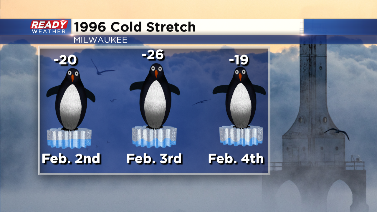
While 2014 had some very cold temperatures, this outbreak of cold is closer to the outbreak of February 1996. The all-time record low was set on February 3, 1996 at -26. It doesn't look like Milwaukee will get that cold but we will make a run at it.
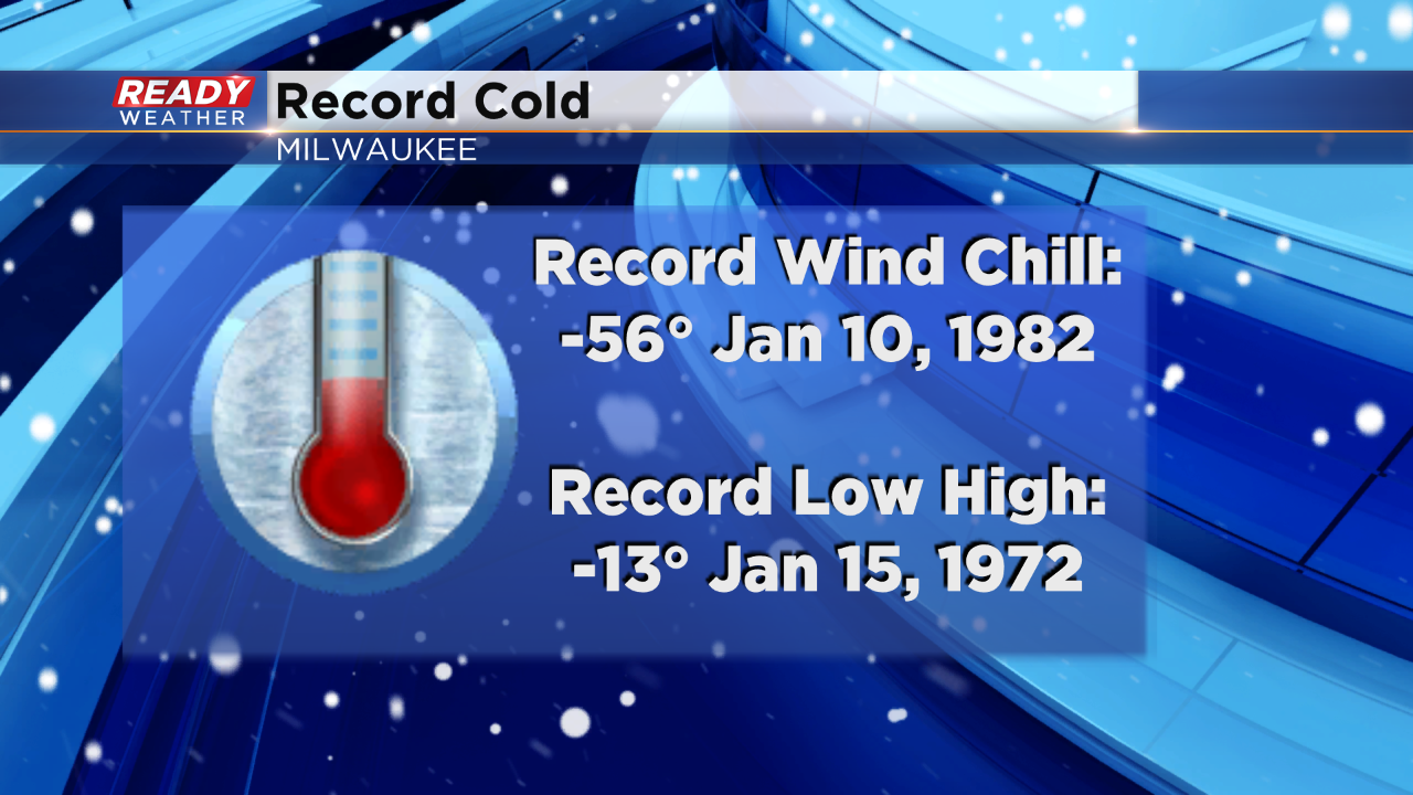
The coldest low maximum is -13! Wednesday afternoon we are expecting a high of -10, so we will monitor that record as well.