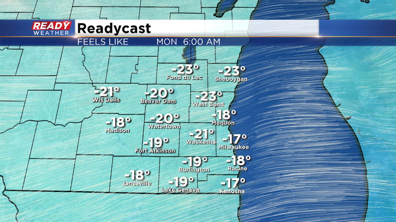
Wind chill advisory issued, records in jeopardy as cold air returns


We are getting ready for another big push of bitter cold. Temperatures on Sunday stayed in the teens with wind chills hanging out on either side of 0° most of the afternoon due to a breezy wind out of the northwest. In anticipation of dangerous cold, a wind chill advisory has been issued for all of southeast Wisconsin from 10 p.m. Sunday night until 10 a.m. Monday morning.

During the advisory wind chills could get close to -30° for some north and western communities and just under -20° for lakeside spots.
Temperatures have trended a bit warmer Monday night into Tuesday morning due to the threat of clouds and a few snow flurries. That warming trend should keep wind chills just warm enough for a wind chill advisory to not be needed for Tuesday morning but it will still be cold with wind chills from -10 to -15° for most.

We are still watching records closely starting Monday morning. The best chance for a broken record will be Monday's high temperature where the coldest high temp on record for March 4 sits at 12°. The current forecast is -11°. Record low temps for Monday will get close and Tuesday's 129-year-old record low of -7° looks safe too.
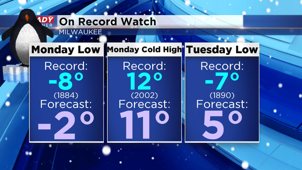
In case you're curious, the coldest temperature ever recorded in Milwaukee in the month of March is -10° which happened on March 1, 1962.
Download the CBS 58 Ready Weather app to see when the 30s return.