Wednesday's Severe Weather Update

The severe weather risk hasn't changed much from the morning. The SPC continues to keep a moderate risk for severe weather across Walworth, Kenosha, Racine, and southern Milwaukee and Waukesha counties. This event is going to hinge upon where the warm front sets up. The last time a moderate risk was issued was June 30th, 2014!
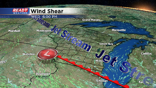
The afternoon model runs keep the warm front just over the border across northern Illinois. If the warm front stays south, the major severe weather will stay away from our area. Right along and south of the warm front is where the tornadic storms will develop. Wind shear will be maximized with a northwest wind aloft, compared to a southeast wind at the surface. Wind shear is the necessary ingredient to get the storms to rotate.
The timing for severe storms will be from 4 pm till 10 pm. We are expecting scattered showers and storms during the morning commute. Some of those storms could produce small hail and gusty winds. We expect those storms to clear by the afternoon to allow temperatures to warm into the 70s.
Storms that fire within the warm sector will be rooted within the boundary layer, and pose the greatest risk for damaging winds, large hail, and tornadoes. A few strong tornadoes will be possible, so we need to watch Wednesday evening very closely for you.
Check back for more weather updates on the CBS 58 weather blog!
