Warmest year on record to date continues with more warmth this week


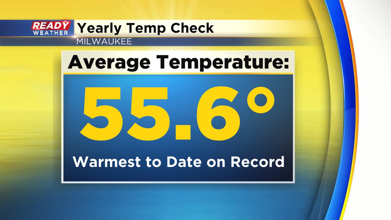
2024 has been a warm year! Overall, the average temperature from January 1st through October 20th is 55.6 degrees, but when you put that into context it is the warmest year to date! We still have two and a half months of the year to go, but 2024 is on track to surpass 2023 as the warmest year on record.
The warmth stays well in place on Monday with highs around 80 degrees. The wind will stay out of the southwest continuing to bring in the warm air. The record high for Monday is 84 degrees set in 1947, so Monday will get close to records!

We drop ten degrees Tuesday but still plenty warm in the low 70s and even the low 60s on the way for the second half of the week are still above average!

With the cooler temps and a front on the way heading into Wednesday, we could see a few raindrops. Accumulating rain doesn't look likely but a few isolated showers or sprinkles are not out of the question for Tuesday, mainly in the afternoon.

Download the CBS 58 Ready Weather app to track the temps through the end of the month!