Warm and humid conditions return to start the work week
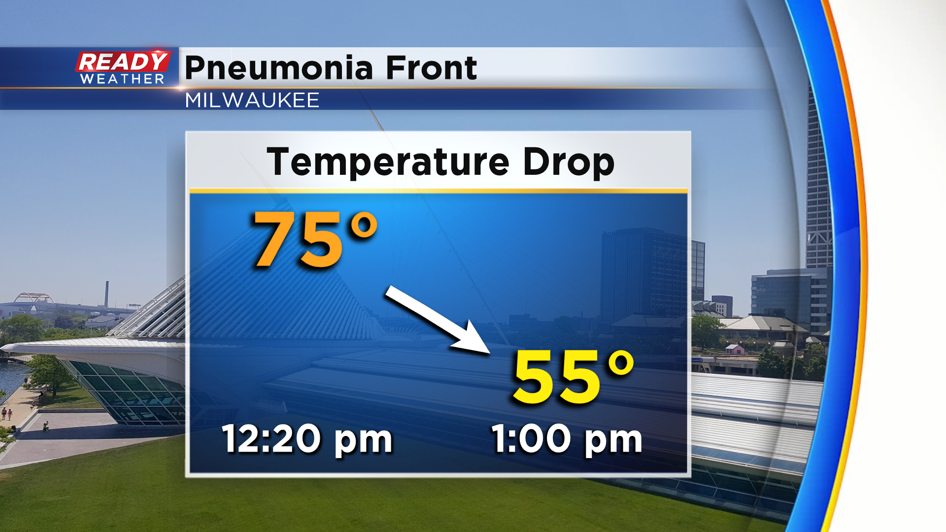
Temperatures topped out in the 70s across southeast Wisconsin today before the pneumonia front came through. The front dropped Milwaukee's temp from 75° to 55° in the span of 40 minutes.
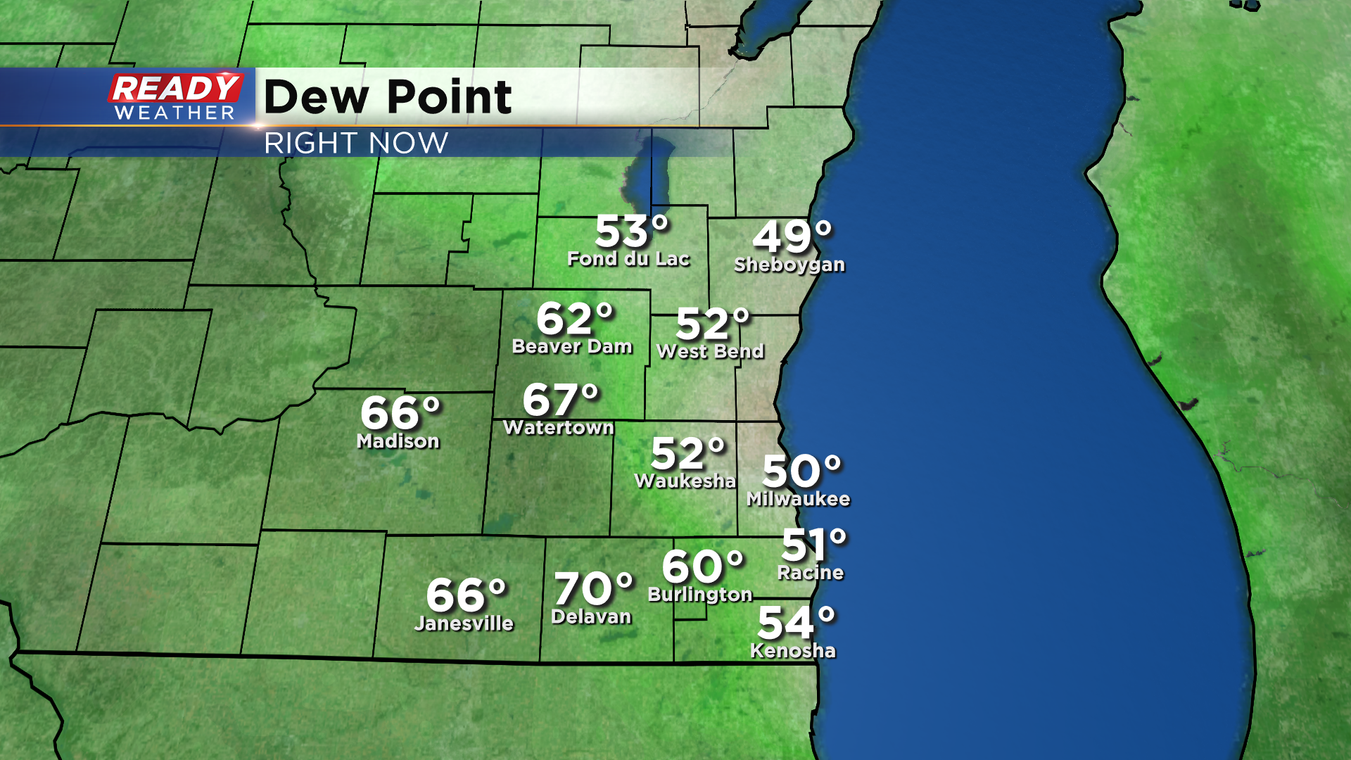
The front has brought a break from the humid conditions as dew points have dropped back to comfortable levels behind the front, but the humidity won't stay away for long.
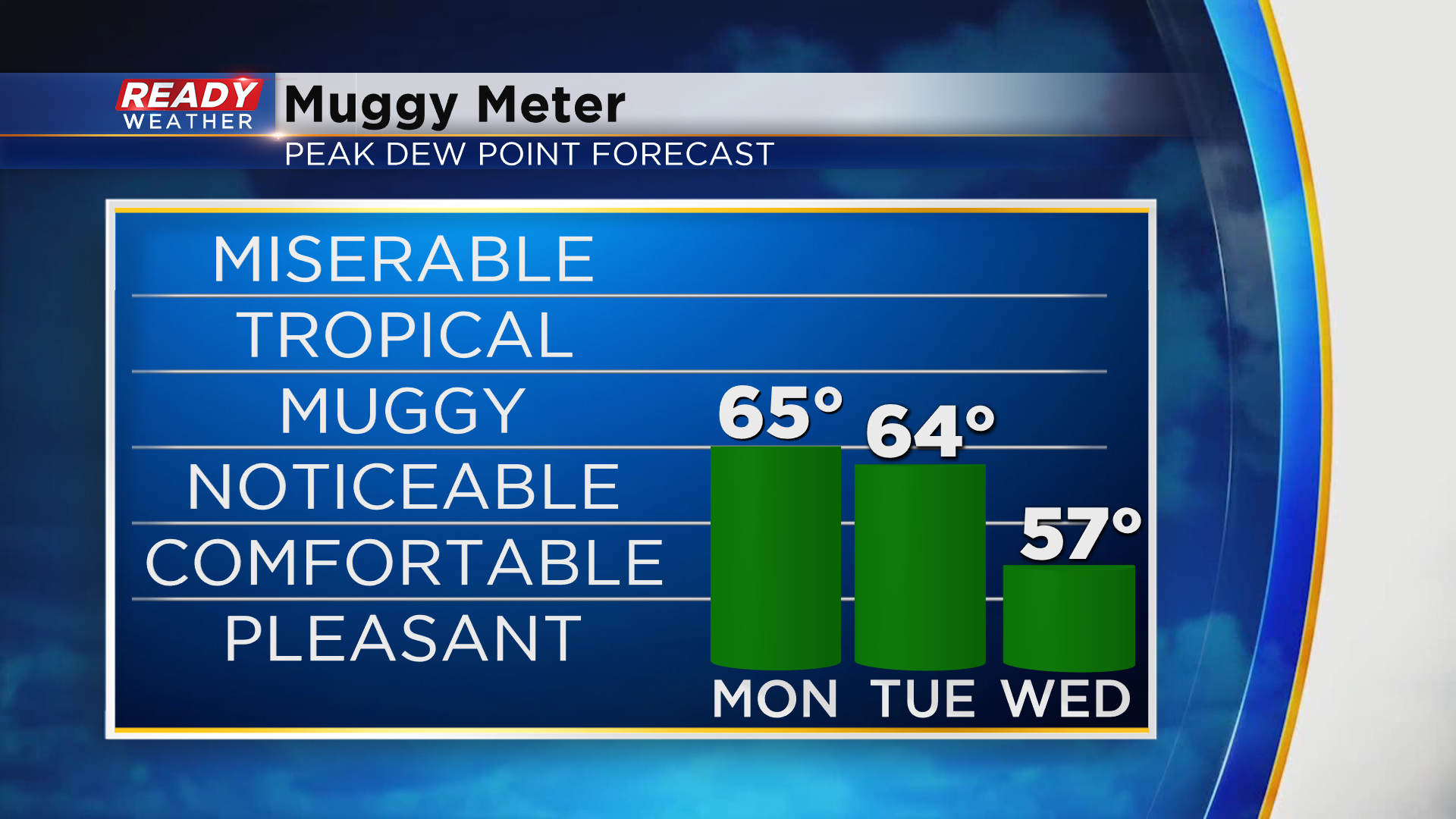
Today's front will work back northward Monday morning as a warm front, allowing dew points to climb back into the mid 60s through Tuesday. A cold front moving through Wednesday morning will allow for more comfortable air to filter back in.
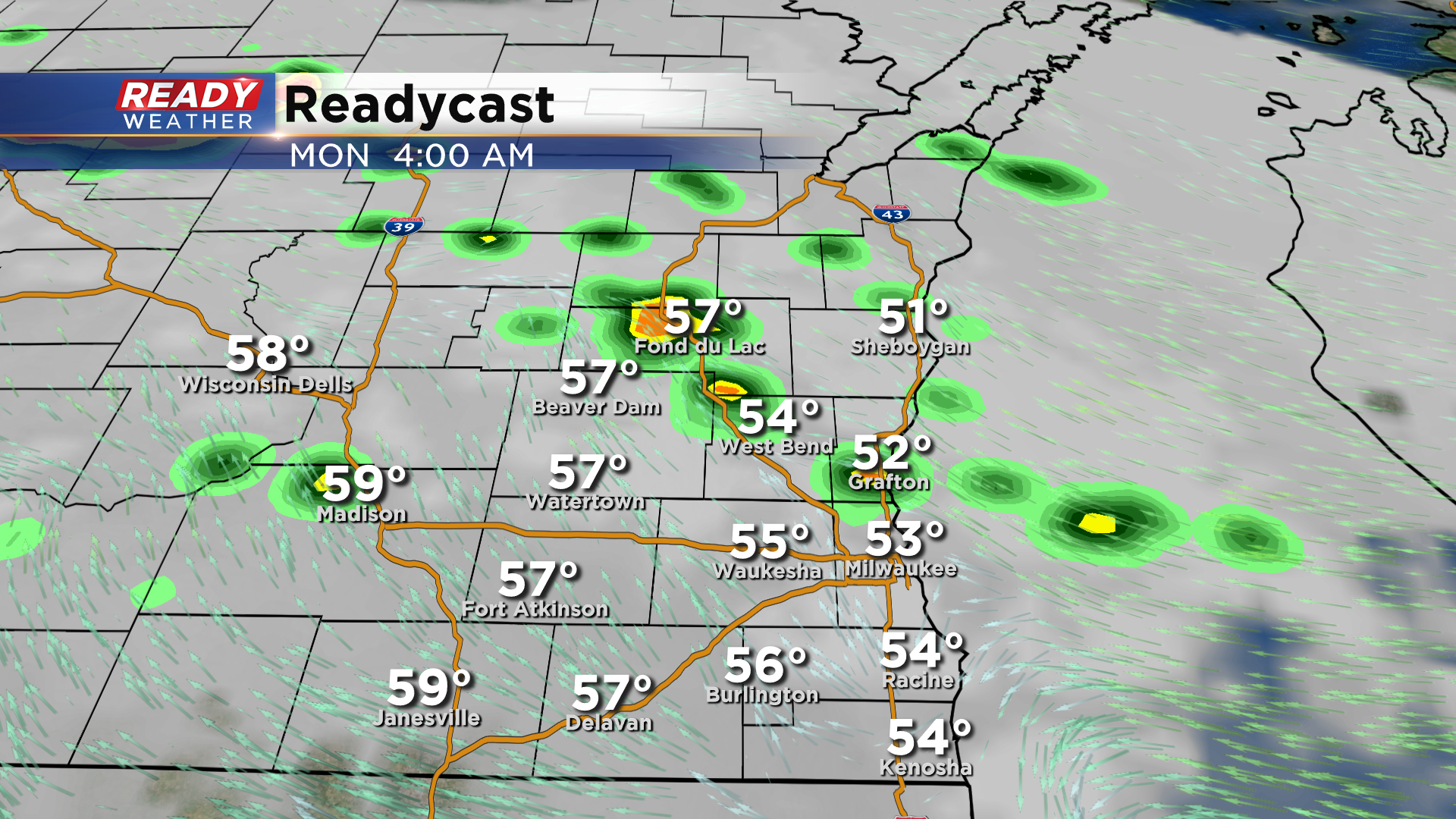
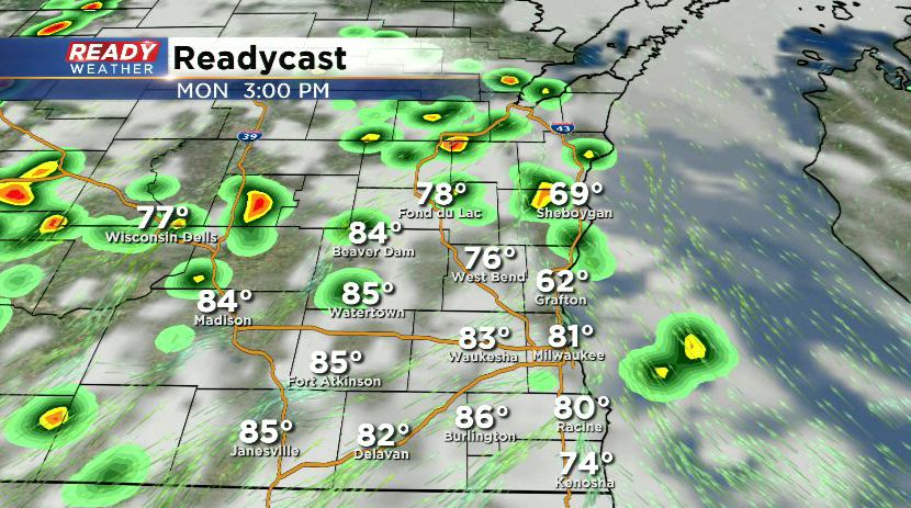
With the humidity around and temperatures in the 70s and 80s, we'll have chances for storms at times to start the work week. The ongoing showers and storms will taper off late this evening, but a few isolated shower will be possible early Monday morning as the front starts to move northward.
Fog and low clouds hang around until the front passes mid to late morning with a few peeks of sun expected Monday afternoon. We can't rule out an isolated pop up shower or storm Monday afternoon, but the better chance will be across central Wisconsin. The peeks of sun and SW wind will help temps warm back into the upper 70s to low 80s besides lakeside areas that may have an onshore wind.
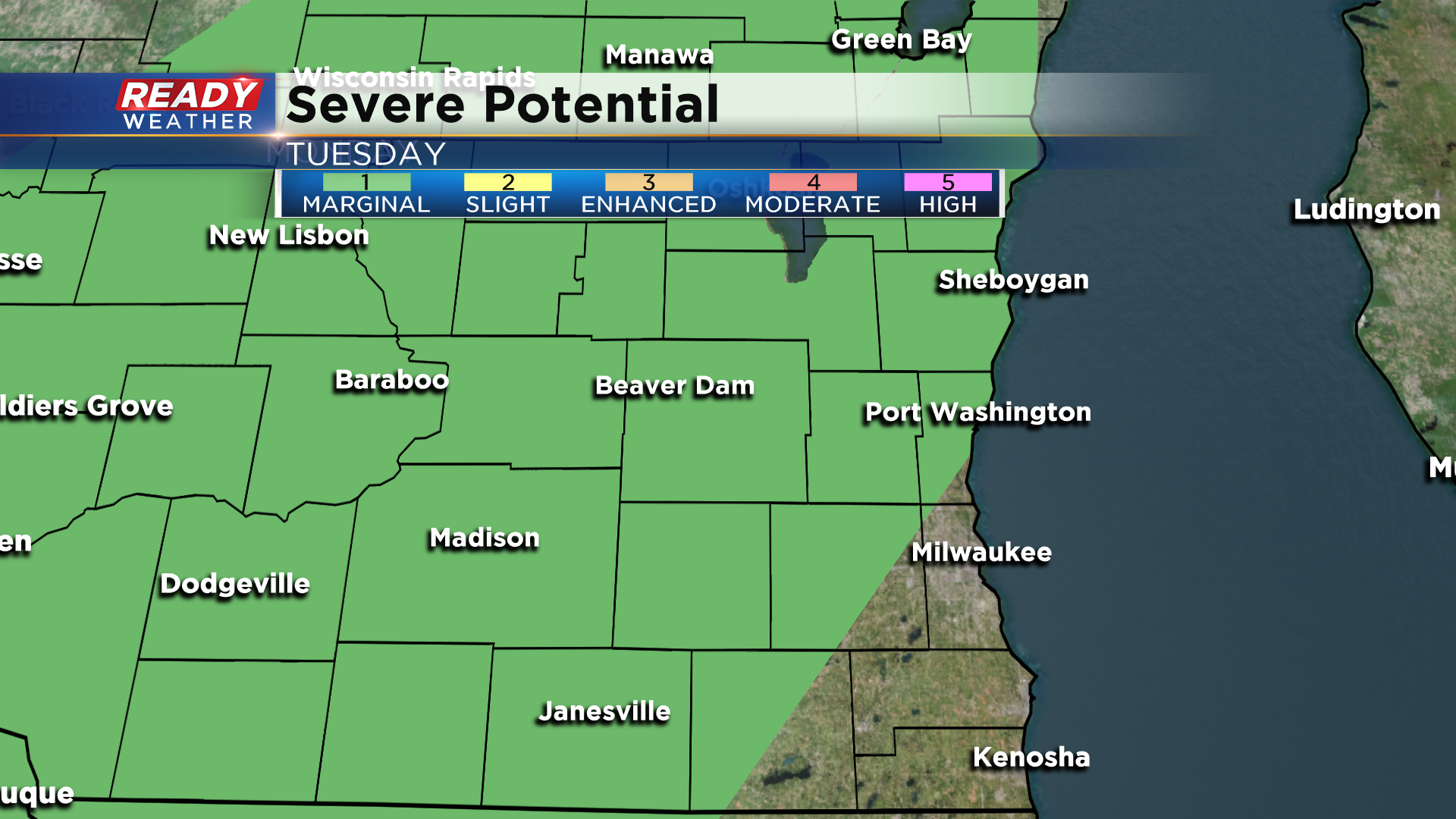
A better chance for showers and storms will arrive on Tuesday, especially later in the day as the cold front moves into the area. With temps expected to be in the 80s and humid conditions in place, we could have a few strong to severe storms. A majority of the area is under a level 1, Marginal Risk, for severe storms on Tuesday.
Temps will still make it into the 70s on Wednesday, but then much cooler weather will settle in for the second half of the week. Download the CBS 58 Ready Weather App to track the storms over the next few days and to get warning sent directly to your phone.
