Late Evening Update: Snow will be done by 10 pm


Updated: Friday, February 18th, 2022 9:10 pm:
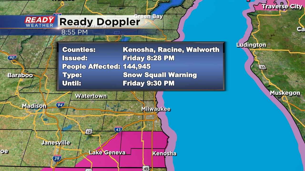
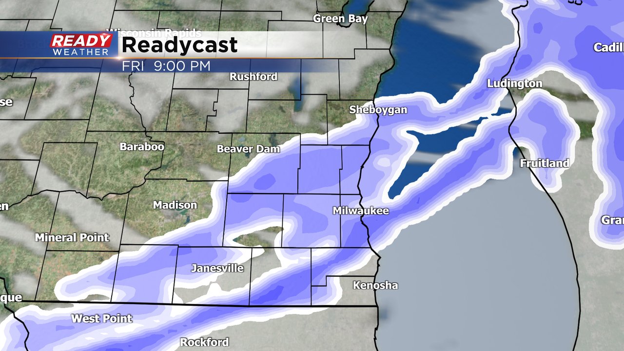
A heavy burst of snow has moved across most of southeastern Wisconsin. The last of the warnings go until 9:30 pm for Walworth, Racine, and Kenosha counties.
The line of intense snow squalls is moving southeast at 45 mph. The snow should completely exit the area by 10 pm. Expect very slow travel and brief blizzard-like conditions as it moves through.
Up to 1" of accumulation is expected. It's more about the visibility and bad road conditions than the total accumulation.
A wind advisory remains in effect until 4 am. Wind gusts to 50 mph are possible. Wind chills overnight will fall between -10 to -20.
______________________________________________________________________________________________________________
Updated: Friday, February 18th, 2022 4pm:
While the initial line of snow is still on track to move through over the next 1-3 hours, the more intense snow squalls are forming along the cold front itself in west central Wisconsin. A Snow Squall Warning is currently in effect near Black River Falls and La Crosse.
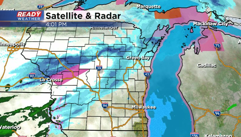
Visibility is down well under a quarter mile in the most intense snow squalls, and they even produced a 55 mph gust in Eau Claire as they moved out!
If the line of intense snow squalls holds together, it would move through southeast Wisconsin between 7-9pm. Expect very slow travel and brief blizzard-like conditions as it moves through.
---------------------------------------------------------------------
Temperatures are starting out cold this Friday morning but the wind isn't too strong....yet. A wind advisory has been issued for all of southeast Wisconsin from 2 PM Friday through 4 AM Saturday. During that time wind gusts could reach 40-50 mph.

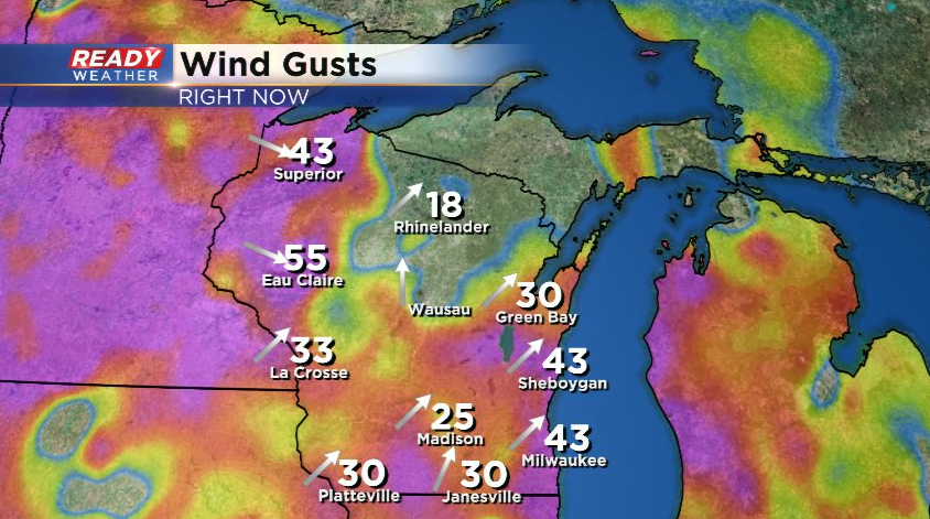
After a light wind Friday morning we will start to see wind gusts above 30 mph Friday afternoon. The strongest wind will likely arrive late Friday evening into early Saturday with frequent gusts above 40 mph to 50 mph. The wind comes down a bit late morning Saturday but still stays blustery with gusts above 20 mph Saturday afternoon. Sunday will also be a windy day with wind gusts between 30-40 mph.
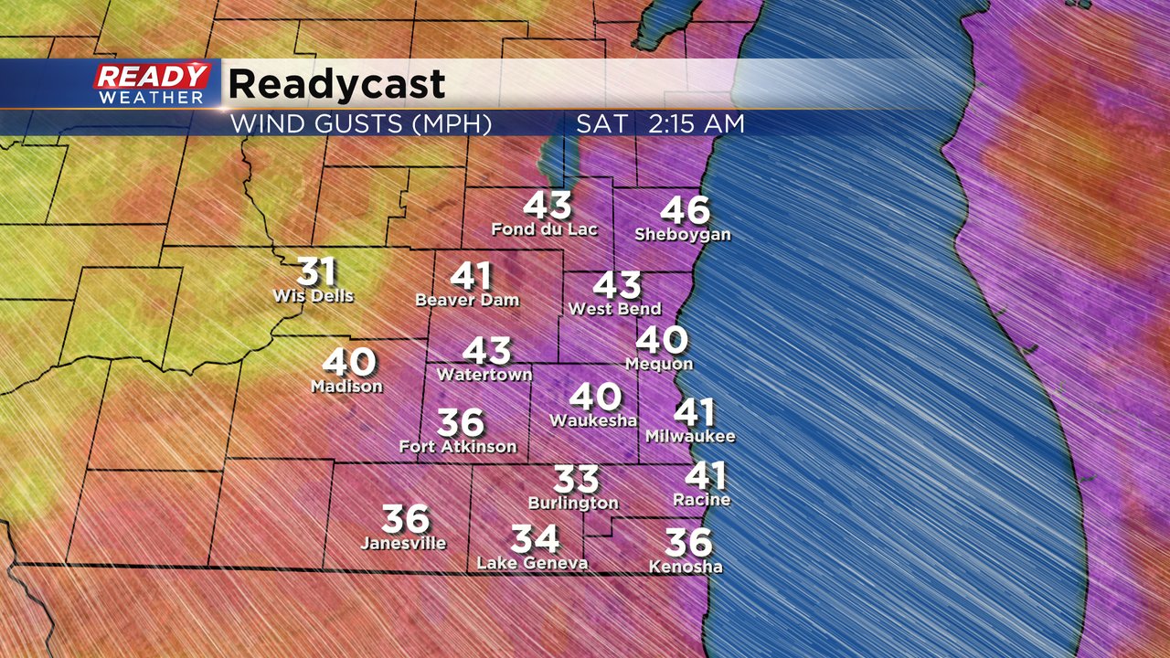
With the strong wind and colder temperatures surging in Saturday morning wind chills will be below-zero for everyone. The sustained wind could be around 20-30 mph Saturday morning resulting in wind chills easily in the -10 to -20 range. By Saturday afternoon the wind chills will rise above-zero once again and stay there through Sunday morning as warmer air returns.

The dropping temperatures Friday night are thanks to a fast moving cold front that rolls across Wisconsin Friday afternoon and evening. This cold front will likely be accompanied by a band of snow. The amount of snow is not concerning but the intensity at which the snow comes down, combined the wind gusts to 40 mph, could result it rapidly dropping visibility. This will likely impact the evening commute especially west and north of the Milwaukee metro.
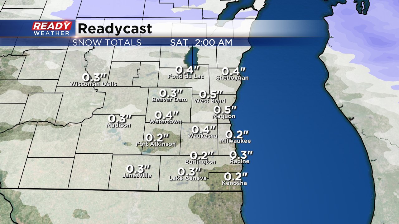
The amount of snow is pretty light with a few tenths to a half inch for most of the area. The intensity of the snow is the concern and the National Weather Service has already mentioned the possibility for Snow Squall Warnings which would come as alerts on your phone recommending you avoid travel as the squall moves through the area.
Download the CBS 58 Ready Weather app to track the snow and wind.