5 PM Afternoon Update: Storms fire this evening, some could turn severe!


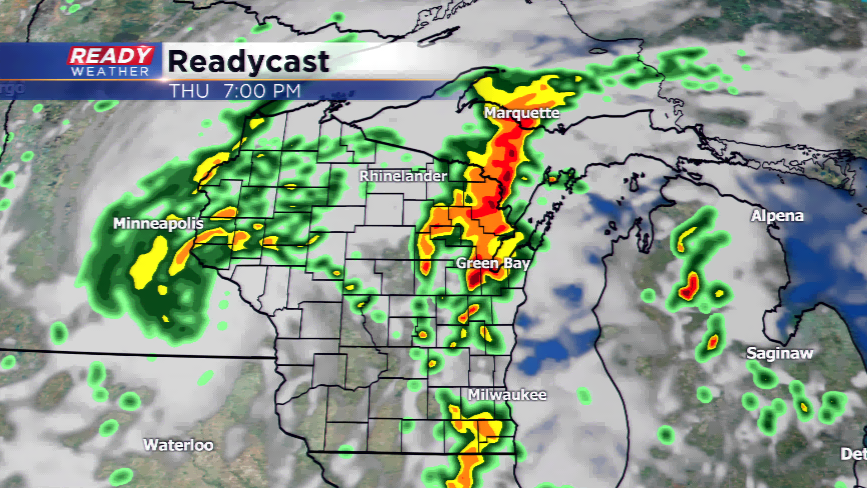
Update (5 PM) We should get a break in the storms through about 7 PM; however, more storms are expected to develop between 7 PM and 10 PM.
Storms that do fire could produce quarter hail, gusty winds, and there is still a very isolated tornado risk early in the evening.
Showers and storms should exit the area after 10 pm.
UPDATE (3 PM) Our first wave of showers and storms continues to move across southeastern Wisconsin this afternoon. Some of the storms had some hail and brief gusty winds.
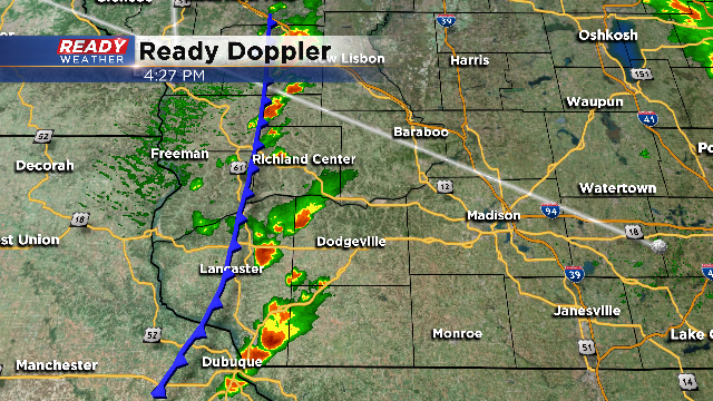
Our attention now shifts to the west. Take a look at the graphic. The actual cold front remains across Iowa and Minnesota. Storms will quickly fire ahead of the front in an unstable atmosphere. The question for our area, will the atmosphere recover from the morning and afternoon convection?
Our atmosphere has been worked so far this afternoon, so we will have to wait and see if the storms out west will maintain their strength as they move into our area. The next round will likely move through between 6 PM and 10 PM.
UPDATE (10am) Scattered showers and thunderstorms are moving through SE Wisconsin right now. Small hail, gusty winds, and lightning will be possible within these cells. Make sure you head indoors if you encounter the storms. The Storm Predictoin Center did update the forecast and now ALL of the CBS58 viewing area is under a *slight* risk of severe weather today.
A strong low pressure system will pivot into the Great Lakes today giving
How much sunshine will the viewing area see today? This is the main question with our severe weather forecasting. Most models are trending to the mostly cloudy sky; however, with any sun today this could lead to more explosive thunderstorms. Look for the storms to develop this afternoon and evening with a few possibly pop
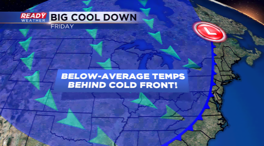
Once the front rolls through later today, the winds will turn out of the cooler direction and usher in Canadian air. Highs will not make it out of the 60s tomorrow with wrap around rain showers. Projected high will be in the mid and upper 60s, the coolest day so far this summer.