


Monday continued our recent trend of gloomy days but at least the rain totals were much lighter than Sunday when spots got up to 7" of rain. Tuesday's rain accumulated to a tenth or quarter inch of rain in many communities. Sheboyan picked up the most.

Some light scattered showers continue Tuesday morning before starting to dry out during the afternoon and evening. Rain totals won't be very high, but any additional rain will prolong our flooding concerns. Up to a quarter inch is possible.

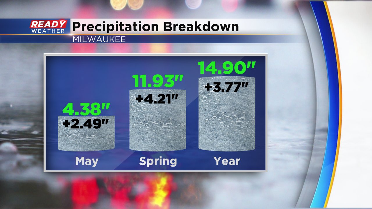
It should come as no surprise after the weekend soaker that we are well above-average on rainfall for the month of May, our spring season and for all of 2020 so far.
There are active river flood warnings in many counties across southeast Wisconsin with a few rivers currently experiencing moderate flooding. Thankfully, many of the rivers are expected to reach their highest levels Tuesday or Wednesday before starting to come down. Here's a list of the latest flood stages:

After Tuesday's lingering rain we are in for a couple of nice dry days with sunshine returning Wednesday and our next good chance for rain not arriving until Sunday. Download the CBS 58 Ready Weather app to track the rain for the holiday weekend.