


After experiencing the coldest temps since the middle of February on Thursday, temps are warming up all day long on Friday with highs not happening until the evening hours in the upper 20s. The slight warm up also comes with the chance for some light snow showers or flurries. Most of Friday morning should be dry but by the mid-afternoon hours we will bring in a light snow chance through the evening.
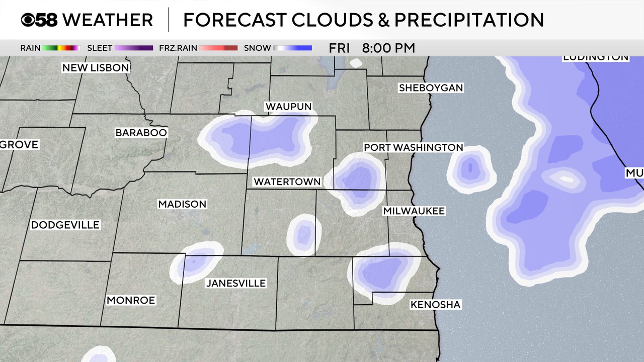
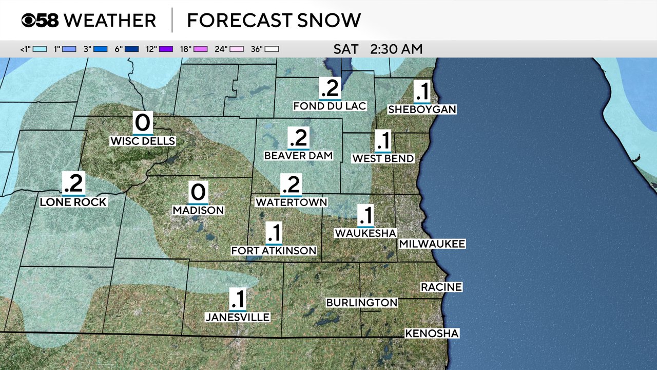
Snow chances should wrap up by midnight. Most only see some flurries with no real accumulation but a dusting to a tenth or two of snow is possible, especially west and north of the Milwaukee metro area.
Most of Saturday is dry with a partly to mostly cloudy sky. Temperatures over the weekend stay pretty steady for highs in the mid 20s. Lows will be in the low 20s both days but Monday morning looks colder.
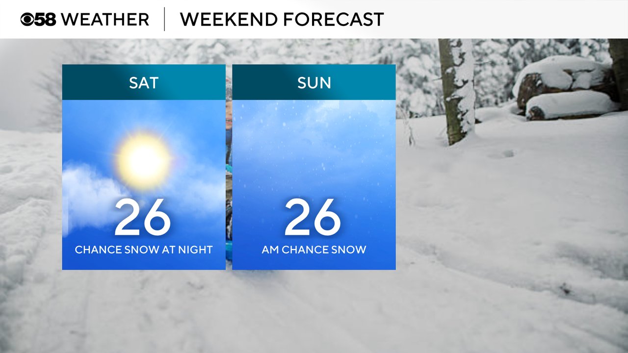
The threat for snow will return by Saturday night going into Sunday morning. An area of steady, light snow is looking better with a quick clipper system.
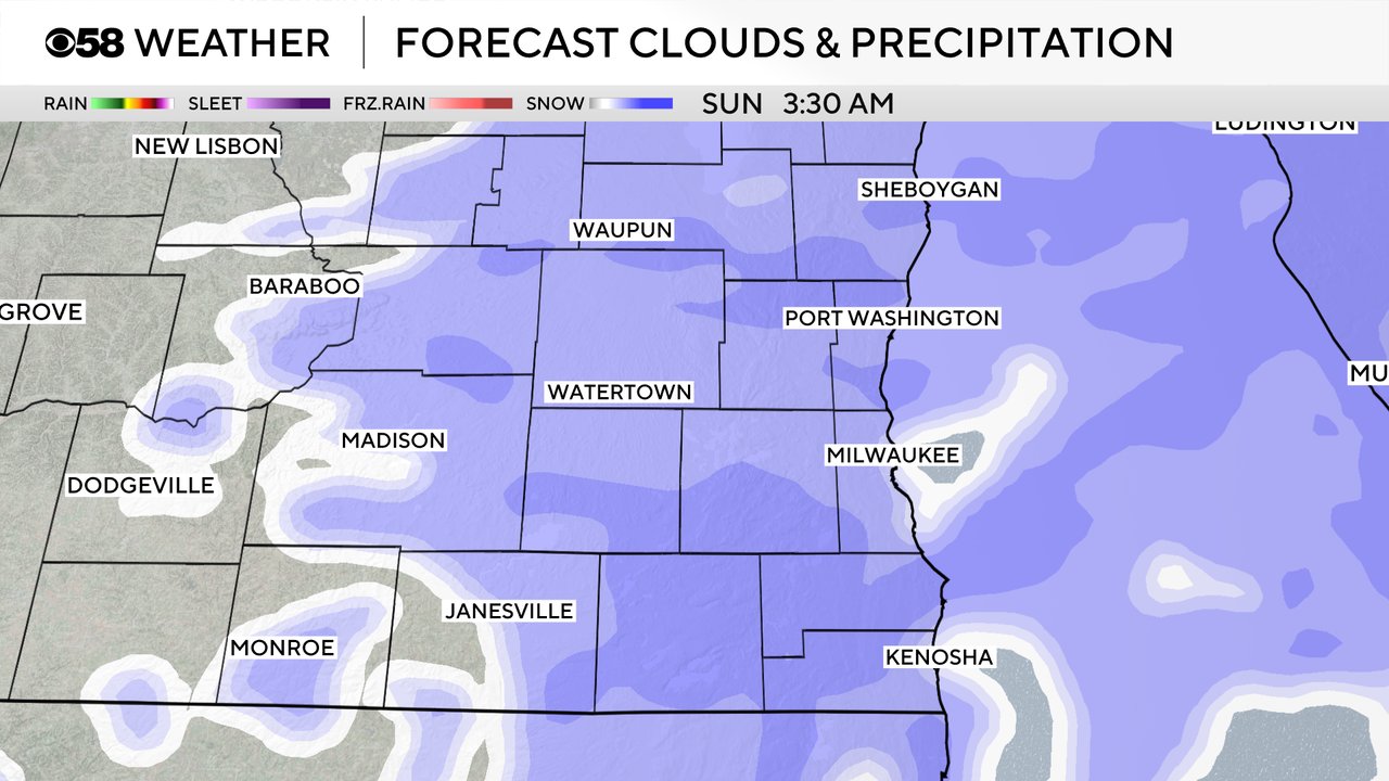
Even though the snow won't last too long, it likely adds up with a fluffy 1-2" of snow possible for most of southeast Wisconsin Saturday night through Sunday morning.

Download the CBS 58 Weather app to track the snow chances.