Mid Evening Update: Severe threat is over


Updated: Sunday, September 25th 9:15pm:
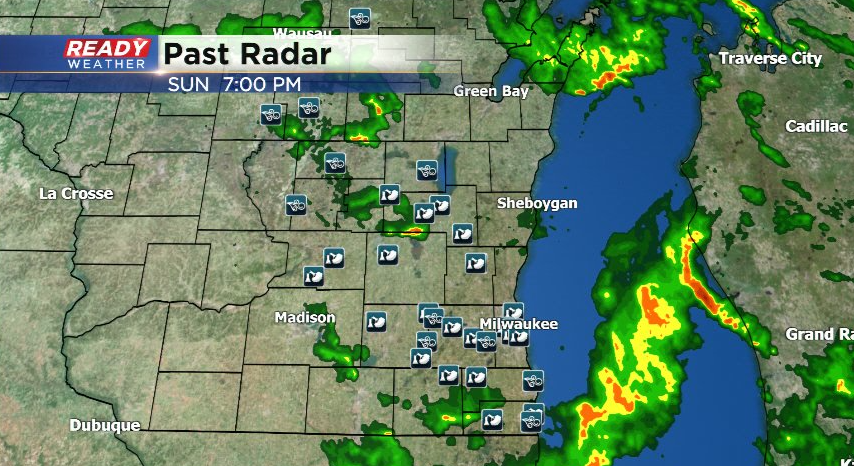
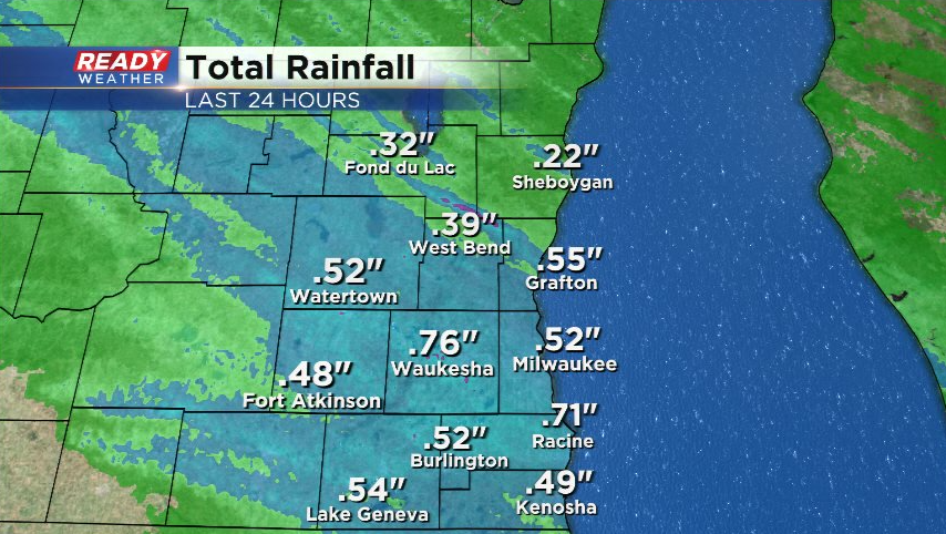
The severe line of storms has moved out of southeast Wisconsin with zero threat for severe weather the rest of the evening. The storms packed a punch, though, with numerous trees uprooted and snapped across southeast Wisconsin.
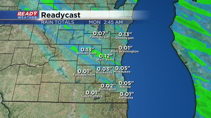
Although a lot of the recorded wind gusts were around 50 mph (sub-severe), so many trees were uprooted due to the saturated ground from the overnight rain. Rain totals from the last 24 hours are between .25-.75"
Besides a sprinkle far north tomorrow, we aren't expected any rain for the rest of the week.
--------------------------------------------------------------------
Updated: Sunday, September 25th, 6:10 pm:
Severe Thunderstorm Warnings are now in effect for Milwaukee, Racine, Waukesha, Walworth counties until 6:45 pm. Between 50-55 mph wind gusts are occurring along this line of storms, which has caused tree damage in Grafton, Oconomowoc, and Fond du Lac.
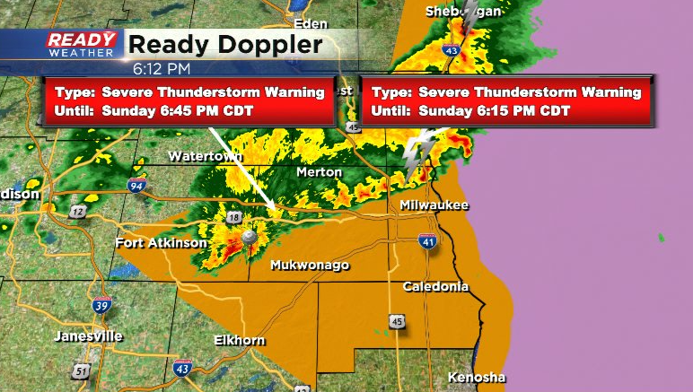
Line will continue to push southeast at 45 mph and exit SE WI by 7:30pm.
-------------------------------------------------
Updated: Sunday, September 25th, 5:00pm:
A severe thunderstorm warning has been issued for Fond du Lac, Dodge, Sheboygan, and NW Washington counties until 5:45 pm. Damaging winds up to 60 mph are possible with this line that also has a history of producing tree branch damage.
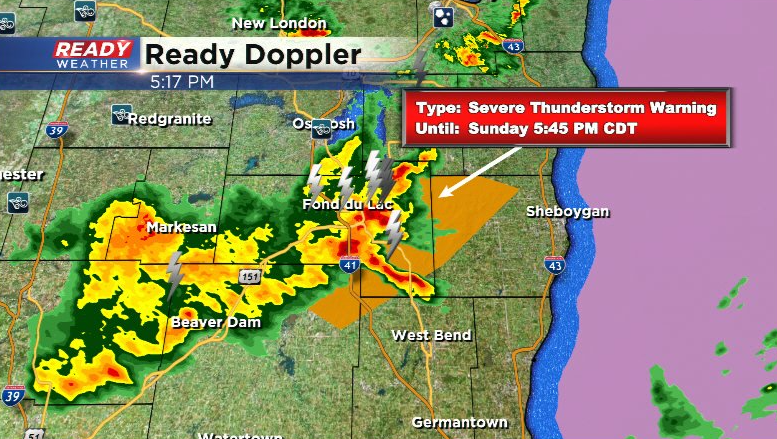
This line will feed off of the sunshine ahead of it, so we're expecting it to hold together as it approaches the Milwaukee metro.
--------------------------------------------------------------------------
Updated: Sunday, September 25th 2:30pm:
Showers have been rather hit or miss so far this afternoon with a couple of peek of sunshine at times. We're watching a more decent area of clearly across central WI and more spotty storms developing between Eau Claire as Wausau.
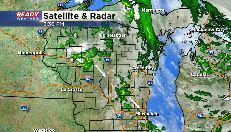
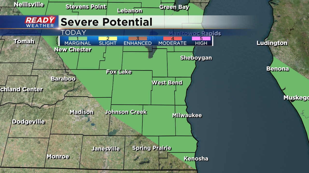
These reach southeast WI between 4-7pm and could be on the stronger side if we can get an hour or so of sunshine. Most of southeast Wisconsin is under a level 1, Marginal Risk, for severe storms with gusty winds and hail late this afternoon, but the best chance will be along and north of I-94.
Storms largely dissipate after sunset with dry weather then expected the rest of the week.
---------------------------------------------------------------------------------
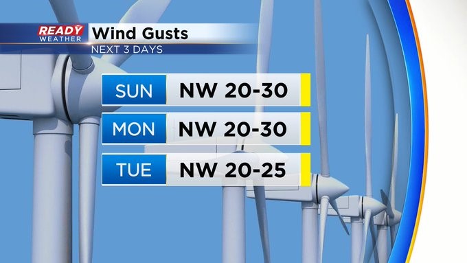
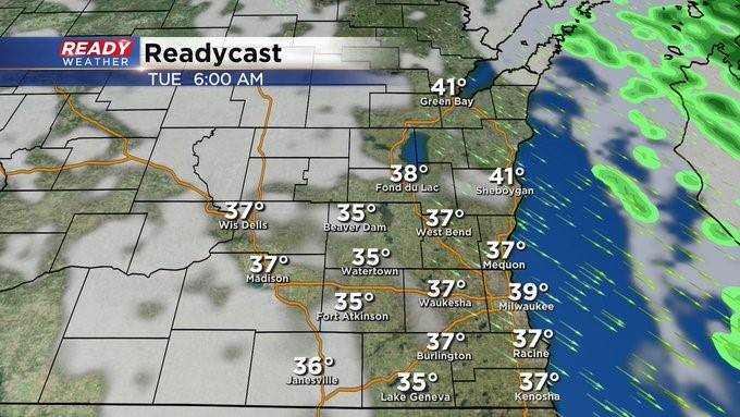
MILWAUKEE (CBS 58)--One more day to deal with pesky showers, maybe even some thunder too, as low pressure pulls east of the area. Highs will be in the 60s. The rather breezy winds will persist through much of Monday. Then we get a nice dry stretch of weather. Frost is even a factor, especially in outlying areas, perhaps Monday and Tuesday nights. Highs in the 50s and 60s. Lows in the 30s and 40s. Also, don't forget to look to the east Monday during sunset to see Jupiter. It's the closest its been to us in some 60 years. You won't need a telescope to see it either. It'll be fairly bright in the sky.