Late Evening Update: Moderate to heavy snow winds down overnight


Updated: Saturday, January 28th: 11:00pm:
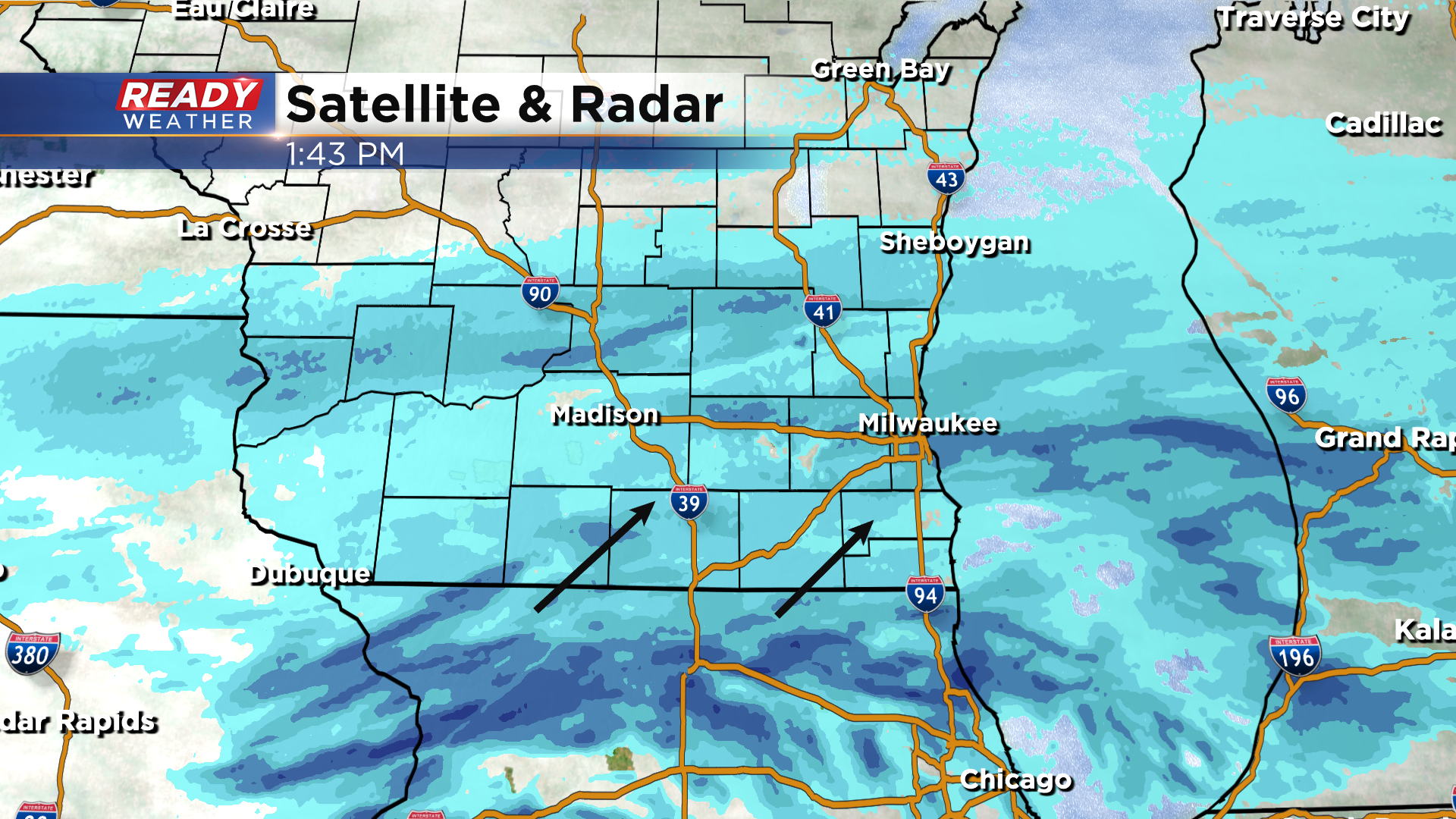
A moderate to heavy band of snow continues to sit over portions of Jefferson, Waukesha, and southern Dodge and Washington counties late this evening. This band of snow has been dropping 1.5-2"/hr. Snow elsewhere isn't quite as heavy, but it's still piling up.
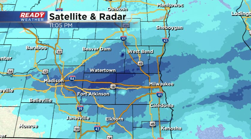
The widespread snow will start to dissipate after 1-2am with a little light, lingering lake effect possibly brushing the lakeshore early Sunday morning.
----------------------------------------
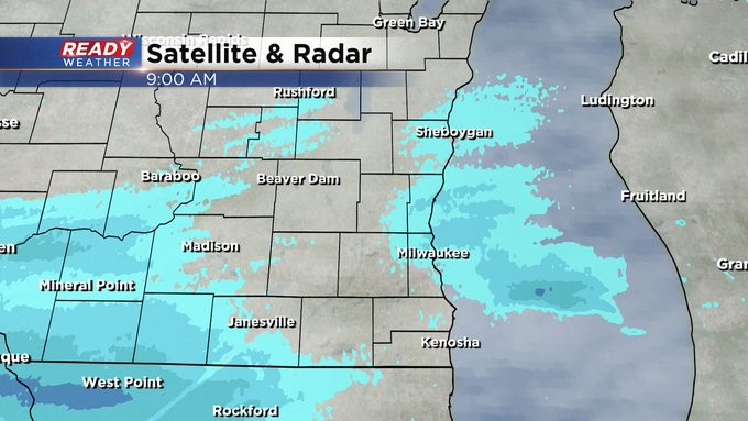
Updated: Saturday, January 28th: 9:00pm:
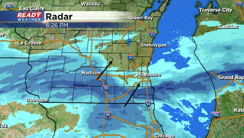
A very heavy band of snow is currently stretching from Watertown to Germantown to Grafton, which is producing 1-1.5" per hour snowfall rates. This is slowly lifting east-northeast and is producing near white out conditions. Snow is also intensifying south of I-94. This widespread snow will continue for a few more hours, tapering off inland after midnight. Snow continues lakeside until early Sunday morning.
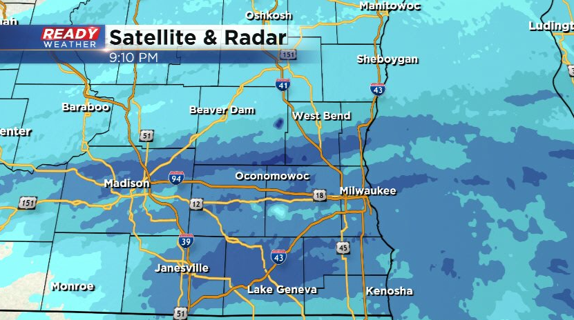
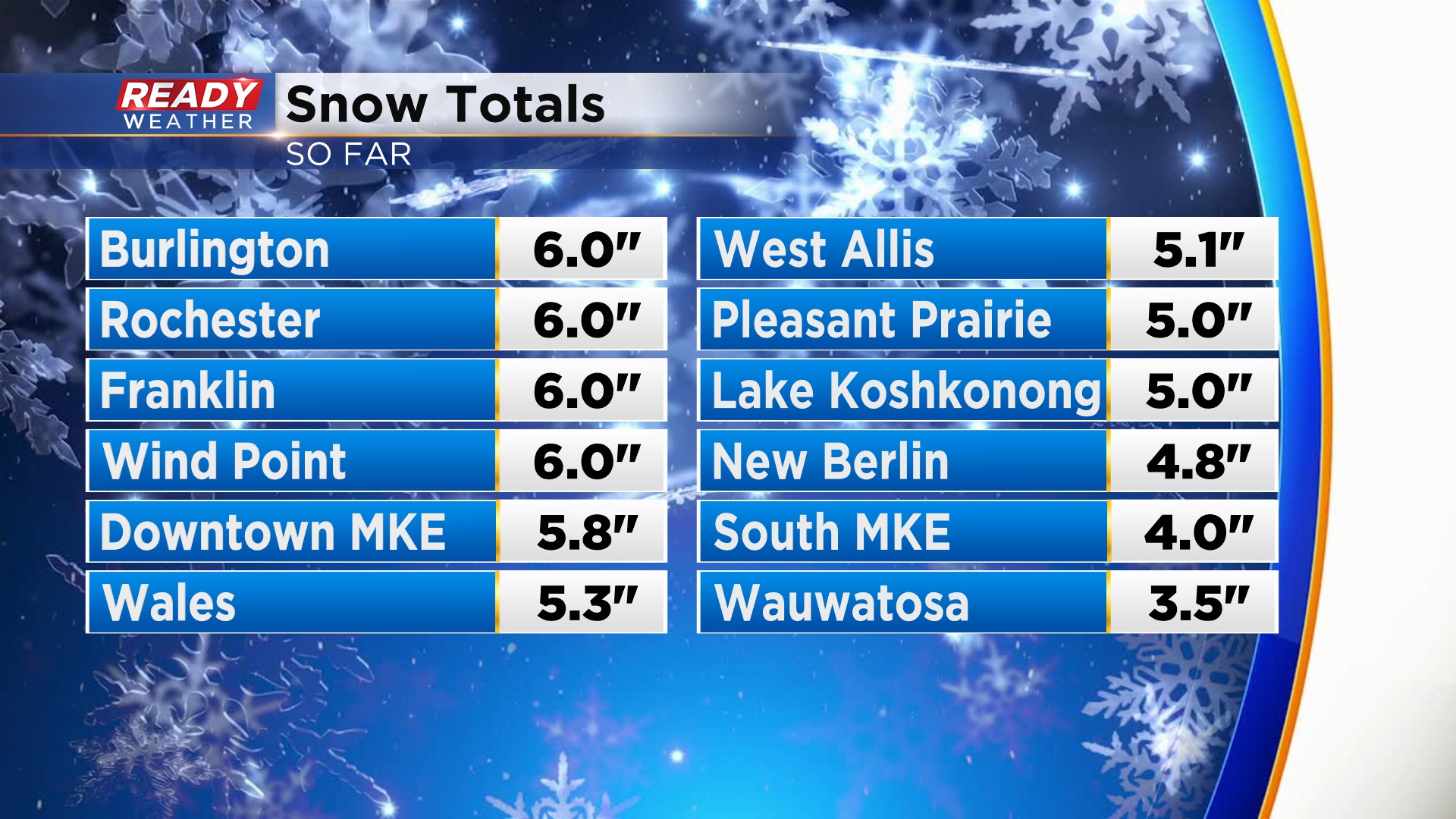
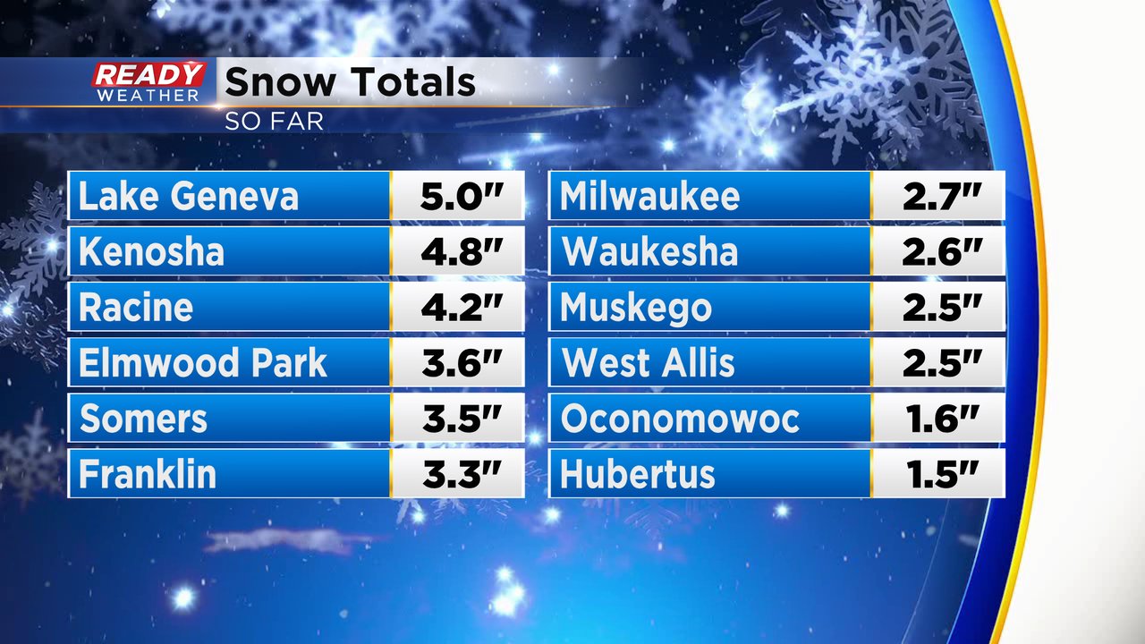
Snow totals across Racine, Kenosha, and Walworth counties have already reached the 6-9" range, and are now approaching 6" in parts of Milwaukee county as well!
--------------------------------------
Updated: Saturday, January 28th: 6:25pm:
Areas in Walworth, Racine, and Kenosha counties have been getting pounded with snow for the last few hours with snow totals currently between 4-5" across most of those counties.
Snow totals start to decrease the farther north you go, but another batch of moderate snow is about to move across SE WI and will bring a good burst of snow for everyone.
Some lake enhancement will also start to kick in this evening, helping to boost snow totals.
-------------------------------------------
Updated: Saturday, January 28th: 4:00pm:
Moderate to heavy band of snow is currently moving through Walworth, Racine, and Kenosha counties and will lift into southern Waukesha and Milwaukee counties over the next couple of hours.
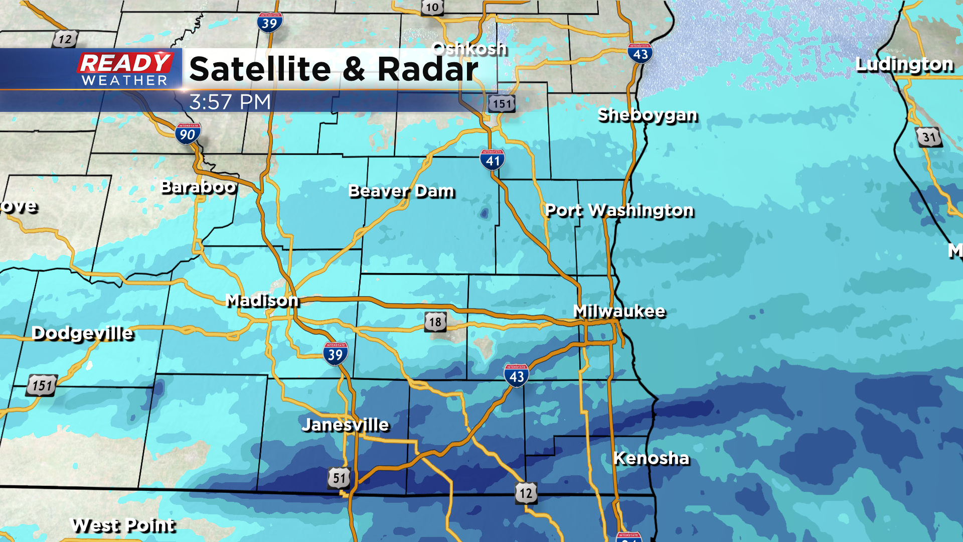
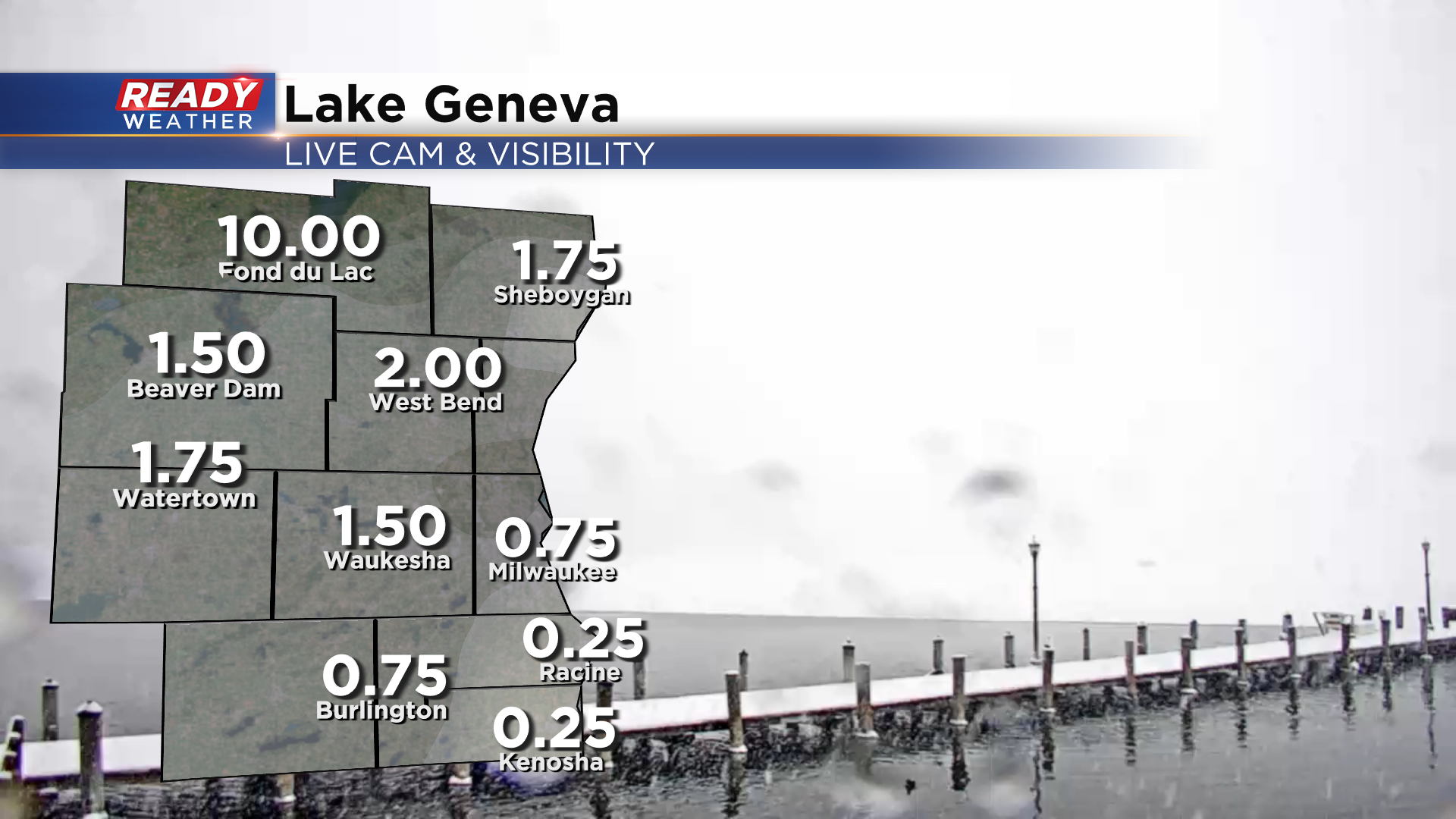
Snow rates within this band are around 1"/hr. It's dropping huge snowflakes and putting visibility under a quarter mile.
Snow will continue to ramp up as we head into this evening as lake enhancement gets going. The previous snow forecast remains on track.
--------------------------------------
Updated: Saturday, January 28th 1:50pm:
Moderate bands of snow continue to lift northeastward out of Illinois. Snowfall rates in the more moderate areas of snow are between a half inch and an inch per hour.
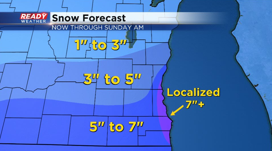
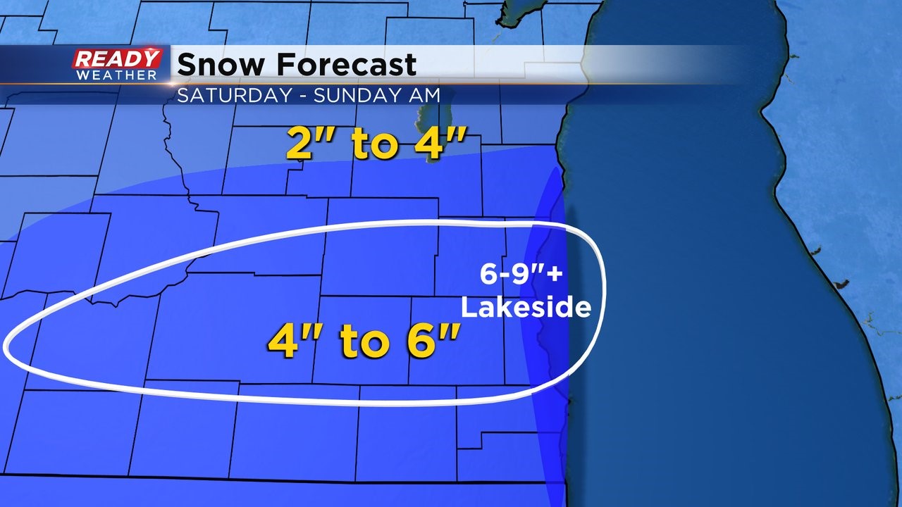
We'll likely see repeated rounds of moderate snow between the WI/IL border and I-94 throughout the afternoon and evening. Lake enhancement also gets going late afternoon through the evening, which will boost snowfall rates. With that in mind, we've tweaked the snowfall totals only slightly with most of the area still in the 3-6" range, but locally higher far south and lakeside.
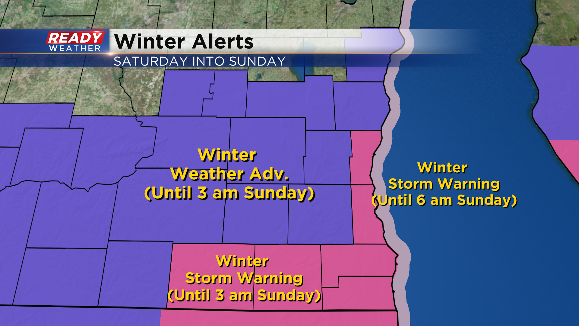
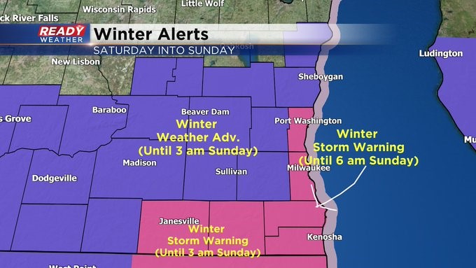
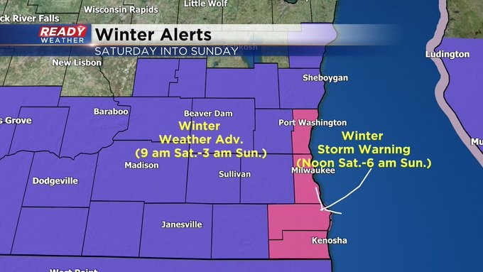
These are the areas that are now under a Winter Storm Warning until early Sunday morning.
--------------------------------------------------------------------------------
Update as of 12:40 pm, Saturday, January 28th...
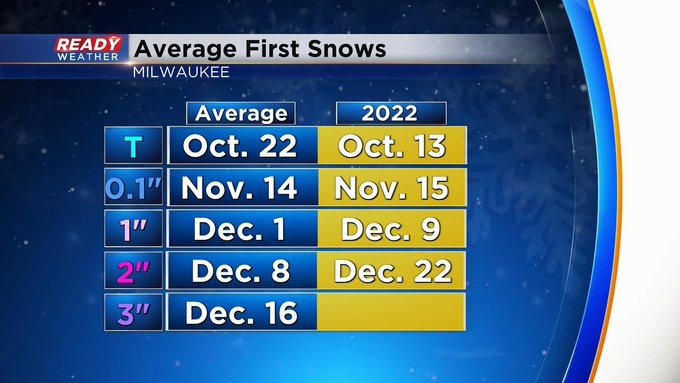
Walworth and Rock Counties are now under a Winter Storm Warning until 3 am Sunday. It's until 6 am for all the other counties shaded in pink. It's interesting to mention we haven't had our first 3" snow in Milwaukee yet. It's supposed to happen in mid-December. Think it'll happen today.
______________________________________________________________________________________________________________
Update as of 12 pm, Saturday, January 28th...
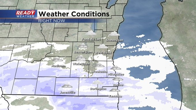
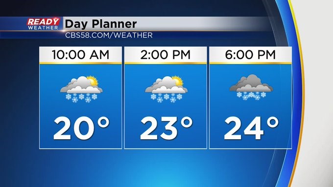
Here we go. The snow has begun, and everyone is currently under some kind of advisory or warning. Conditions have deteriorated rapidly. It'll only get worse this afternoon with the reduction in visibility as the wind blows the snow around the area. Temps won't warm much either. 4 to 6 inches, generally speaking, still looks good with higher amounts by the lake before this wraps up Sunday morning.
_____________________________________________________________________________________________________________
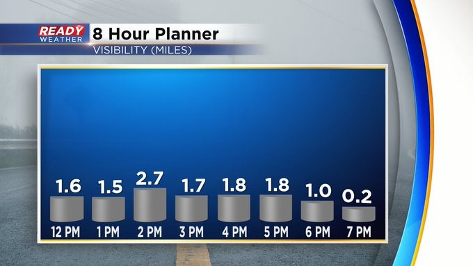
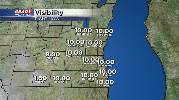
Update as of 9:15 am, Saturday, January 28th...
It's hurry up and wait for the snow. Beside a few flakes north of Milwaukee, the biggest push is well south and west of the metro. Expect its arrival into the afternoon. Then conditions deteriorate quickly. It'll be a powdery snow, being blown around by the wind.
_______________________________________________________________________________________________________
MILWAUKEE (CBS 58)--We knew it was only a matter of time. A major snow system would affect us, and it will this weekend. Low pressure passing to the south will throw snow our way for most of the day, and it'll linger into Sunday. We have a Winter Storm Warning lakeside (except Sheboygan County) from midday Saturday until dawn Sunday. At least 6 to 9 inches of snowfall can be expected. For the inland counties, you're under a Winter Weather Advisory from 9 am Saturday until 3 am Sunday. A general range between 3 and 6 inches can be expected here. This will be a light, fluffy snowfall. We could have issues of blowing and drifting as well, making travel rather hazardous. So if you do have to venture out, please do so with extreme caution.
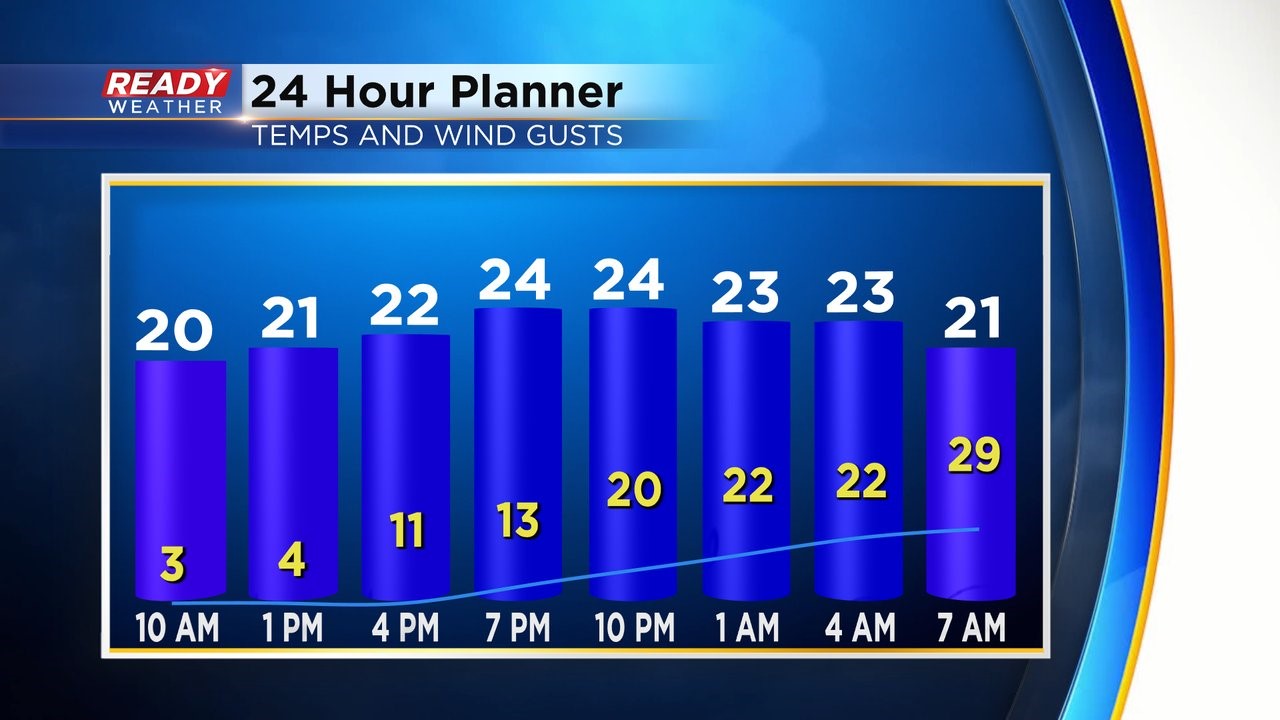
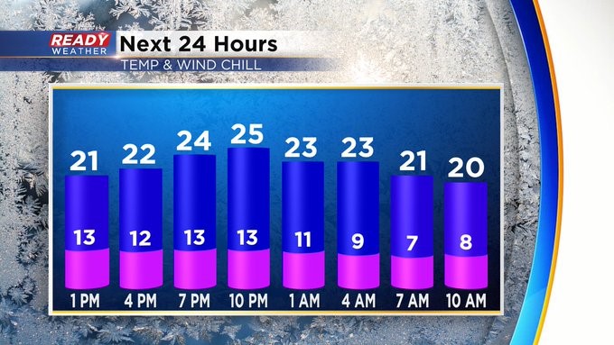
Extreme cold follows the snow. Expect highs in the teens by midweek with subzero temperatures by Tuesday morning. Groundhog Day is Thursday. It'll be partly cloudy then with highs in the low 20s. But 30s will be here by next weekend!