Temperature whiplash continues with a 40 degree drop in temps for some


Temperatures and wind chills have been all over the place the last couple of days. Wednesday was one of the coldest days of the season with lows in the single digits to around 10* and wind chills as cold as -10*. Then we slowly warmed all day with highs by late Wednesday evening in the middle 30s. Lows Thursday morning were running about 25* warmer than Wednesday morning with highs Thursday expected in the middle and upper 30s. Then a big drop.
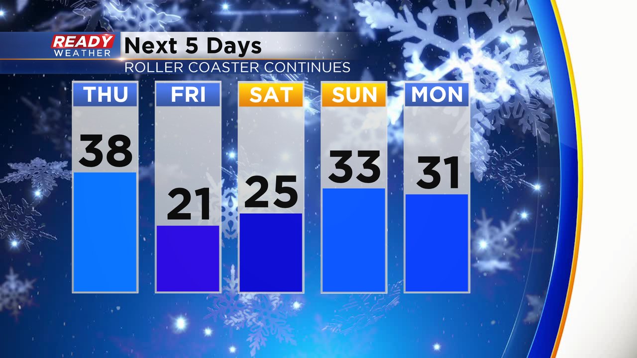
Another front will run through Thursday night dropping lows into the teens but it stays breezy and wind chills will stay in the single digits and below-zero in many spots.
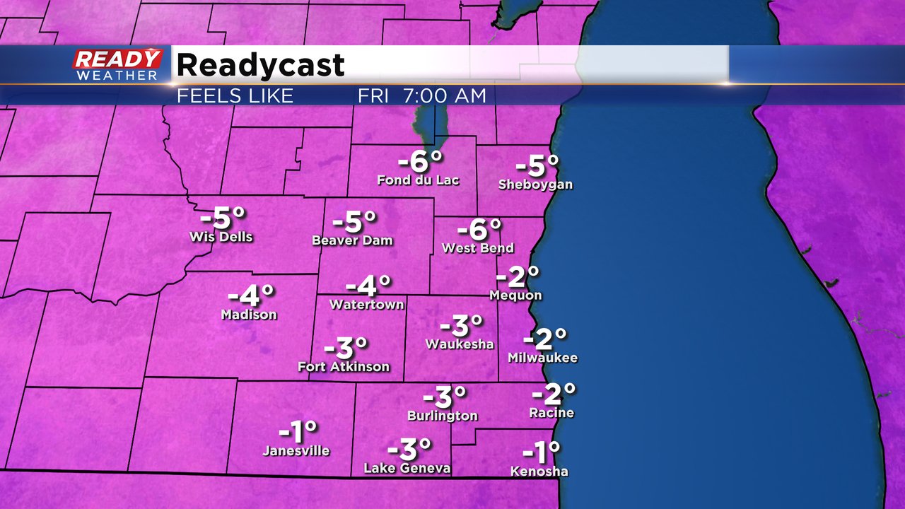
Unlike the cold blast we had Wednesday morning that was short lived, the one for the end of the week will last a little longer with highs only in the low 20s Friday and Saturday before warming back up around freezing for the weekend. The good news is the wind starts to die down Friday night so wind chills Saturday morning will be in the single digits close to zero.
Download the CBS 58 Ready Weather app to track the rising and falling temps.