Strong to Severe Storms on Saturday...Watching the Weekend Forecast
All eyes are on the Father's Day weekend as chances for showers and storms return to the forecast. Right now it looks like most of Father's Day should be good with highs in the upper 70s; however, Saturday could be a different story with severe weather arriving by the evening.
Right now the SPC has the southern part of our viewing area under a slight risk for severe weather. My hunch is that risk will be expanded further north to include the Milwaukee metro area. If this setup continues to look good, an upgrade to an enhanced risk is very possible.
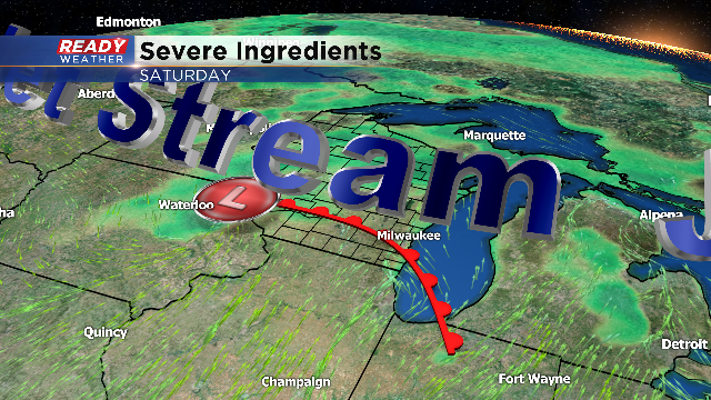
A lot of key ingredients will come together on Saturday to produce strong to severe storms. Humidity is the fuel that these storms need, and there should be plenty of that pooling across SE WI just south of the front. Dewpoints will soar into the upper 60s and lower 70s, and that's more than enough for severe weather.
The jetstream overhead will ignite the storms by the late afternoon and early evening. Wind shear, which is the change in the wind direction with height is a key ingredient for rotating updrafts that support severe storms. The winds at the surface will be increasing out of the south during the day, while the winds aloft will be out of the west. That change in direction and speed with height is wind shear. Wind shear is usually maximized right along the warm front, which will be draped across southeastern Wisconsin by the evening.
Rotating storms can produce very large hail, damaging winds, and tornadoes. The exact placement of the front will change, so we will continue to update the forecast as we get more information.
