8:30 PM Update: Rain and storms remain well below severe limits


Updated: Friday, July 14th 8:30 PM
Thankfully, the storms at this point have remained below severe limits. Other than some brief gusty winds, the overall severe threat has diminished considerably since the watch was issued.

Strong to severe storms are moving across northern Illinois, but those pose no risk to our area. Hopefully, just some rain will impact Milwaukee with no storms.
----------------------------------------------------------------------------------------------------------------------------------------------------------------------------------------
Updated: Friday, July 14th 6:15pm:
Clouds and a little light rain ahead of the storms are helping to somewhat stabilize the atmosphere directly head of them. While outdoor events will get damp in a couple hours, hopefully this will help limit our severe potential so nothing gets cancelled.

--------------------------------------------------
Updated: Friday, July 14th 4:20pm:
A Severe Thunderstorm Watch has been issued for Milwaukee, Racine, Kenosha, Waukesha, Jefferson, and Walworth counties until 10pm this evening. Large hail and damaging winds continue to be the main threats with storms this evening.

---------------------------------------------
Updated: Friday, July 14th 3:15pm:
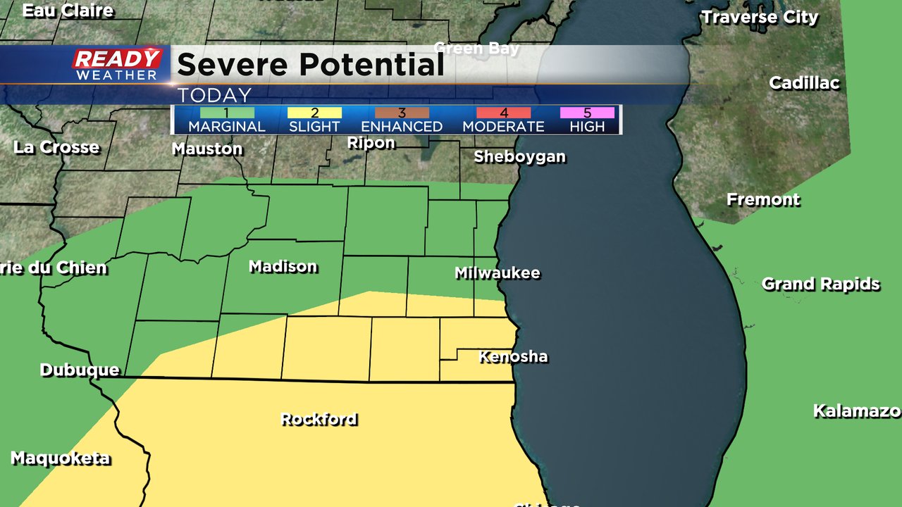
Marginal Risk (level 1 of 5) for severe storms has expanded across a good portion of the state, while the Slight Risk in far southern WI remains unchanged. The Storm Prediction Center is monitoring the area in the Slight Risk for a potential Severe Thunderstorm Watch.

Strong to severe storms are rapidly developing in eastern Iowa. We'll be watching for additional storm development over the next couple of hours closer to the WI/IL border.

------------------------------------------------------------------------------------------------
Updated: Friday, July 14th 1:10pm:
Heat and humidity continue to increase in southeast Wisconsin with heat index values starting to climb into the low 90s.

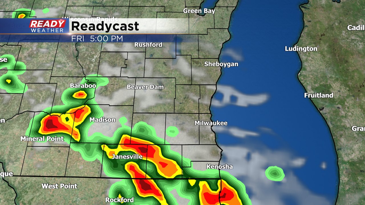
The forecast remains on track for scattered strong to severe storms to develop late this afternoon through mid evening. Storms may fire as early as 4pm near the WI/IL border.

Additional scattered storms will be possible through sunset, exiting by 9-10pm at the latest.

Damaging wind, hail, and torrential downpours remain the primary concern in storms.
--------------------------------------------------------------
Updated: Friday, July 14th 10:45am:
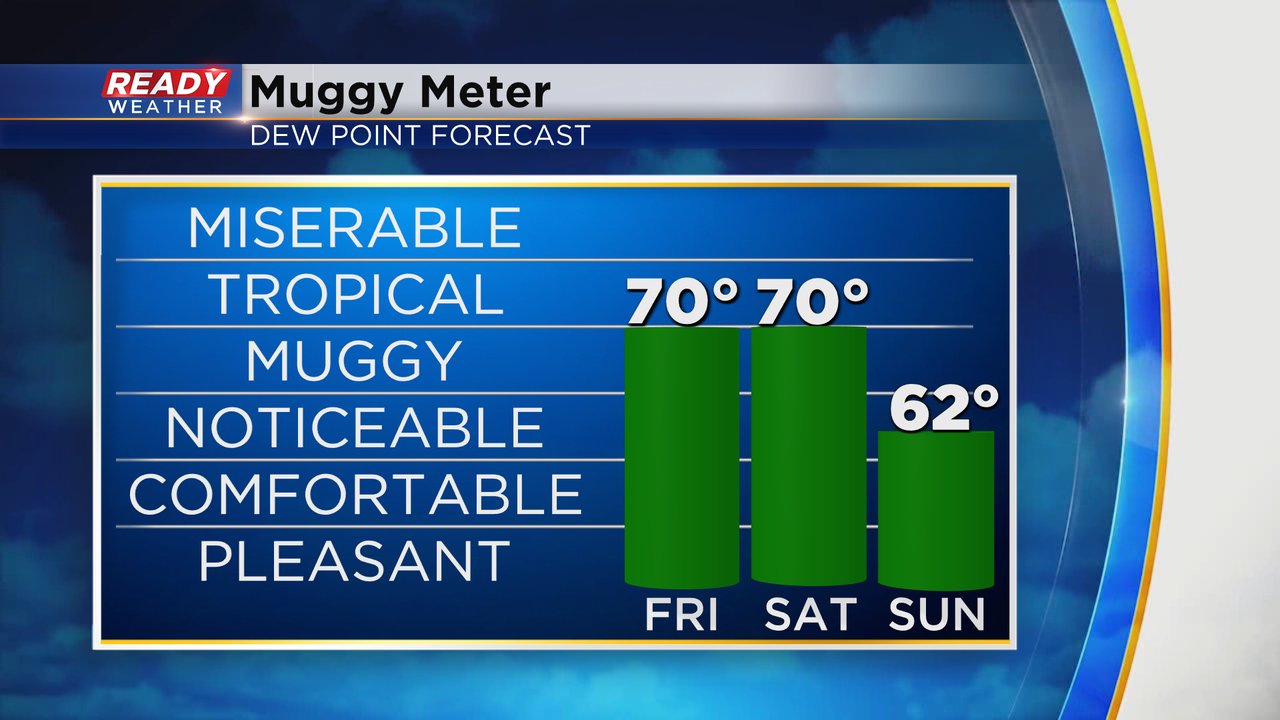
Heat and humidity are gradually building across southeast Wisconsin late this morning with temps in the 80s and dew points in the mid 60s. Higher dew points in the upper 60s and low 70s are just south of the Illinois border and will push in for the afternoon.

The heat, humidity, and sunshine will help make southern Wisconsin fairly unstable by late afternoon and early evening when we expect strong to severe thunderstorms to develop. Damaging winds, hail, and torrential downpours are the main concerns with storms that form.

The main window for storms continues to be between 4-9pm.
-----------------------------------------------------------------
A few showers and storms rolled through southern Wisconsin during the overnight and early morning hours of Friday. Some of the storms in and around Madison were strong with some gusty wind but weakened as they moved into the Milwaukee area with just showers locally. Now that the first round of rain is done we watch the heat and humidity build in. High temperatures Friday likely reach the upper 80s with some making a run at 90. The warmth will last through the weekend then temperatures get more comfy Monday and Tuesday.
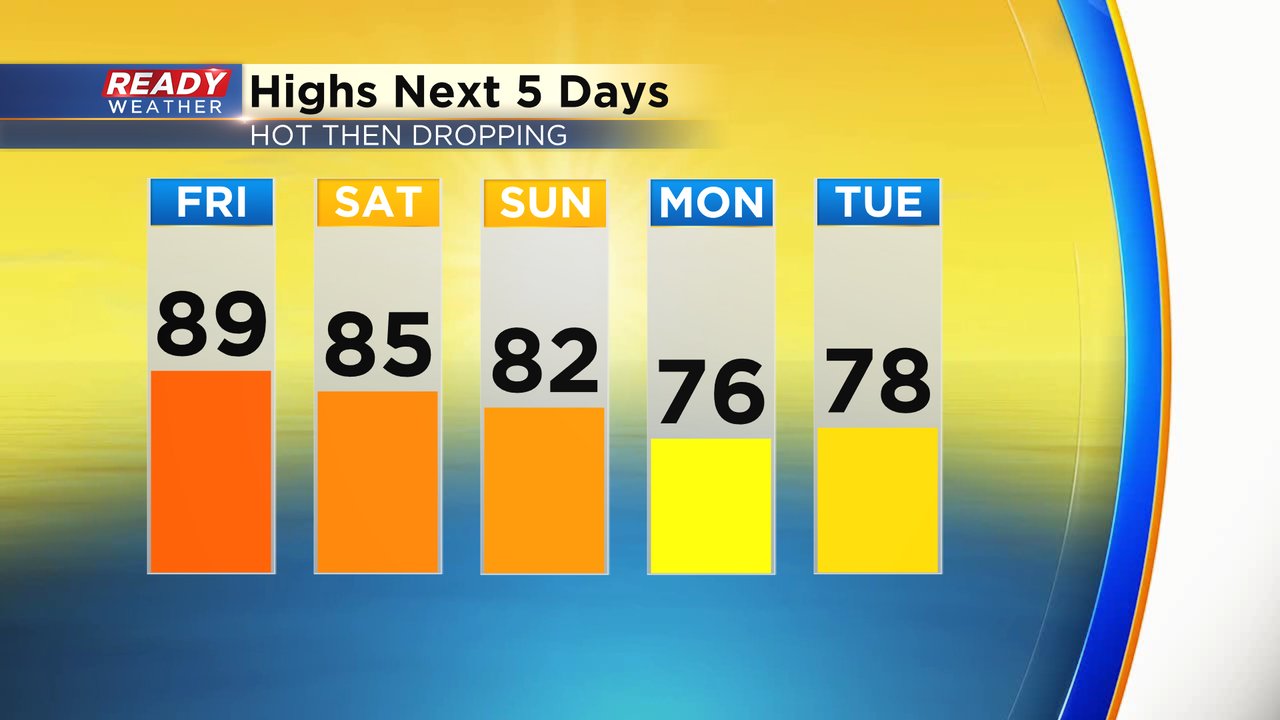
Once you add in the humidity it's going to feel hotter Friday and Saturday. Peak dew points will get close to 70* which makes it feel tropical. Feels like temps on Friday could reach the lower 90s and around 90 for Saturday. By Sunday the dew points will start to drop a bit making it feel a bit better.
All of that heat and humidity on Friday will increase the fuel for thunderstorms during the afternoon and evening. The best chance for storms looks to be after 4 PM but could linger into the late evening. This could have an impact on Bastille Days and the Green Day concert at the Harley Homecoming.
Areas south of I-94 have been added to the Level 2 Slight Risk for severe weather with damaging and hail the main threats. There is no tornado threat at this time. The rest of southeast Wisconsin is on the Level 1 Marginal Risk for some stronger storms.
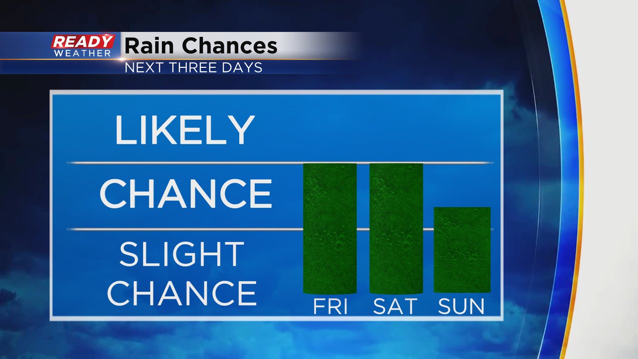
The storm chance will continue Saturday and Sunday. Similar to Friday the best chances for rain will be in the early morning and again in the late afternoon /evening. The strong to severe storm chances look less for the weekend.
Download the CBS 58 Ready Weather app to track any storms that develop and get alerts if warnings are issued.