Midday Update: Severe storms are moving out of our area


Updated: 2:00 p.m. Sep. 7, 2021
The severe weather threat is over for our area! The Severe Thunderstorm Watch and all warnings have all expired.
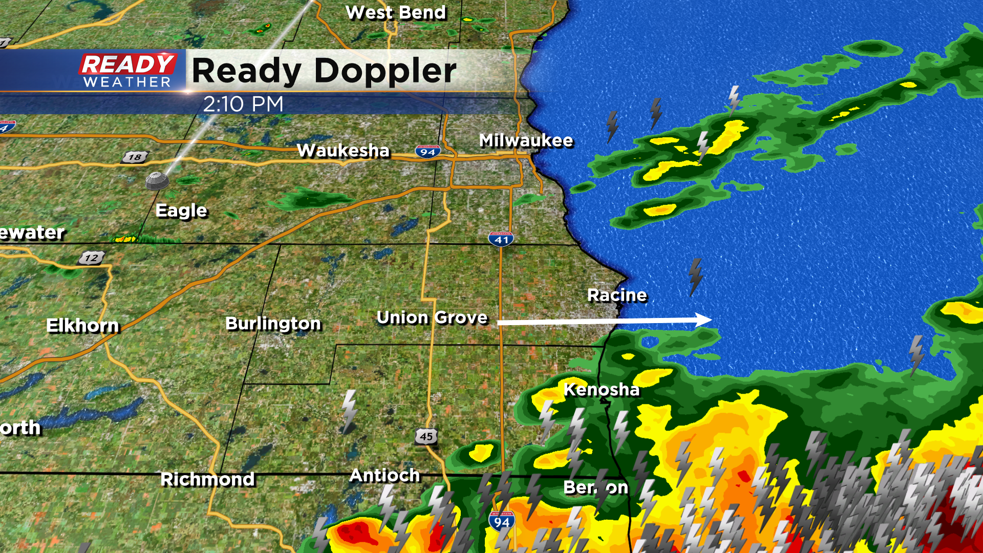
Updated: 1:00 p.m. Sep. 7, 2021
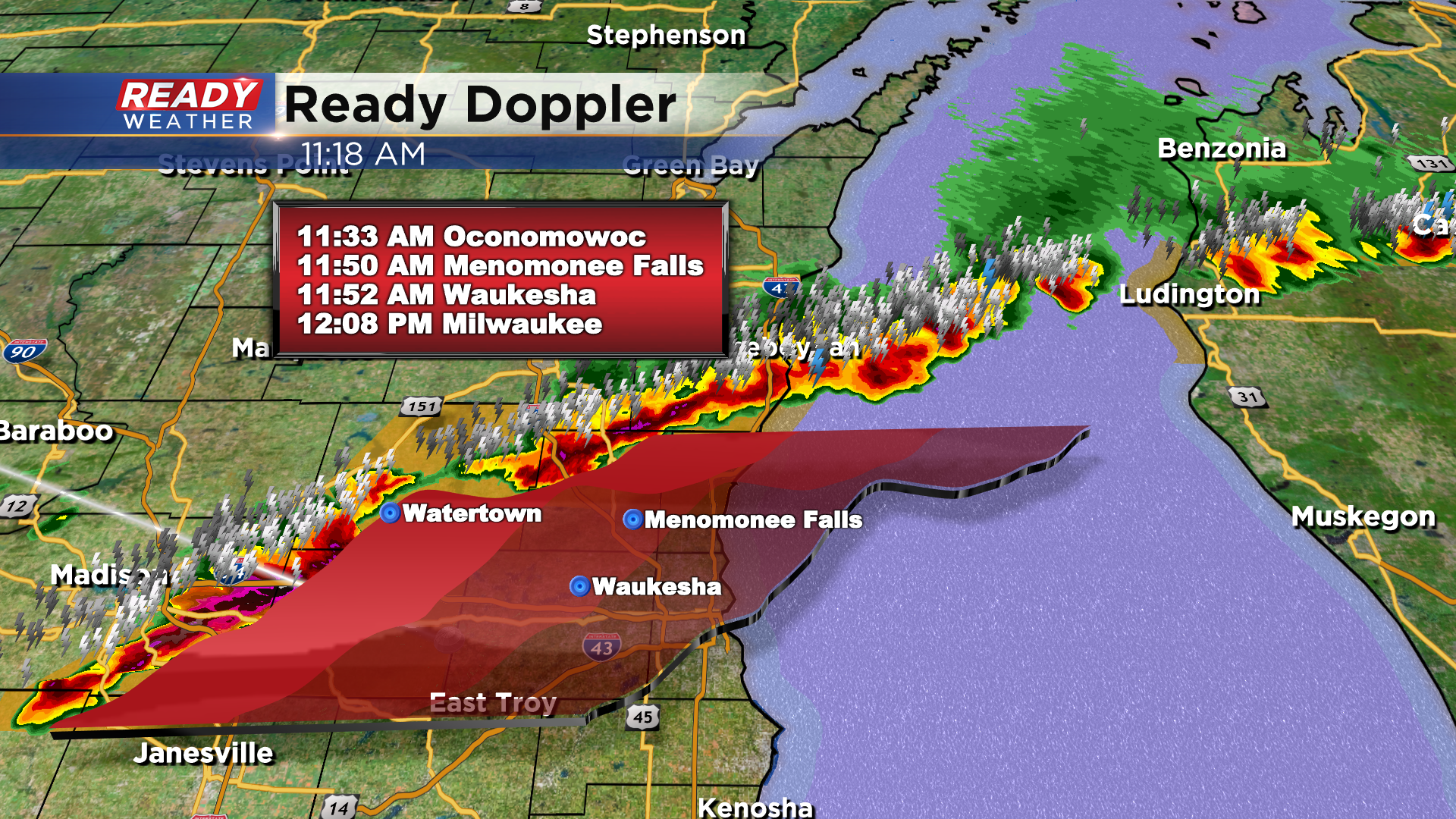
The main line of showers and storms continues to move southeast around 50 mph. Severe thunderstorm warnings for Walworth, Racine, and Kenosha counties remain in effect until 1:30 pm. Strong gusty winds and hail up to quarters remain possible.

Max Grover, Delavan
This should be the last of the warnings for the day. While some scattered showers remain possible this afternoon, the main line of storms will push east. Expect clearing this evening behind the front!
______________________________________________________________________________________________________________
Updated: 12:00 p.m.. Sep. 7, 2021
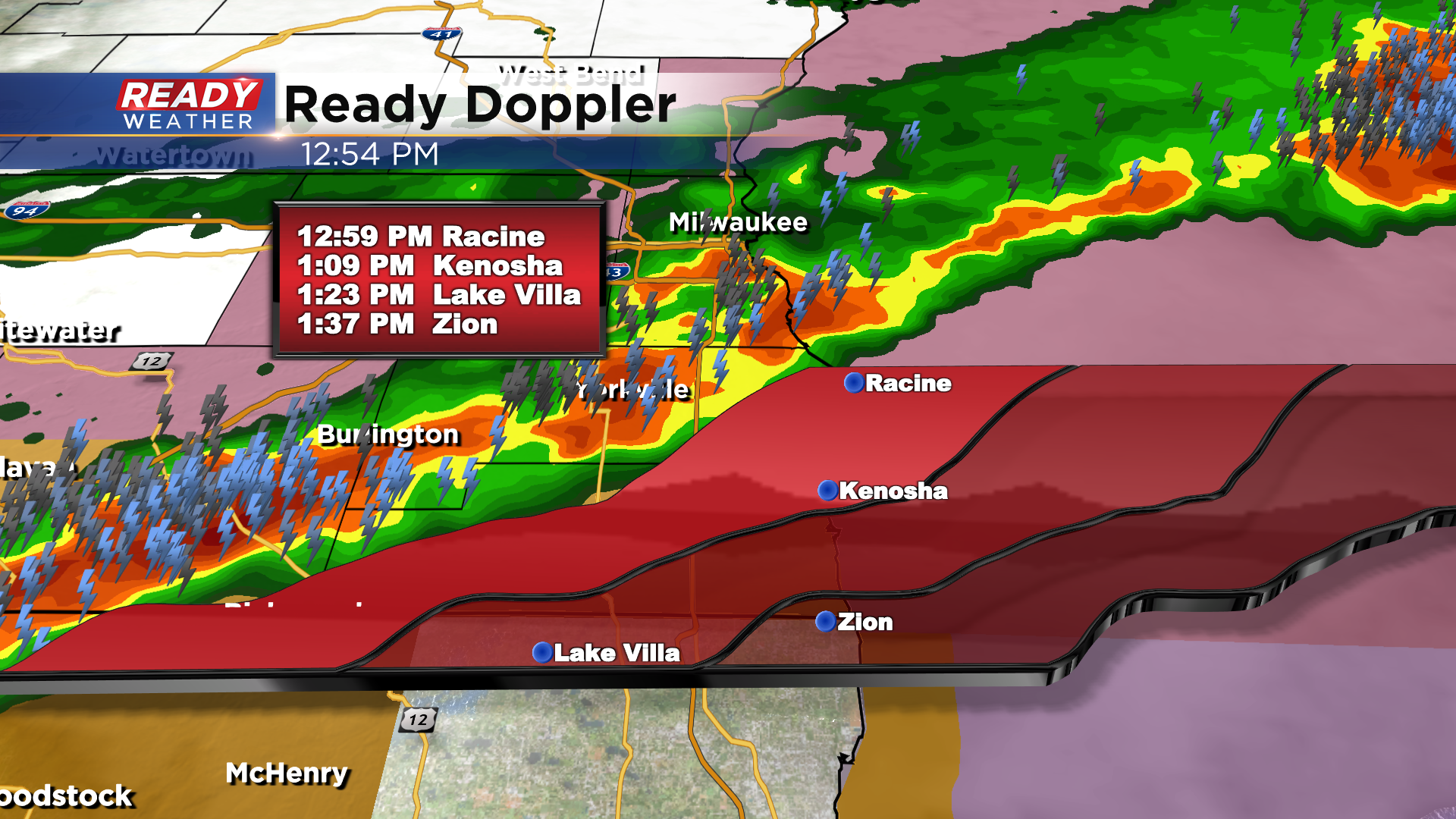
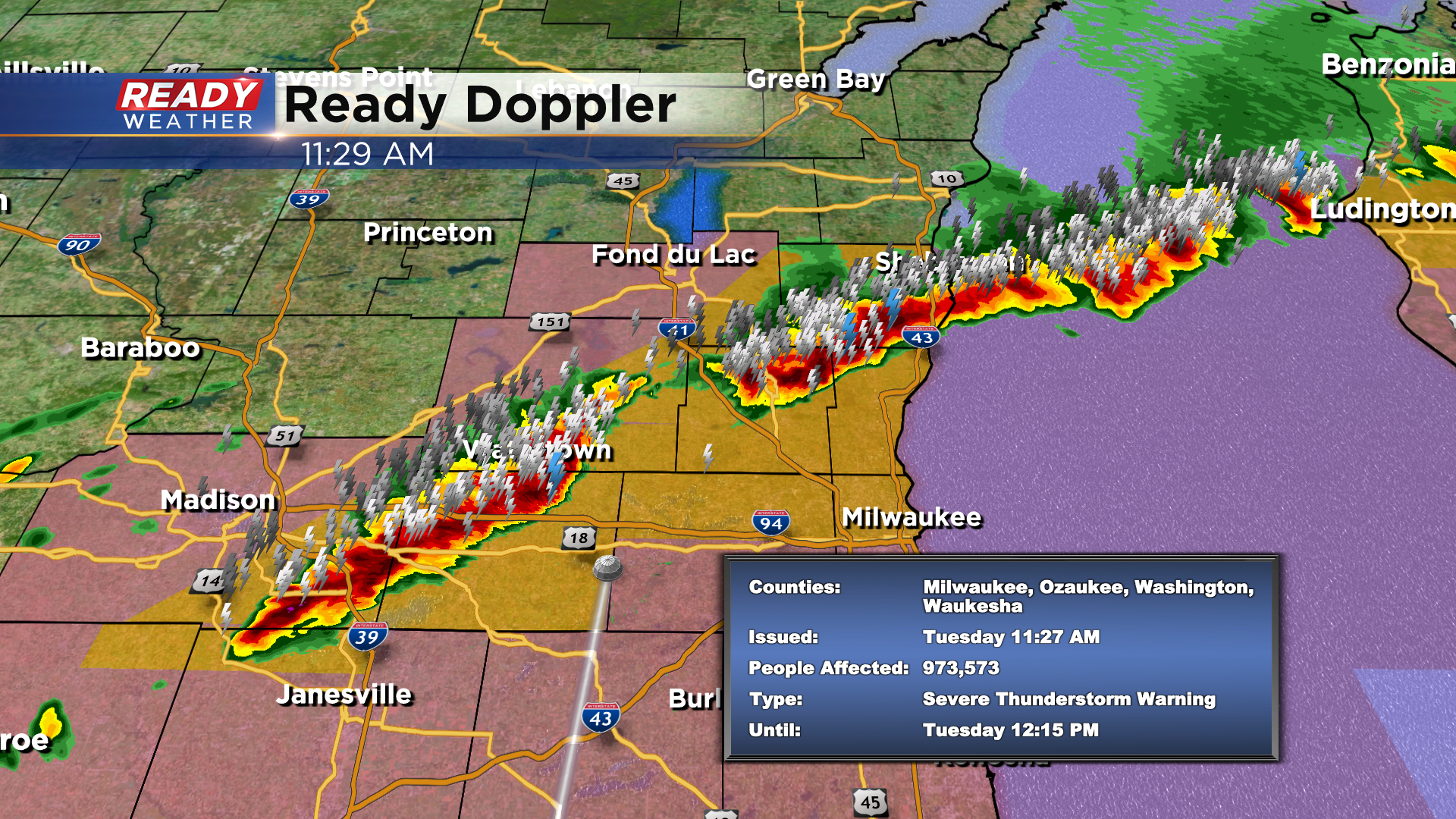
A majority of southeast Wisconsin has either already seen severe storms or is currently under severe thunderstorm warnings. As of noon, areas north of I-94 are under a warning until 12:15 p.m. Areas south of I-94 are under the warning until 12:45 p.m. Fond du Lac, Sheboygan, Dodge, Washington and most of Ozaukee and Jefferson Counties are basically done with their severe threat for the day. Racine, Kenosha and southern Walworth Counties are not currently under warnings but will likely see some issued this afternoon.

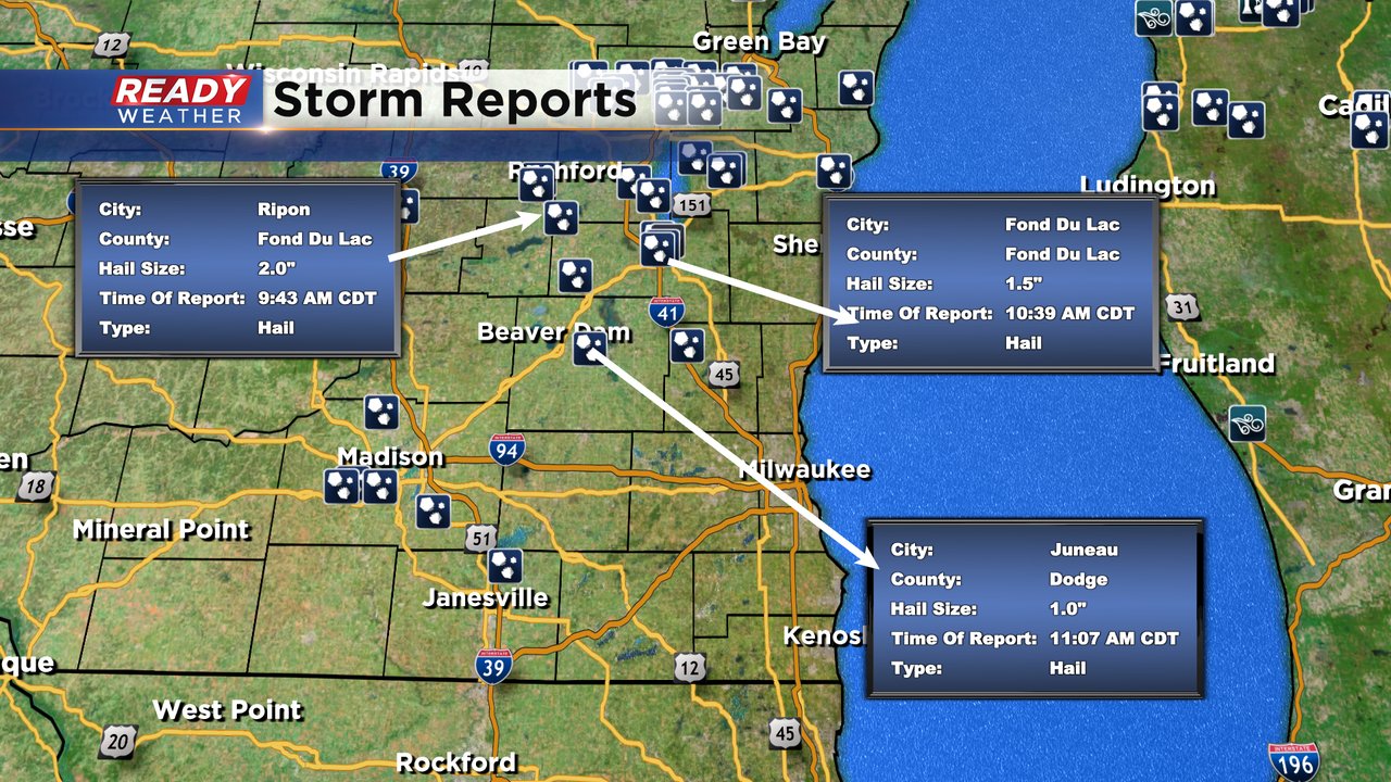
Large hail has been the primary threat with the storms so far. A 2" hailstone was reported in northern Fond du Lac County and there have been multiple reports of quarter (1") size hail. As the storms form more of a line the threats will turn to more of a wind threat with gusts to 60 mph. Downed trees and power outages are possible.
------
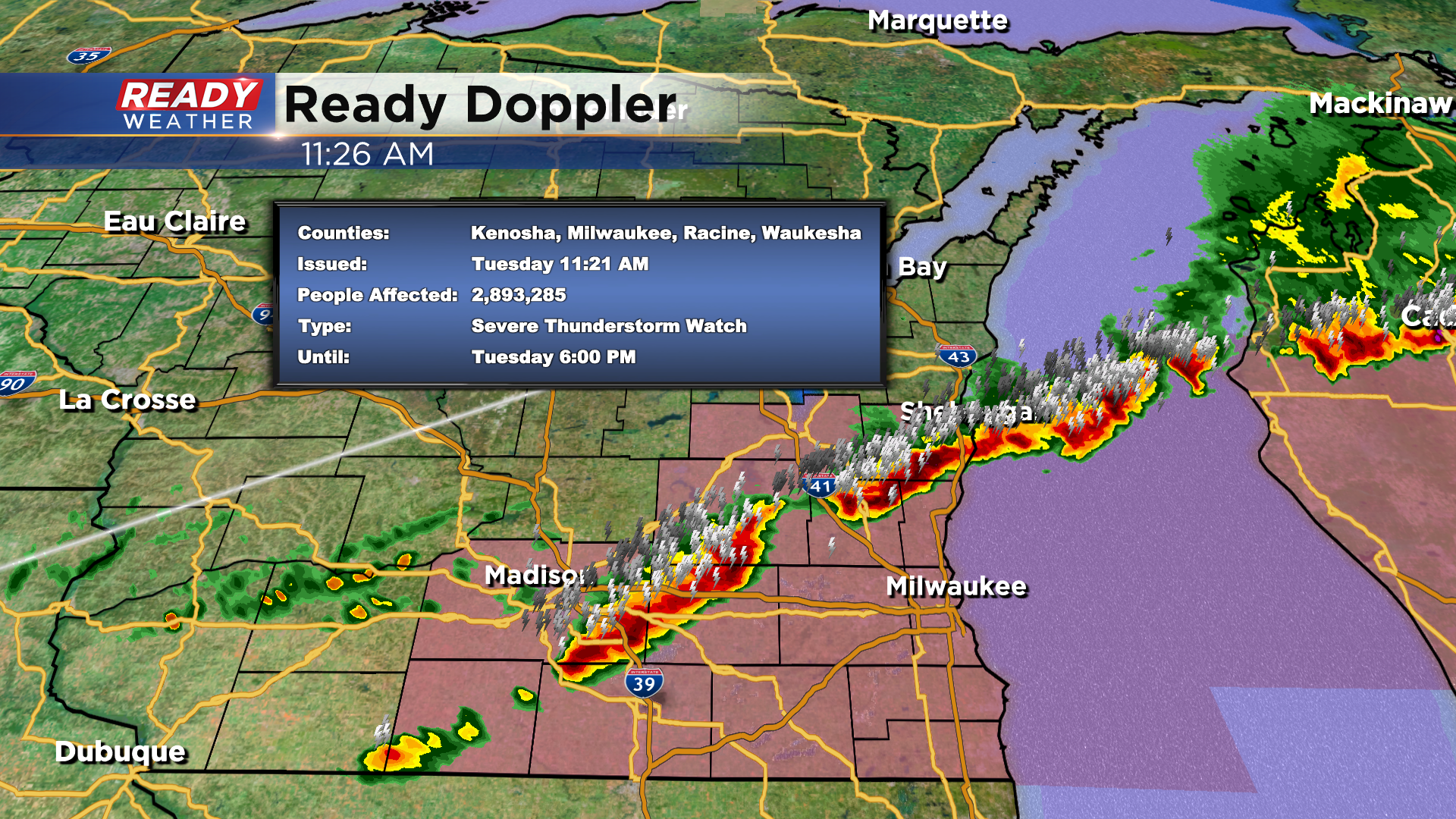
Updated: 11:30 a.m. Sep. 7, 2021
A handful of counties continue under a Severe Thunderstorm Warning until Noon today.
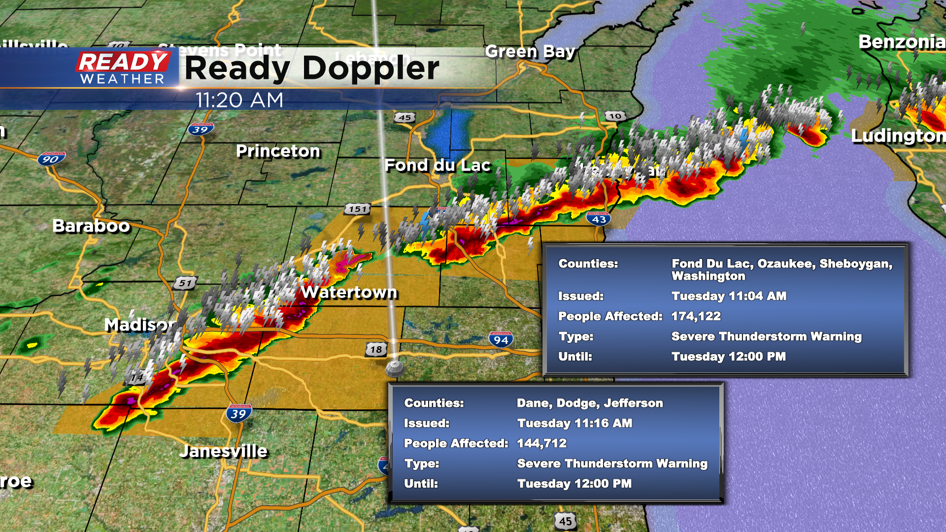
The storms have had a history of large hail, golf ball size and even larger. Additionally, wind gusts to 60mph are possible.
------
Updated: 9:28 a.m. Sep. 7, 2021
Some strong to severe storms have developed around the Green Bay and Oshkosh areas. Hail has been the main threats with these storms with hail reported the size of tennis or baseballs which is over 2.5" in diameter! As of 9:30 a.m. no severe thunderstorm warnings have been issued for our local area but they are definitely possible as more storms are forming to our west.
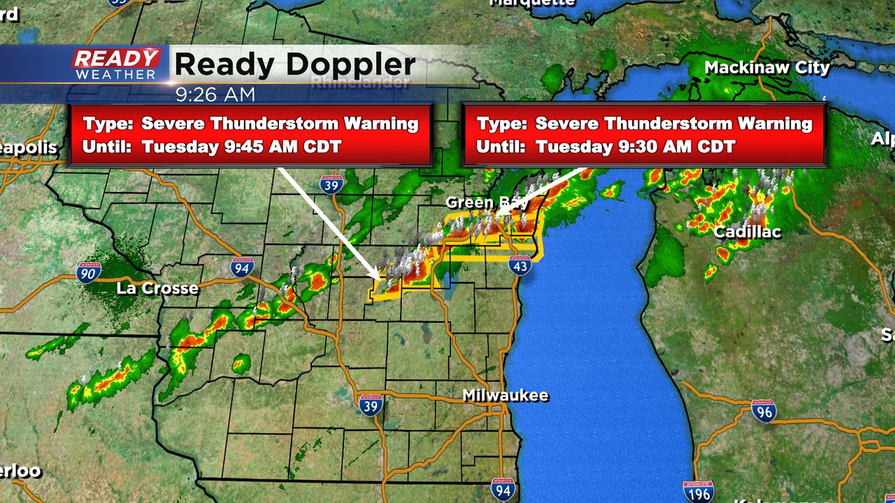
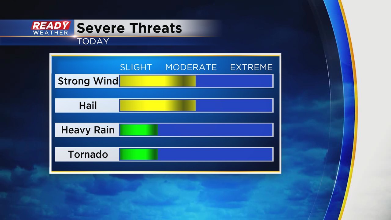
Hail and damaging wind will be the main threats with any storms today. A few downpours with lots of lightning are also expected. The tornado threat is low.
------
Posted: 6:51 a.m. Sep. 7, 2021
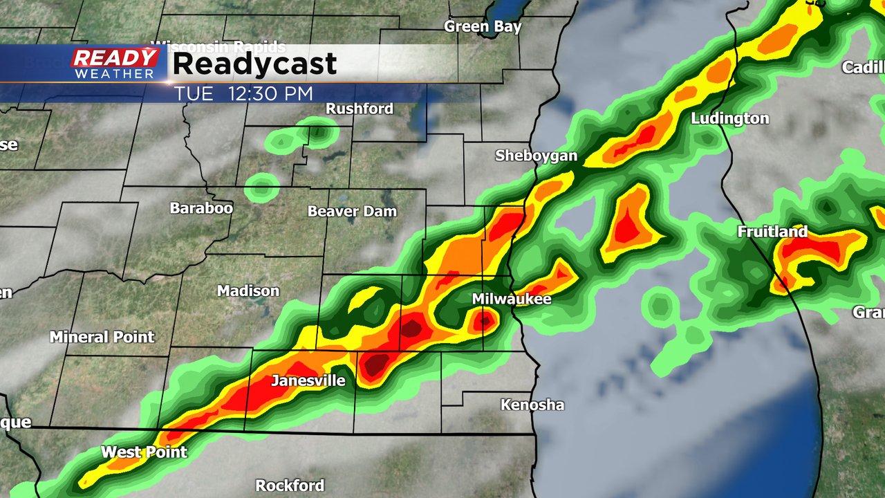
After a comfy and nearly perfect weather day for Labor Day, the heat and humidity will start to increase along with a chance for storms. We are watching showers and storms just ahead of a front in northern Wisconsin Tuesday morning. That rain will pick up a little steam and slowly strengthen as it moves across the state. The best chance for rain in our local area is from 10 AM in NW counties through 4 PM as it exists our SE communities. Storms should be in the Milwaukee/Waukesha area between 12-2 PM.
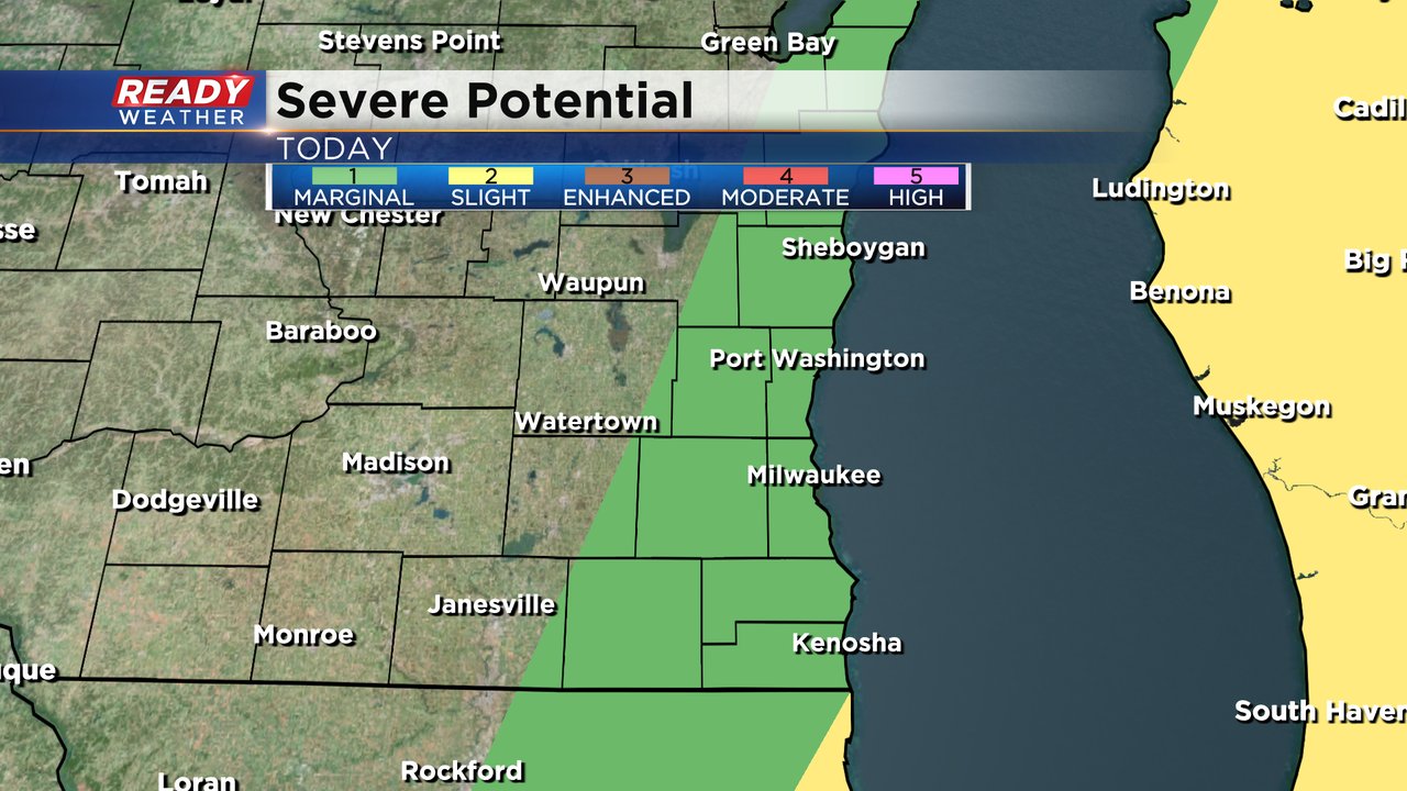
The storms will likely go from garden variety storms in our northern counties to strong or even possibly severe storms in areas around and south of Milwaukee. Most of our local counties are under the marginal risk for severe weather which is the lowest of the five risks. But the slight risk is just barely to the south of IL border. Damaging wind would be the main threat with any storms that form.
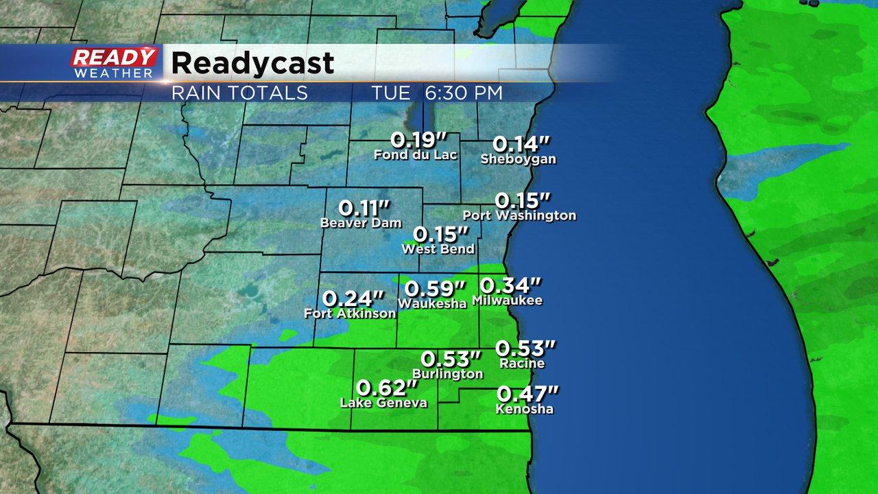
As storms strengthen they will drop more rain. Our northern counties might only get a tenth or two of rain but some southern communities could get up to or just a bit more than a half inch of rain.
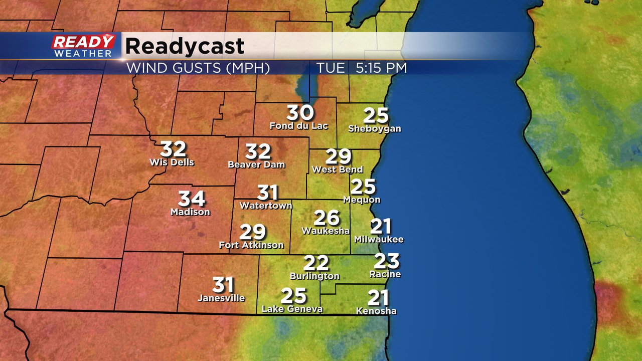
Regardless of the storms Tuesday will be a windy day. The wind out of the southwest will gust to 30 to 35 mph throughout the day. Wednesday also looks like a windy day with gusts to 25 mph.
High temperatures for Tuesday will greatly depend on when the cold front moves through. Some northern counties may only reach the upper 70s before the front arrives but some areas near the IL border could hit the middle 80s. Milwaukee and Waukesha should reach the low 80s. We may also see temps rebound a bit in the afternoon hours after the rain and storms end and the sunshine returns.
Download the CBS 58 Ready Weather app to track the storms and get alerts.