


Storm chances will return to southeast Wisconsin as we head into the upcoming weekend. The start time for those storms has trended earlier over the last 24 hours and now showers and storms look possible as early as Thursday evening.

Storm chances will increase after midnight Thursday night with scattered storms likely on Friday. The best timing for storms on Friday looks like morning and again in the evening but some dry time may be possible from late morning through the afternoon. Scattered storms are also likely on Saturday with timing looking most likely in the morning but could potentially linger through the afternoon.

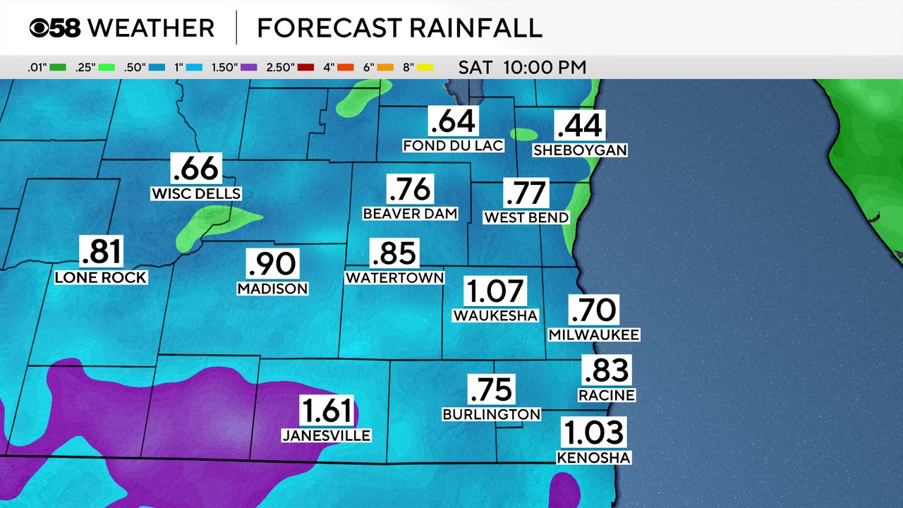
A decent soaking rain is possible with most of the local area picking up anywhere from a half to full inch of rain from Thursday evening through Friday evening. Some communities could get more if they see multiple heavy downpours or strong storms.
The strong storm potential is there for the weekend as well. None of southeast Wisconsin is currently included in any risk for severe weather for storms that form on Thursday, but an isolated strong storm cannot be ruled out. There's slightly better ingredients for strong to severe storms for Friday and Saturday with a Level 1 Marginal Risk in place for all of southeast Wisconsin.

Download the CBS 58 Weather app to track the storms with the interactive radar.