Some temporary relief from the heat and humidity around the corner

-
2:46

Tornado warning issued for parts of SE Wisconsin
-
3:29

Racine Zoo rounds out summer with concerts, car show and fundraising...
-
1:20

EAA AirVenture wraps up week of aviation thrills in Oshkosh
-
0:37

19-year-old killed in Milwaukee shooting near 73rd and Beckett
-
0:59

Jordan Love hosts youth football camp ahead of Packers training...
-
1:45

Madison protesters hold State Street sit-in, renew calls for...
-
0:38

14-year-old dies after e-bike crash in Sheboygan
-
2:49

30 p.m. Update: Severe weather threat ramps up overnight
-
1:59

37th annual Wheelchair Softball tournament gives purpose to each...
-
4:37

One father signs up to donate organs before passing, saving another...
-
1:25

Kenosha Sand Dunes
-
5:08

Family sits down to remember the joyful life of Nikolai Hanson

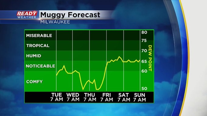
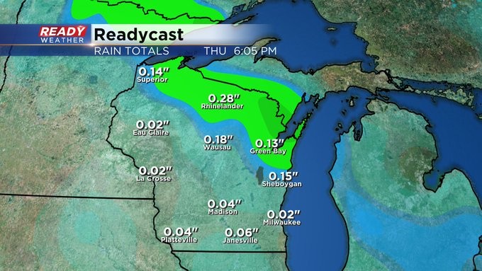
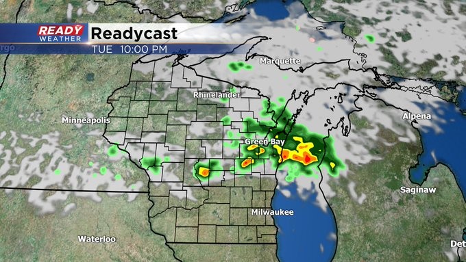
MILWAUKEE (CBS 58)--After reaching 90 degrees on Monday (sixth 90 degree day for the season), look for a little relief on Tuesday with highs in the 80s. You'll notice a slight decrease in humidity. But there's one more front we're waiting on, and it'll push through later Tuesday evening. This system will give us the chance for showers and storms into the evening. But once it passes, we'll be in the clear with both temps and humidity. We're talking about highs in the 70s for both Wednesday and Thursday.
It won't last long though. And why would it? It's mid-July after all. Some heat and humidity will return by the end of the week with a chance for showers and thunder by Friday evening, lasting into Saturday. Sunday should be fairly quiet. Highs then will be back in the 80s. Even warmer still into next week.