Soaking rains on Sunday for some with a few more storms possible Monday


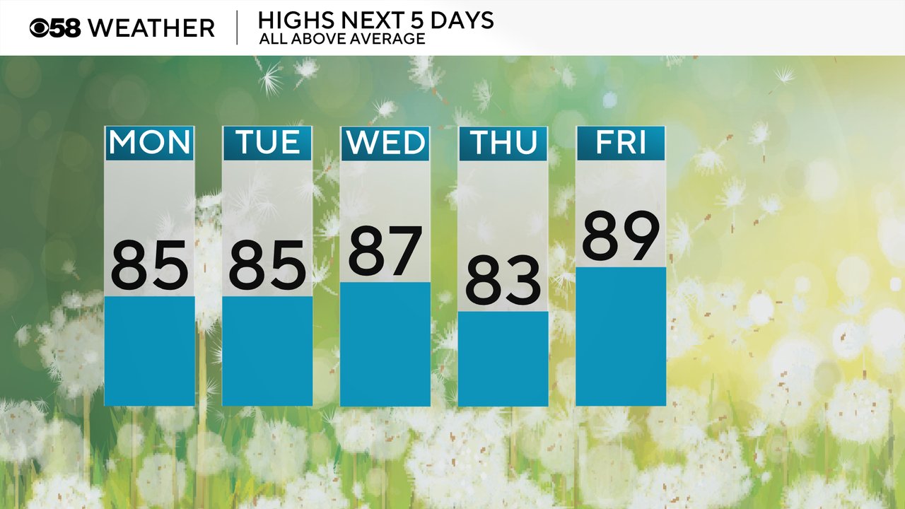
After a cooler day in 70s on Saturday things warmed up fast Sunday with highs in the upper 80s and low 90s. We will stay warm Monday with highs in the mid 80s and Tuesday will be similar. Wednesday warms up a touch then Thursday falls a bit but the beginning of the 4th of July weekend looks hot around 90.
The humidity stays very high and sticky for Monday with dew points hovering around 70 degrees putting it at near tropical levels. Less humidity is expected Tuesday and Wednesday in the lower half of the 60s but it doesn't completely go away. Expect that humidity to rise once again by the end of the week.
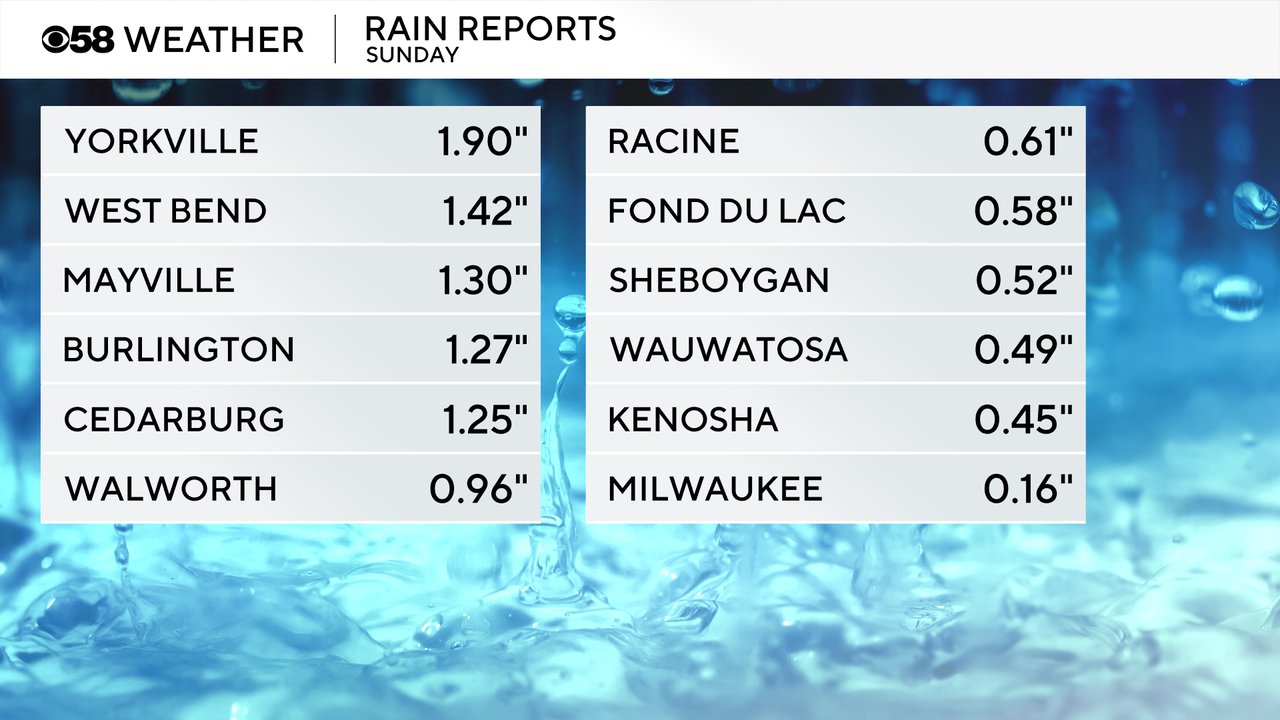
Sunday was a soggy day for parts of southeast Wisconsin. A few stronger thunderstorms popped up and while most of us at least saw something others got much more. Milwaukee and Waukesha only saw rain totals around a tenth or two but other communities got a half or full inch of rain and some areas like western Racine County and parts of Dodge and Ozaukee County saw over an inch or two.
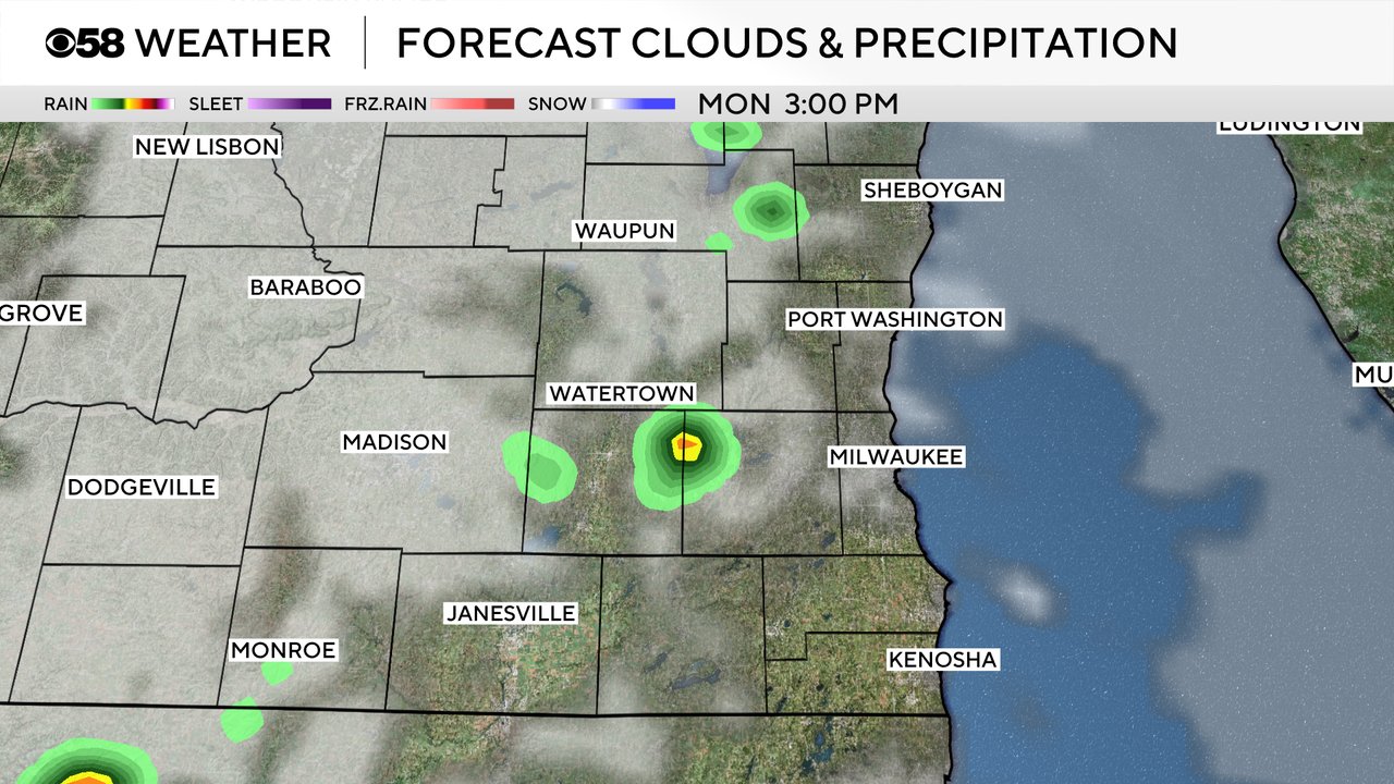
After a dry Monday morning through the midday hours, more isolated showers and storms are possible this afternoon and evening. Not everyone sees the rain but those that do could get quick downpours with a quarter to half inch of rain possible. The risk for strong storms is not great.
Download the CBS 58 Weather app to track any storms with the interactive radar and see the hour-by-hour forecast for the best chance for rain.