Soaking rain likely this weekend with a chance for strong to severe storms


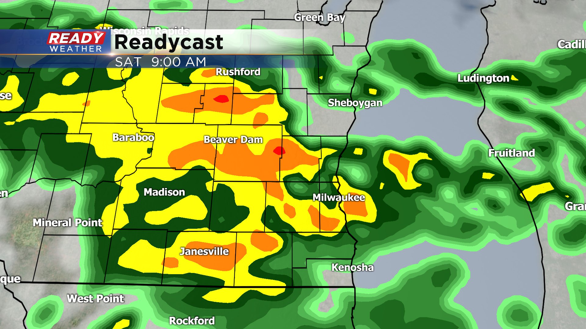
We've had some light rain over the past couple days but the greatest chance for rain, including some storms, arrives as we go into the weekend. Shower chances will start around sunset Friday evening. Most of the Friday night precipitation will stay fairly light and scattered but some heavier downpours are possible. There's a decent chance for a soaking rain in the mid-morning hours of Saturday before drying out around midday.
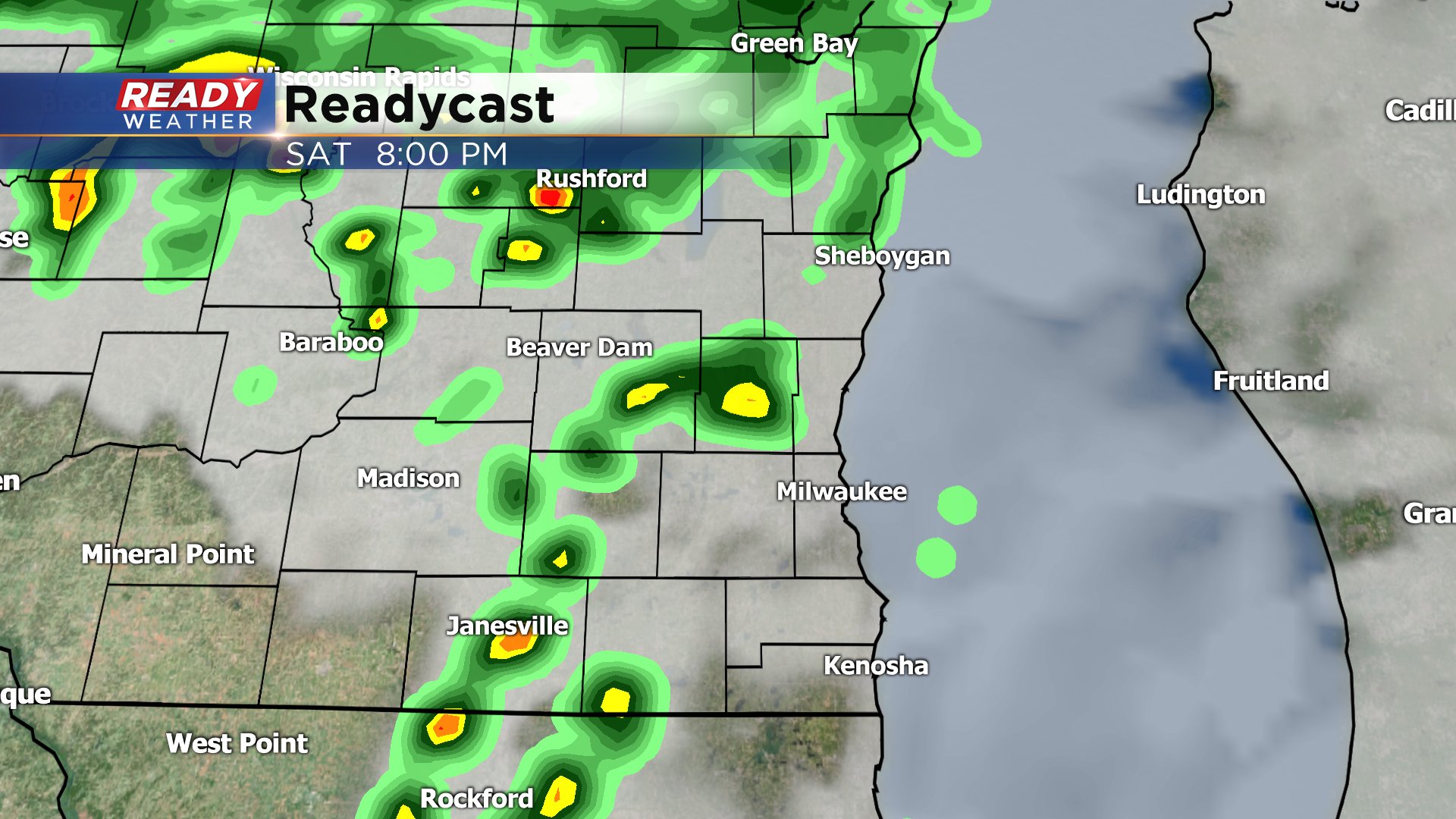
Any showers and storms that do form Saturday late afternoon and evening could be on the strong to severe side with heavy downpours likely.
This rain event lasts a little over 36 hours through around noon on Sunday. By the time it's all said and done many communities can expect to pick up 0.50-1.50" of rain. Some localized flooding and ponding of water may be possible since the ground is still frozen.

The severe weather threat is greatest to our south in west central Illinois where they are under a moderate risk. Severe storms there look fairly likely with the chance for some tornadoes. We cannot rule out an isolated tornado in southeast Wisconsin because the atmosphere has a lot of spin in it right now. Strong wind and large hail will be the main threats here along with some heavier rain.
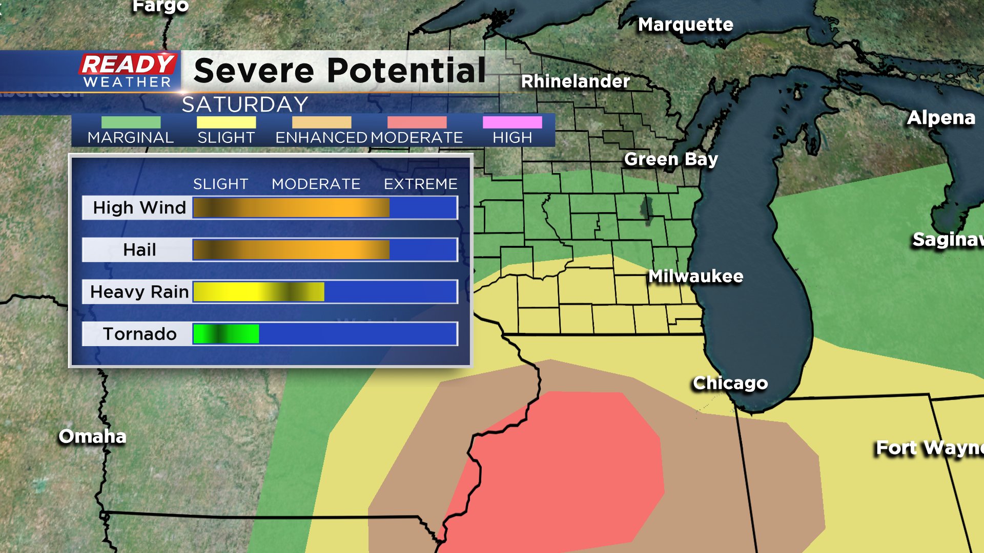
The focus of any severe weather for Saturday will be along the warm front. The last time we had the chance for severe weather was a very similar setup but the warm front stayed just south of the border keeping our temperatures cool. That is still possible however many weather models have the warm front at least getting up to the Wisconsin/Illinois border so those locations have the best chance for a severe storm.

Download the CBS 58 Ready Weather App to track any rain and storms that develop the next three days. The app will also give you alerts if severe thunderstorm or tornado warnings are issued.