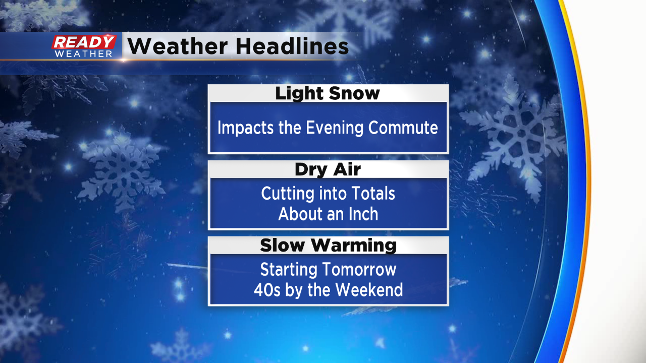
Evening Update: Light snow still possible.


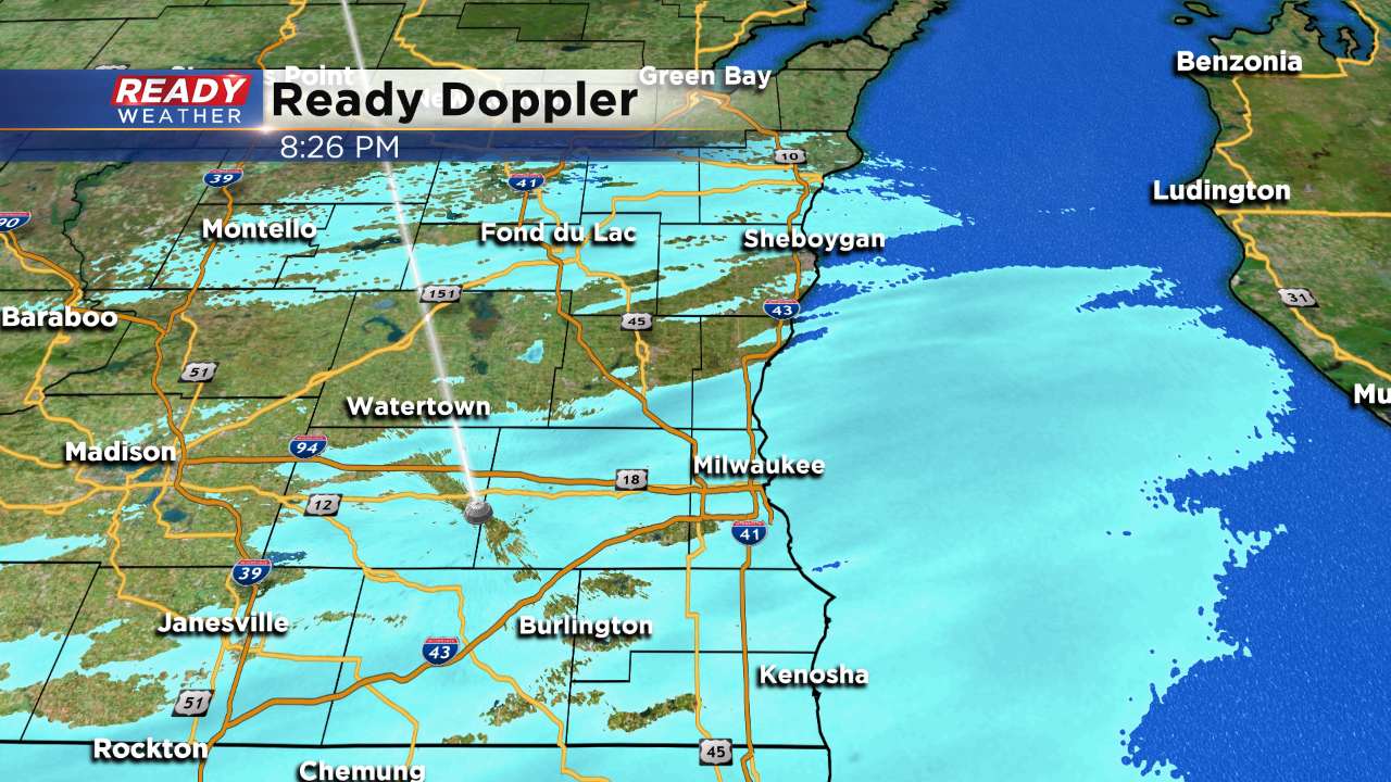
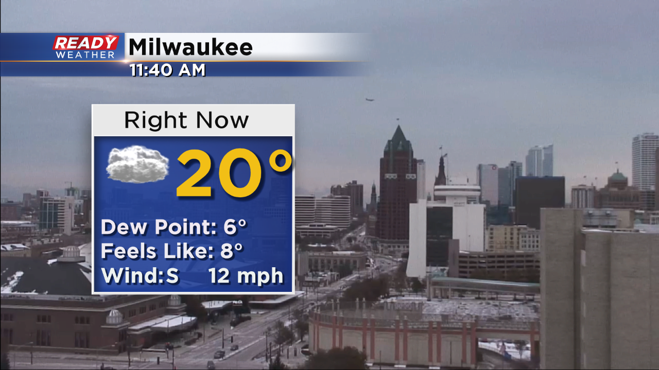
Snow continues to fall across the southern part of the area tonight. Temperatures in the middle 20s are helping to create slick secondary and side roads.
The light snow should move out by 11 pm with a gradual clearing later tonight. Overall accumulation should stay below a half an inch.
______________________________________________________________________________________________________________
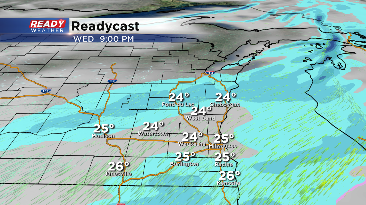
Light snow remains possible through 10 pm tonight. Light snow isn't expected to accumulate over a half an inch. The dry air has really cut into any significant totals.
Temperatures this evening will remain in the middle 20s, so snow could lightly coat roads with some minor problems.
______________________________________________________________________________________________________________
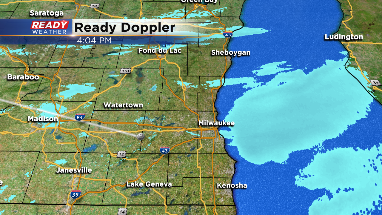
4 PM Update:
Light snow remains possible across southeastern Wisconsin this evening. Thankfully the dry air has been too much for the snow to overcome, so only light snow or flurries is expected through the evening.
Little to no additional accumulation is expected!
______________________________________________________________________________________________________________
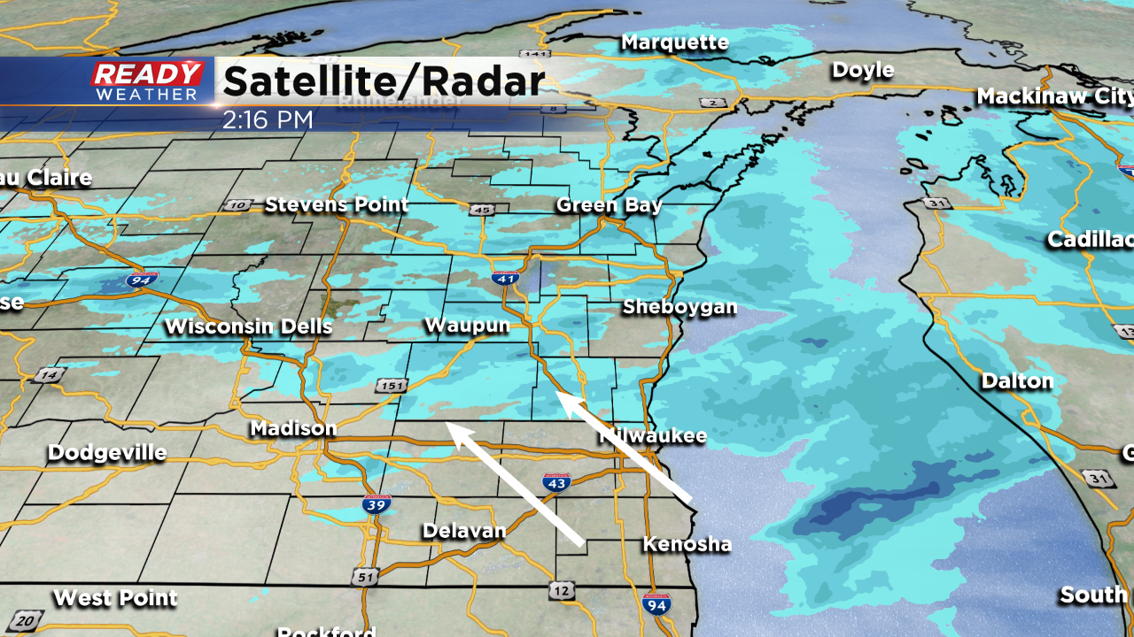
2 PM Update:
Light snow continues to fall north of Milwaukee. The lowest levels of the atmosphere remain very dry, so the snow has had a hard time overcoming the dry layer.
Light snow will continue to develop this evening; however, only very light accumulation is possible across the metro area. Temperatures are in the 20s, so there could be some accumulation north of Milwaukee.
______________________________________________________________________________________________________________
Updated: Noon November 13, 2019
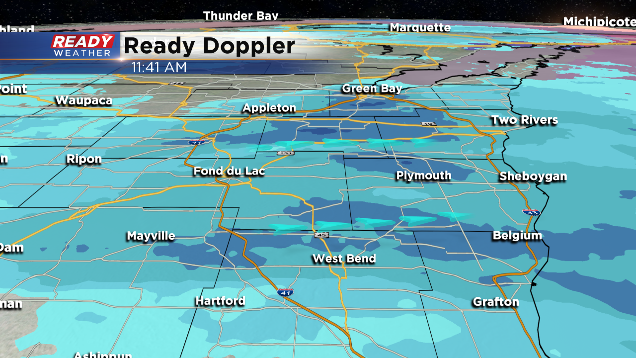
Snow is in progress for counties north of I-94. Here's the latest radar:
Updated: 9:45 a.m. November 13, 2019
Snow has tried to develop across Wisconsin Wednesday morning, but is battling dry air. Most of the snow is not reaching the ground, but a few flurries have been reported just west of Fond du Lac. Northern counties in our viewing area could see some flakes this morning, but the bulk of the snow is build in this afternoon with the steadiest snow this evening.
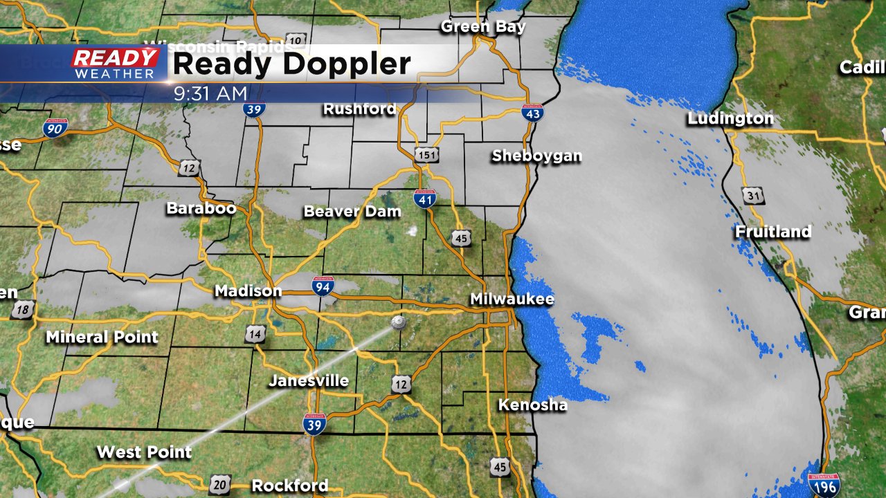
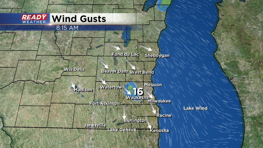
The wind has continued to pick up gusting to 30 mph at times. Once the snow starts, visibility will be the biggest issue falling below 1 mile at times.
------
Posted: 5:18 a.m. November 13, 2019
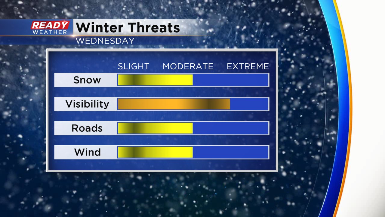
It's been a week full of winter with snow Monday, record cold Tuesday and now another round of snow Wednesday. The morning commute for Wednesday morning will be just fine but snow starts to develop in the afternoon and continue through the evening. Expect some light snow showers to continue through around midnight.
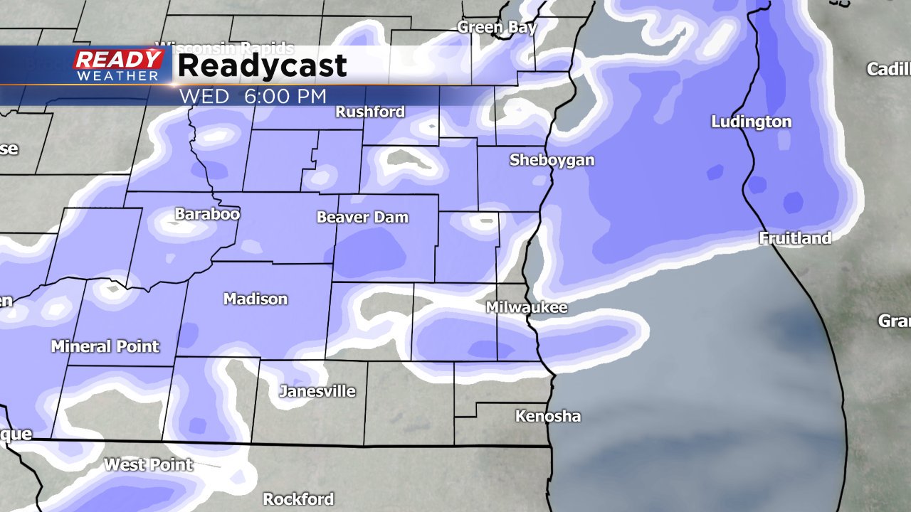
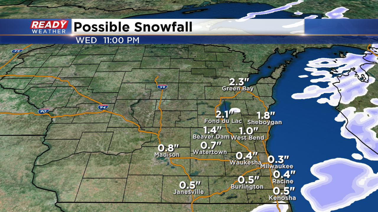
The evening commute will likely be a little slick with snow covered roads in spots. Snow totals have come down a little from Tuesday morning's forecast with up to 2" for most. Some spots near the Illinois border may not even see an inch with highest totals in northern communities where isolated spots could see 3".

Although the rate of the falling snow will be fairly light there will be a good amount of wind to contend with so expect visibility to be below a mile at times. The wind will gust as high as 30 mph during the afternoon and early evening.
Download the CBS 58 Ready Weather app to track the snow and look ahead to our next chance.