Snowy stretch comes to an end pushing Milwaukee above-average for first time this winter
Our long stretch of days with snow in southeast Wisconsin has come to an end. Sunday morning all of southeast Wisconsin saw at least a little snow with totals ranging from just 1" in Fond du Lac to just over 6" in Wind Point, Racine County.
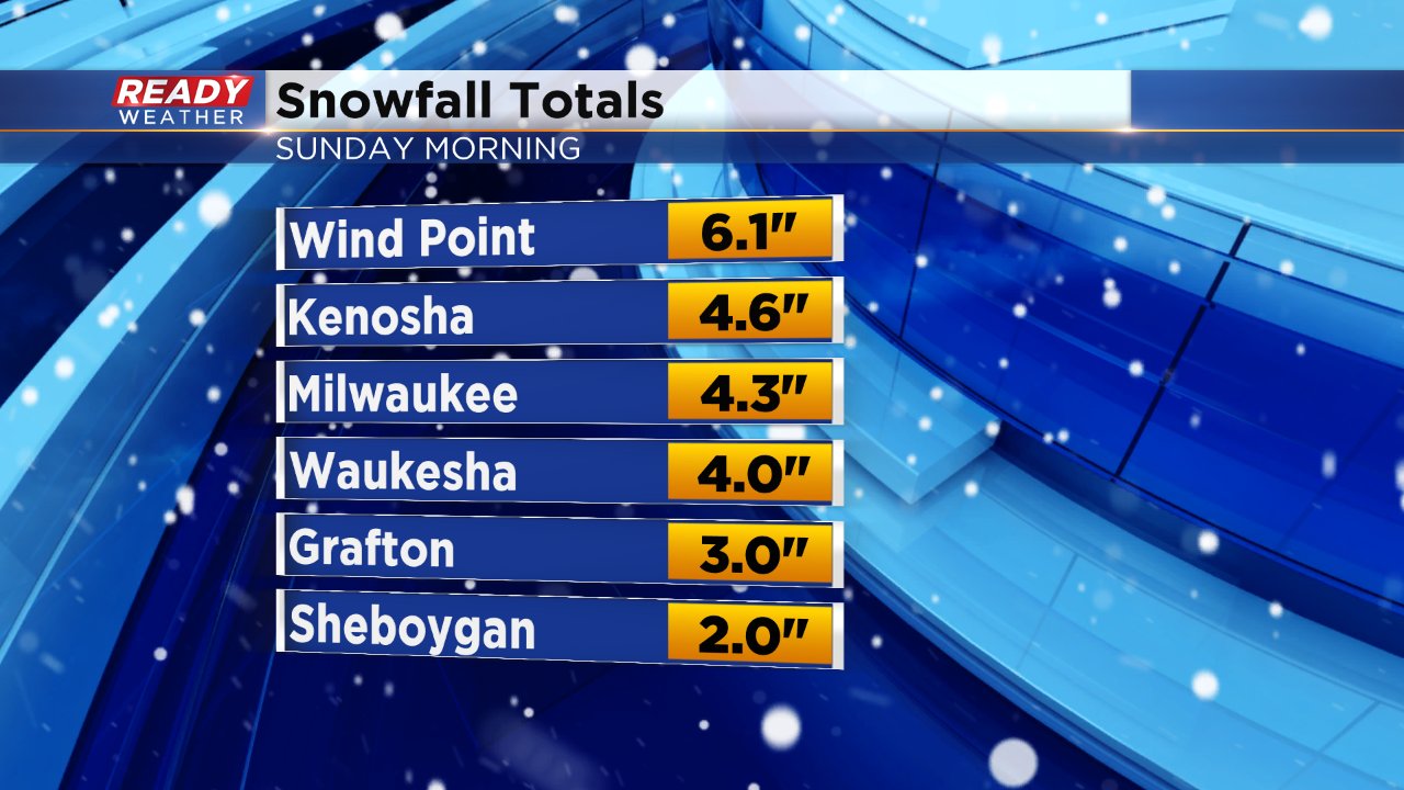
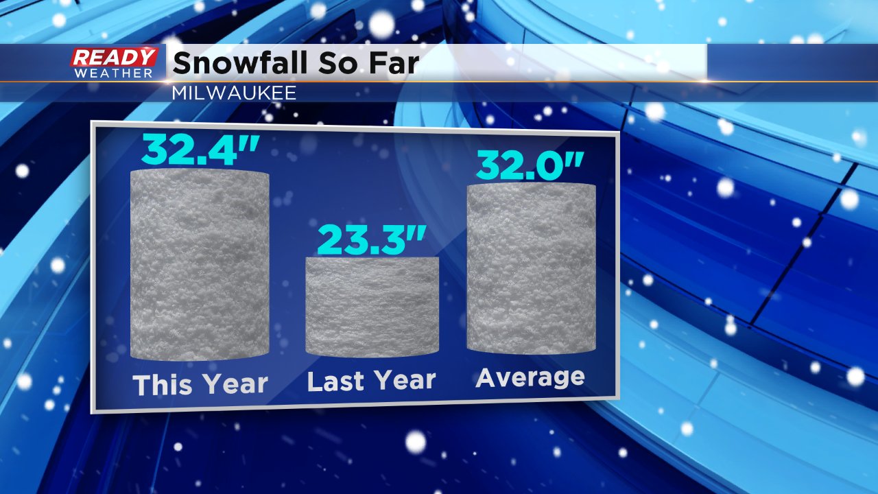
Milwaukee officially picked up 4.3" of snow Sunday morning which is enough to push this winter over the average snowfall through today's date of 32" for the first time! We are also about 10" above last year's snowfall of 23.3". Our yearly average snowfall in Milwaukee is 46.9", the last time we had an above-average snowfall season was winter 2013-2014 when 63.4" of snow fell.
The past nine days in southeast Wisconsin have been the snowiest stretch of weather since 2015. Each day has seen at least a dusting of snow. Tuesday was the only day that did not get measureable snow only recording a trace officially. If Tuesday had seen at least a tenth of snow it would make this nine stretch the longest stretch on record. Snow the past nine days totaled 16.2" with the biggest storm arriving Thursday night into Friday when 5.4" of snow fell in Milwaukee.
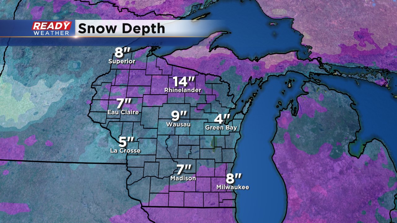
This long stretch of snow has put Milwaukee's snow depth at 8" which is the deepest it has been this winter.
Now we get enjoy some quiet weather with our next chance for snow (this time mixed with rain) arriving Thursday.
