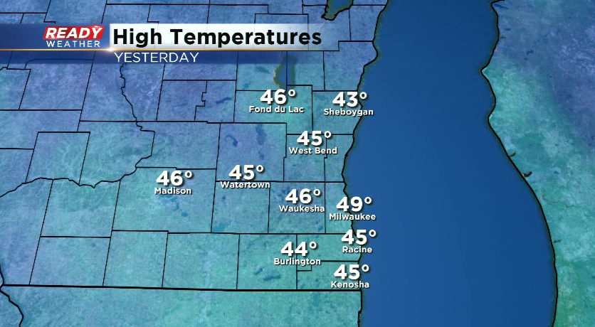
Tuesday was our warmest day so far this year as temperatures warmed into the mid to upper 40s.
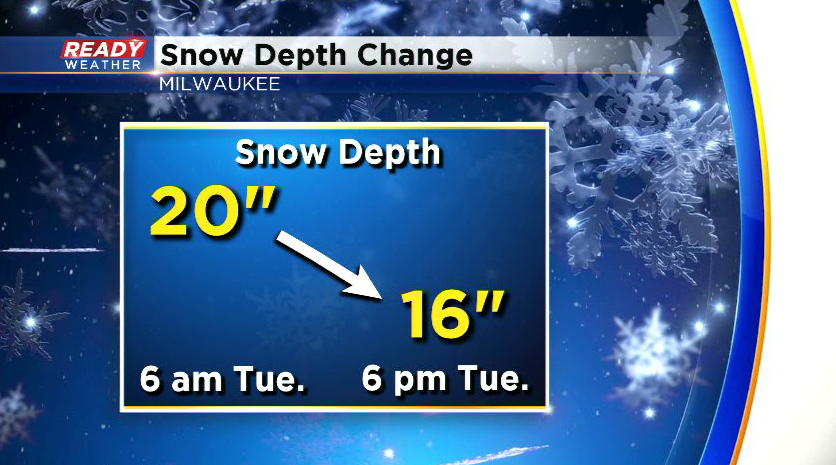
The mild temps and sunshine helped make a good dent in our snowpack. Around 20” of snow was on the ground Tuesday morning, but by Tuesday afternoon it had already dropped to 16”
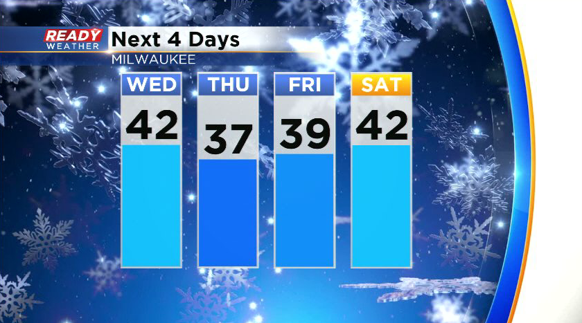
Expect the melting to continue as temperatures remain mild over the next few days with highs in the 30s to low 40s. However temps will be a bit colder the next few nights, dropping back into the 20s.
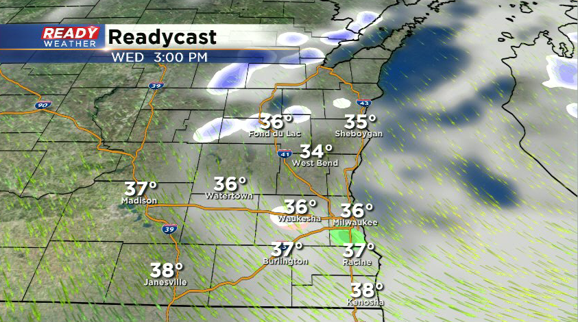
While primarily dry weather is expected for the second half of the work week, we can't rule out a few isolated sprinkles or flurries this afternoon as a cold front moves through. Best chance will be north of Milwaukee.
A better chance for a rain/snow mix will come late Friday night into early Saturday morning. Download the CBS 58 Ready Weather App to track the sprinkles and flurries.
