Evening update: Light to moderate snow coming to an end by 11 pm; slick roads reported.


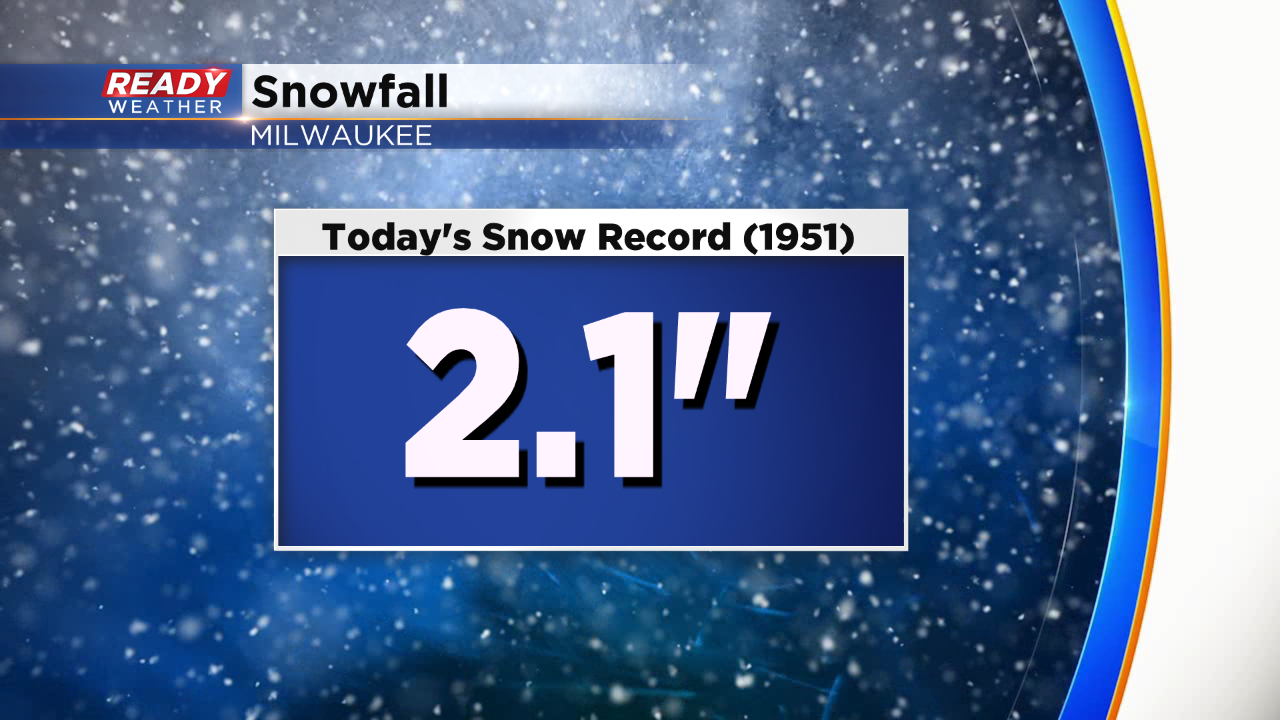
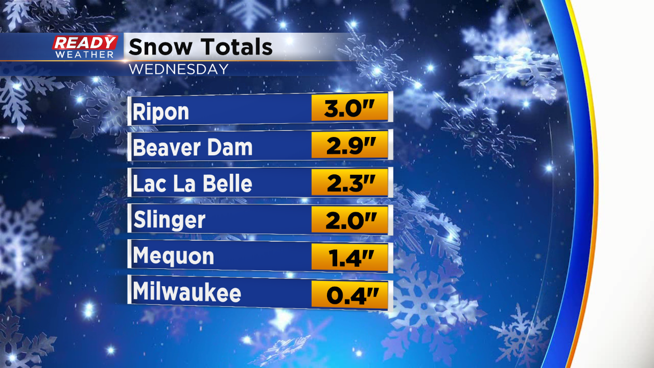
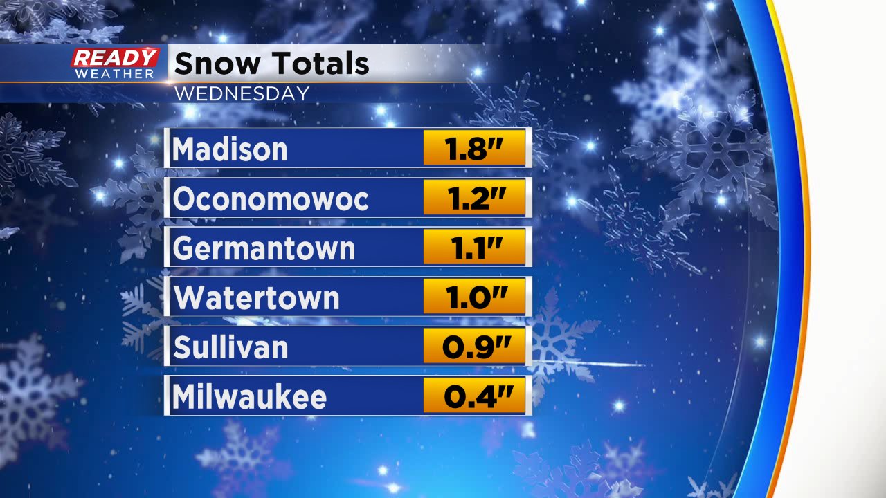
Today's snowfall record in Milwaukee is 2.1". Unofficially Milwaukee has recorded 2.5" of snow so far. A record breaking day.
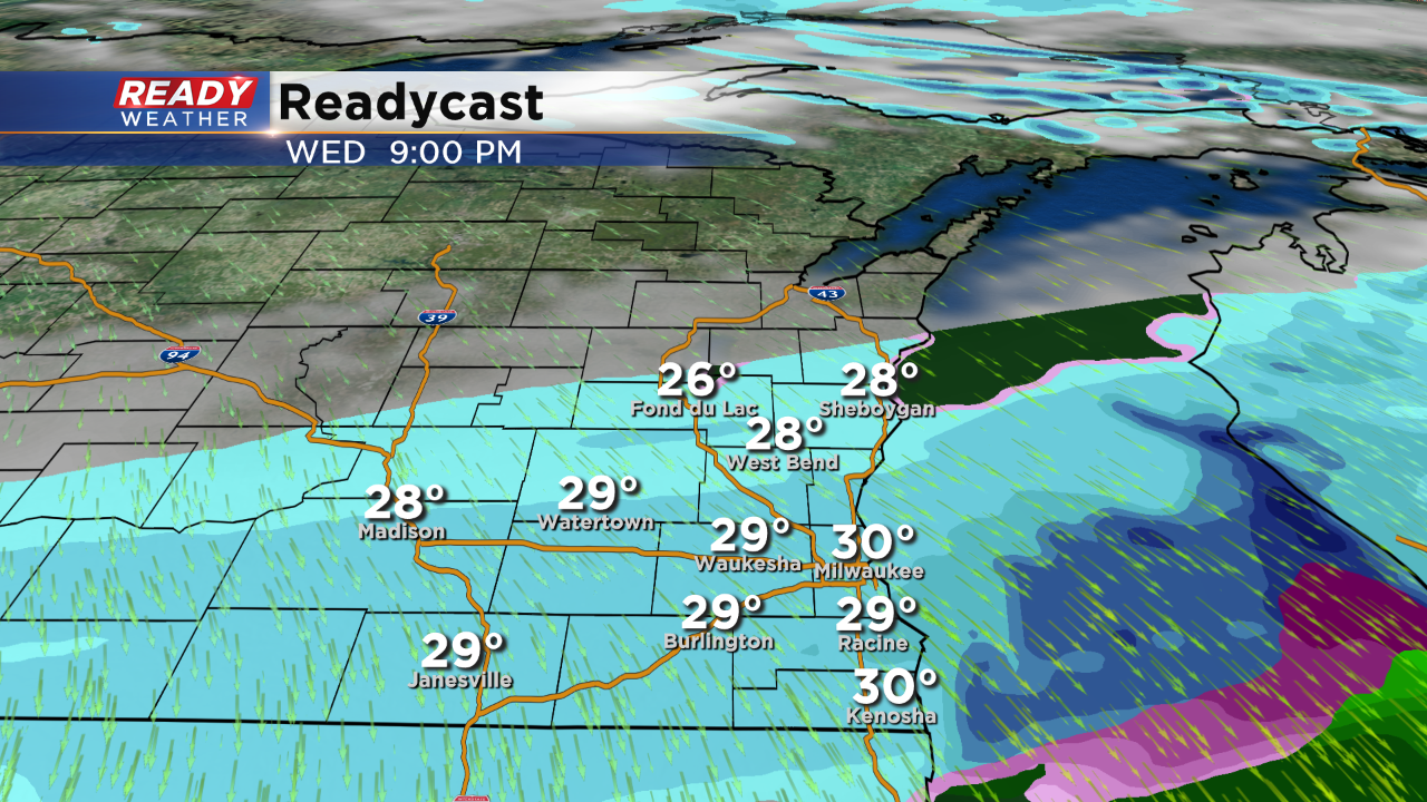
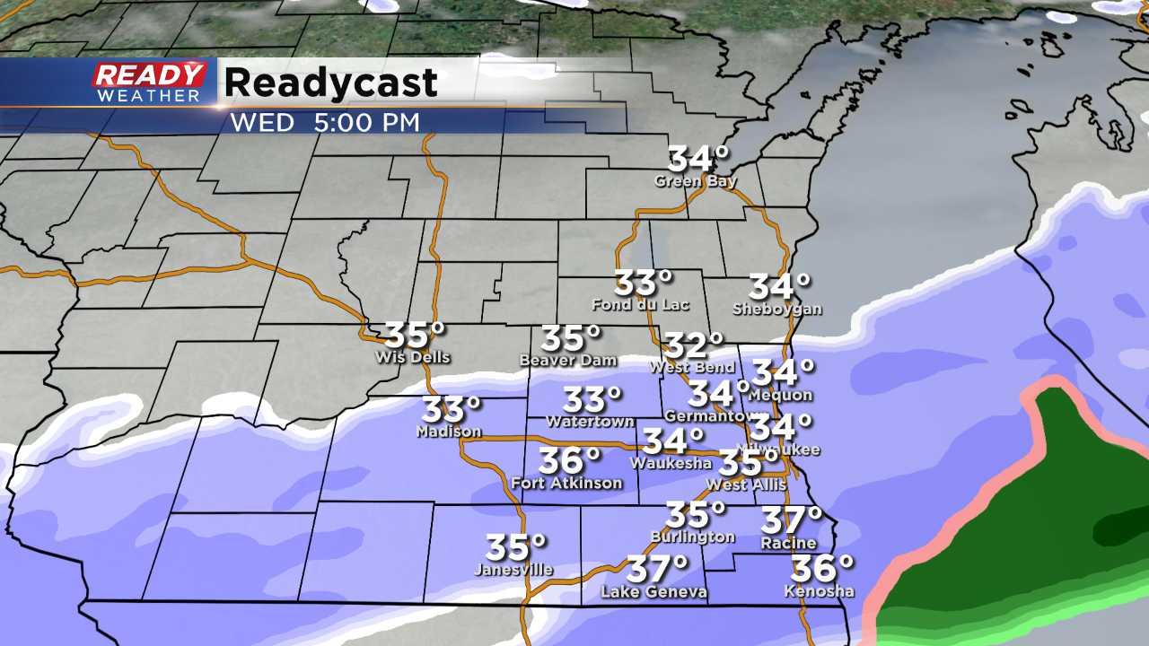
Temperatures will remain in the upper 20s and lower 30s through 11 pm. Light to moderate snow will continue to fall across southeastern Wisconsin through 11 pm. While an additional inch of accumulation is possible, we aren't expecting another advisory to be issued. Roads are slick, especially side roads. Use caution while driving.
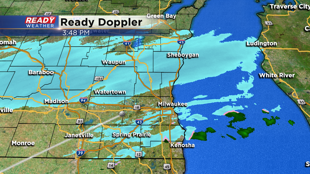
Heavier snow bands have also reduced visibility!
______________________________________________________________________________________________________________
4:00 PM
The second and final round of snow is now sliding back across the area. Expect the light snow to continue through 10 pm. While some accumulation is possible, totals will remain below an inch.
Some roads could be slick this evening, so please use caution.
______________________________________________________________________________________________________________
2:00 PM Update:
The winter weather advisory has been cancelled. More snow is possible this evening; however, it shouldn't cause major issues on the roads.
Light accumulation up to an inch is possible. The snow should exit the area by 11 pm.
______________________________________________________________________________________________________________
Updated at 11:45 a.m. November 6, 2019
We're starting to see a lull in the snow activity.
Updated: 9:55 a.m. November 6, 2019
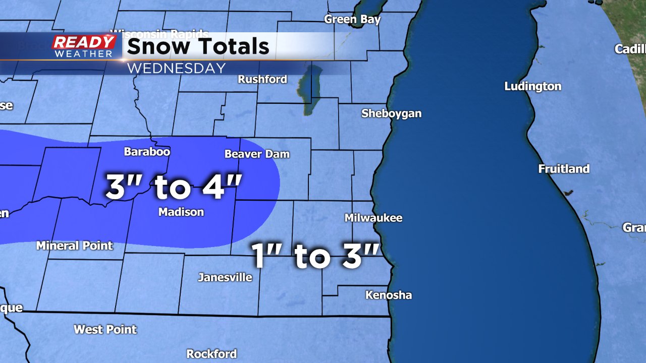
Snow totals continue to roll in as steady snow falls for most of southeast Wisconsin. Southern communities along the Illinois border haven't seen much beyond a few snow showers and for the most part snow is staying north of there. As we go into the afternoon we could see some more snow develop in these areas but expect the lowest totals south of I-94 where most see just around 1" or less. The highest totals so far have come in north of I-94 in parts of Dodge and Washington Counties where moderate snow bands have been consistent.

Expect the moderate snow to continue for the next few hours but is already ending west of Madison. We are awaiting a secondary wave which will be the focus of some redevelopment during the afternoon. Snow is expected to end from noon to 9 p.m. from north to south across the area.
------
Updated: 7:42 a.m. November 6, 2019
Steady light to moderate snow is currently falling across most of southeast Wisconsin, especially along and north of I-94. The moderate snow will continue for a few more hours and then become a little lighter as we go into the afternoon. Snow totals are still on track for 1-4" for most of the area.
Snow reports are starting to come in with just a few tenths in some eastern communities and around an inch or just a bit more in some western spots.
------
Updated: 5:51 a.m. November 6, 2019
Snow has been increasing in intensity throughout Wednesday morning with numerous crashes reported. Snowfall rates will continue to increase as we get closer to the morning commute with a couple inches of snow possible in some areas by 8 a.m. The snow itself combined with the impact on roads and the morning commute will be the biggest threat this morning. A little rain could mix in for southern spots but wind is fairly light.
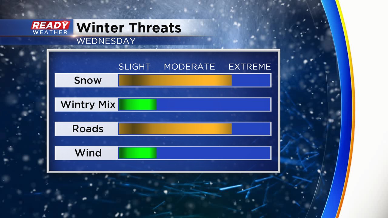
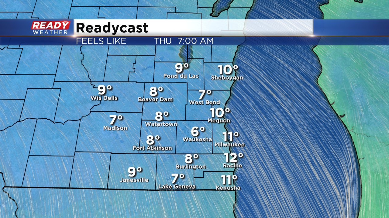
After the snow moves through expect a big push of cold air with wind chills Thursday morning staying in the single digits for some.
------
Posted: 4:25 a.m. November 6, 2019
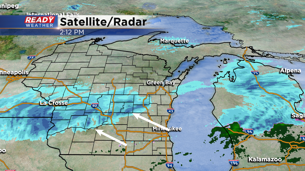
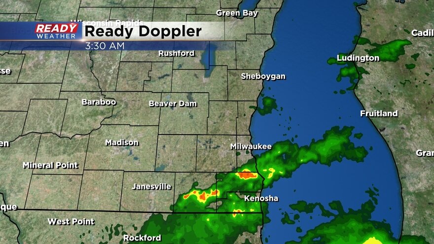
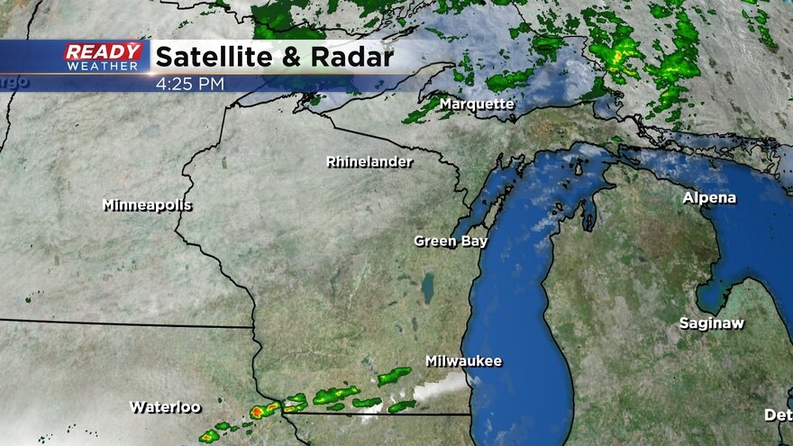
Snow flakes started falling just after 2 a.m. in southeast Wisconsin Wednesday morning. The snow battled some dry air before it picked up in intensity. Expect light to moderate, but steady snow, to ramp up the next few hours becoming very steady through the morning commute. Here's the latest radar image:
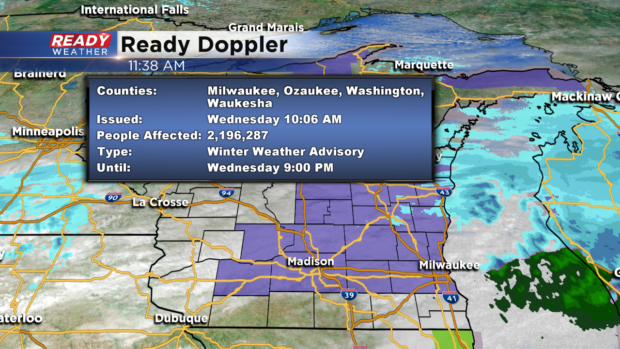
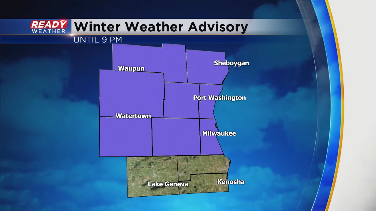
There is increasing confidence that the snow will last through the afternoon in some communities finally wrapping up in southeast spots by Wednesday evening. The winter weather advisory has been extended until 9 p.m. for Sheboygan, Dodge, Washington, Ozaukee, Jefferson, Waukesha and Milwaukee Counties. Walworth, Racine and Kenosha Counties are still not included.
Snow totals look fairly on track with 1-4" for most of southeast Wisconsin. The highest totals will likely be in western spots where around 4" is likely.
Download the CBS 58 Ready Weather app to track the snow all throughout the day.