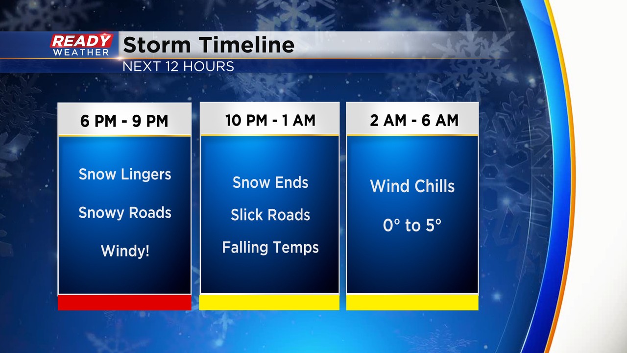
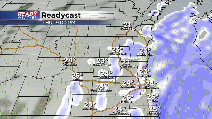
Evening Update: Snow coming to an end by 11 pm


9:30 p.m. February 16, 2023
The snow will come to an end from west to east by 11 pm. It doesn't look like lake enhancement will influence the lakeside areas tonight. Roads will remain bad across the entire viewing area. Temperatures in the 20s aren't helping anything.
While the snow will be coming to an end, the wind chills will be an issue by morning. Plan on single digit wind chills to start Friday!
______________________________________________________________________________________________________________
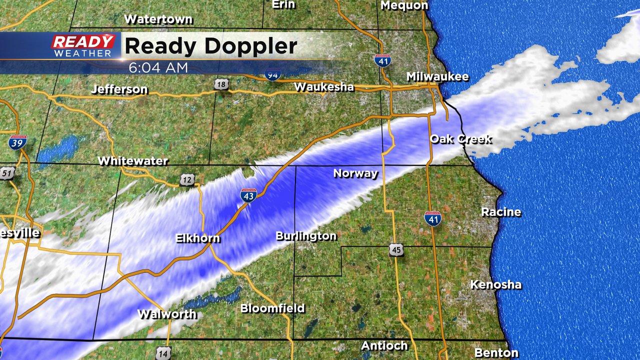
6:30 p.m. February 16, 2023
The back edge of the snow will rotate through from now until 10 pm. We still have the chance for a lake enhanced band that will impact Milwaukee, Racine, and Kenosha.
Generally, another 1" to 3" will be possible as that band comes through. Roads are already problematic and won't improve this evening. Wind chills by Friday morning will be in the single digits.
______________________________________________________________________________________________________________
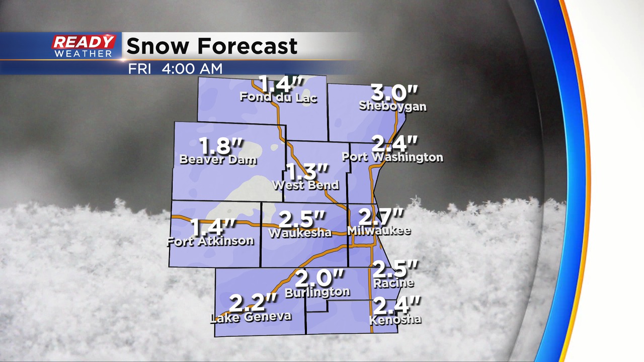
4:00 p.m. February 16, 2023
Most of the advisories and the warnings have been extended to account for the snow. We are expecting the snow to remain steady through the evening. Most of the snow will come to an end from 10 pm until Midnight. The roads will continue to deteriorate this evening with the back edge of the snow coming through.
Lakeside areas might experience a lake enhanced band to add to the totals. Overall, we are already seeing 3" to 6" across the winter storm warned area. Another 2" to 4" are possible tonight within the warning.
______________________________________________________________________________________________________________
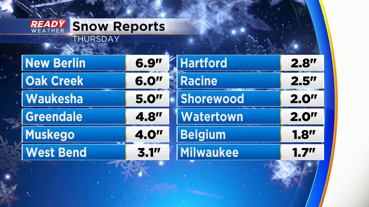
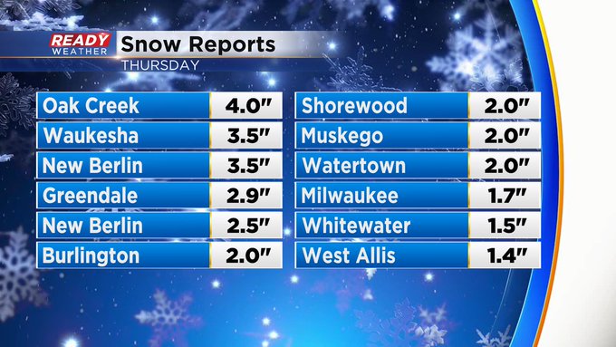
1:30 p.m. Feb. 16, 2023
At times snowing to beat the band! Look at some of these totals!
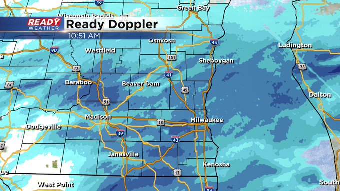
10:55 a.m. Feb. 16, 2023
Moderate snow now covers the entire viewing area.
9:06 a.m. Feb. 16, 2023
A band of snow that is already dropping accumulation has been expanding and impacting most of Milwaukee, Waukesha, Walworth, Jefferson and Racine Counties. The bigger area of steady snow is still moving in from the west and south.
Most of southeast Wisconsin will see steady snow by late morning with the heaviest snow expected during the afternoon and evening. Snow is still on track to wrap up by late evening with 4-8" of snow for most.
Monitor closings in southeast Wisconsin HERE
Keep track of the latest forecast in the CBS 58 Ready Weather app. Download it HERE
------
Updated: 7:04 a.m. Feb. 16, 2023
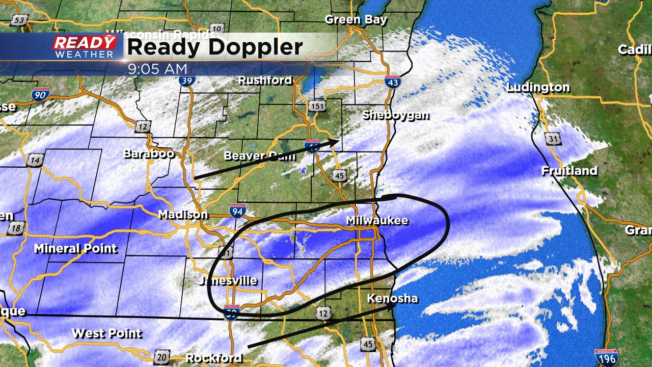
Snow is starting to roll into southeast Wisconsin. Around 6 Am we saw a thin band of moderate steady snow develop from Lake Geneva northeast into Oak Creek. Snow has been reported at the airport in Milwaukee. Air temperatures are cold enough where the snow will stick immediately when it starts to fall.
Steady snow is still expected for all of southeast Wisconsin by mid-morning with heavy snow in the afternoon and evening and snow ending by 10 PM in lakeside areas.
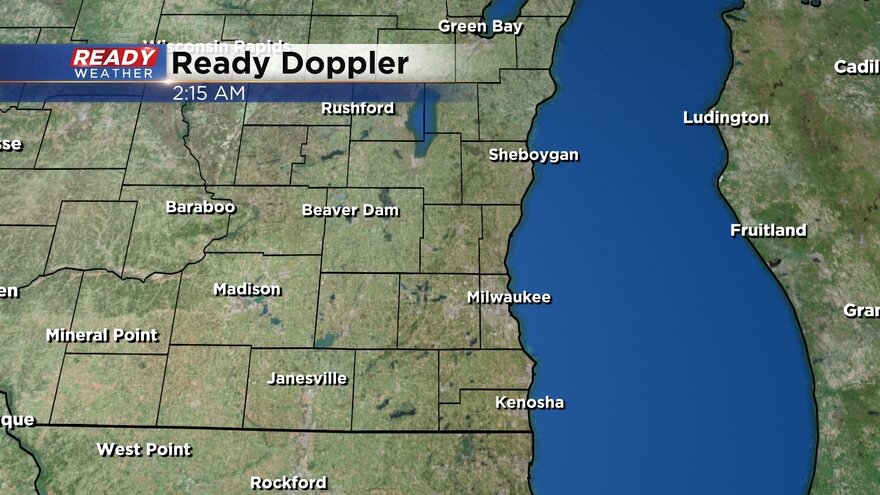
Here's a check of the current radar image that will update with time:
There is no change to the snow forecast with most of southeast Wisconsin expecting 4-8" of snow. Scroll down to the previous update to see the updated snow map. If any changes are made today it may be to add more snow where up to 10" may be possible.
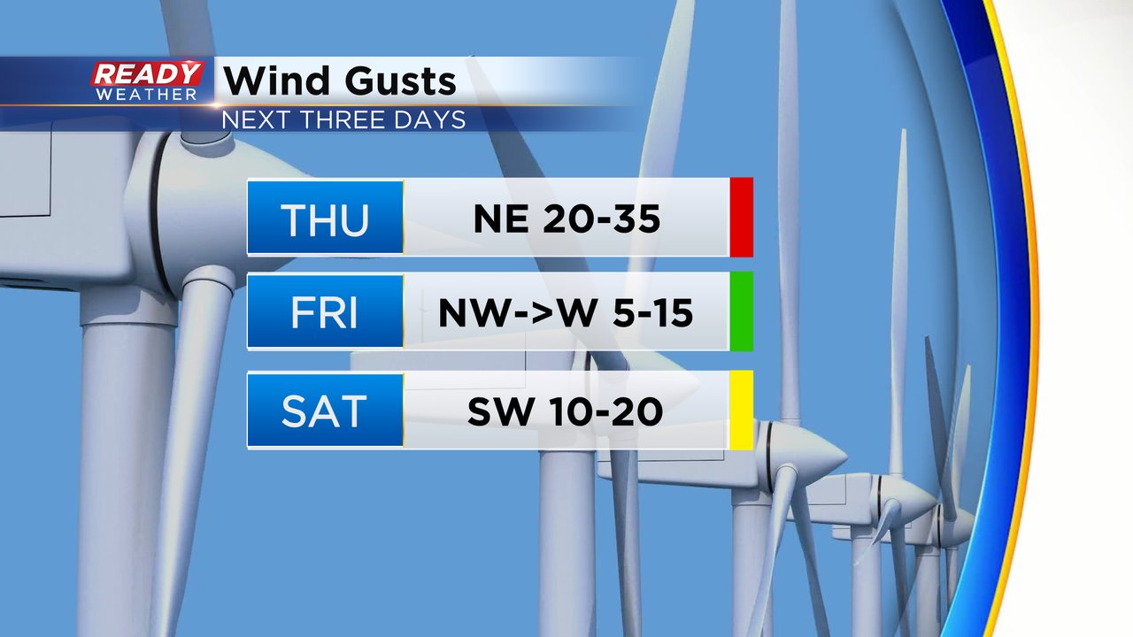
The wind and resulting blowing snow will be a big issue with gusts over 30 mph at times on Thursday. The wind will stay strong Thursday night then lighten up during the day Friday. Another round of strong wind is expected Friday night with a breeze lingering most of Saturday.
The CBS 58 Ready Weather app has all the tools you need to track this winter storm.
------
Posted: 4:53 a.m. Feb. 16, 2023
Our winter storm is knocking on the door. As of 5 AM snow is right along the Wisconsin/Illinois border and moving northeast. Getting into work might be ok but getting home this afternoon and evening will be very difficult.
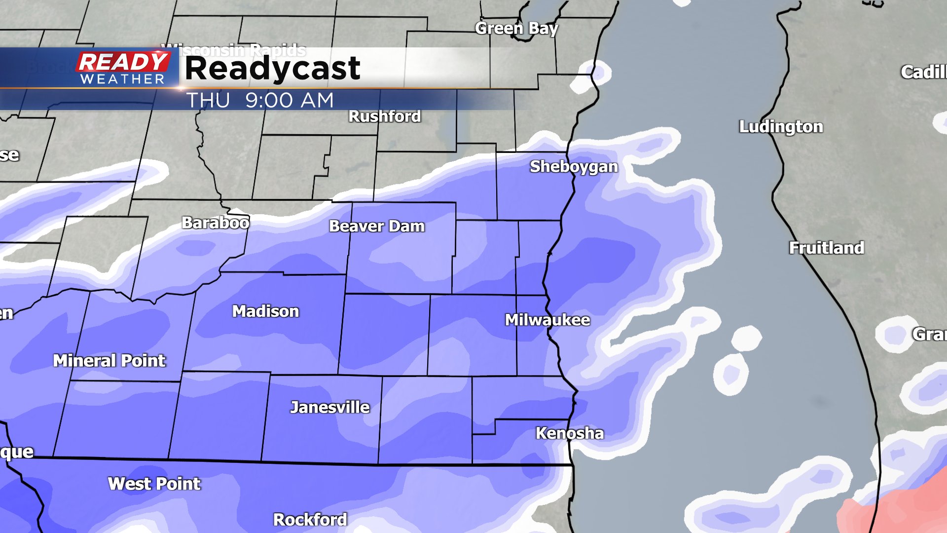
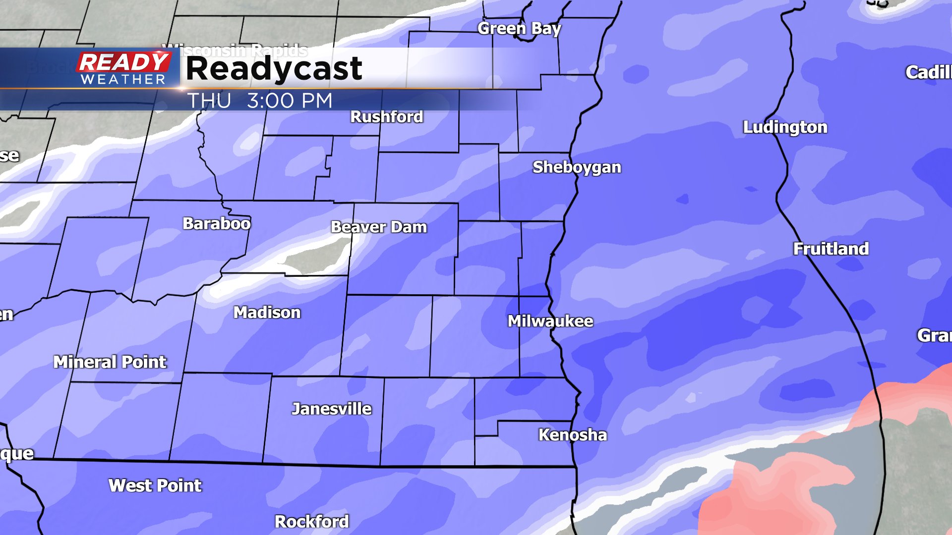
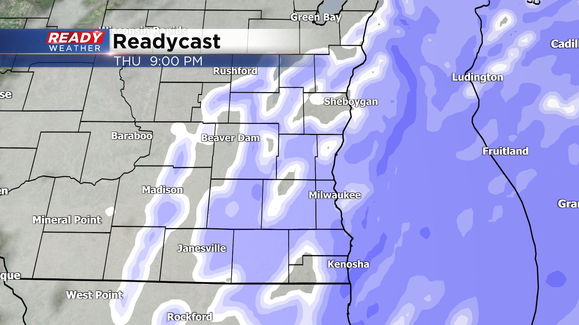
Blowing snow will be an issue all day but the heaviest snow bands are expected during the afternoon and evening. Snow will roll in during the morning commute and by 9 AM most of southeast Wisconsin is seeing steady snow. The steady, and at times heavy snow, will last through dinner time then starts ending between 7-10 PM from west to east with most of southeast Wisconsin done with accumulating snow by 10 PM.
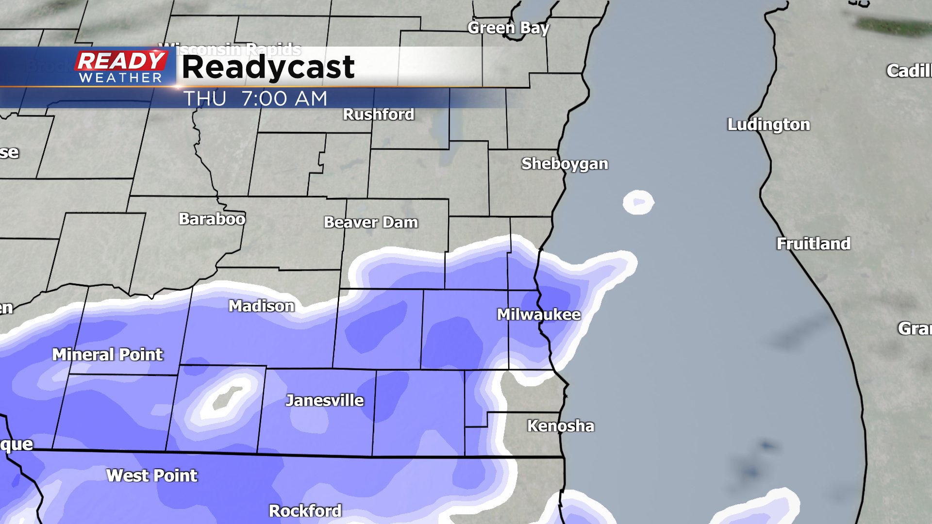
Here's a snapshot of the expected radar at different points of the day:
A winter storm warning and winter weather advisory will go into effect at 9 AM Thursday morning. The advisory is in effect for Fond du Lac, Sheboygan and Dodge Counties. The warning is in effect for the rest of southeast Wisconsin. The end time of the advisory or warning depends on where you live but most are done with the snow by 9 or 10 PM.
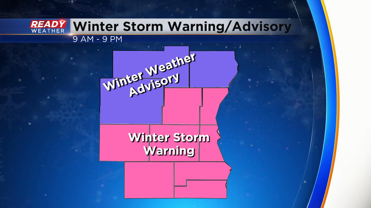
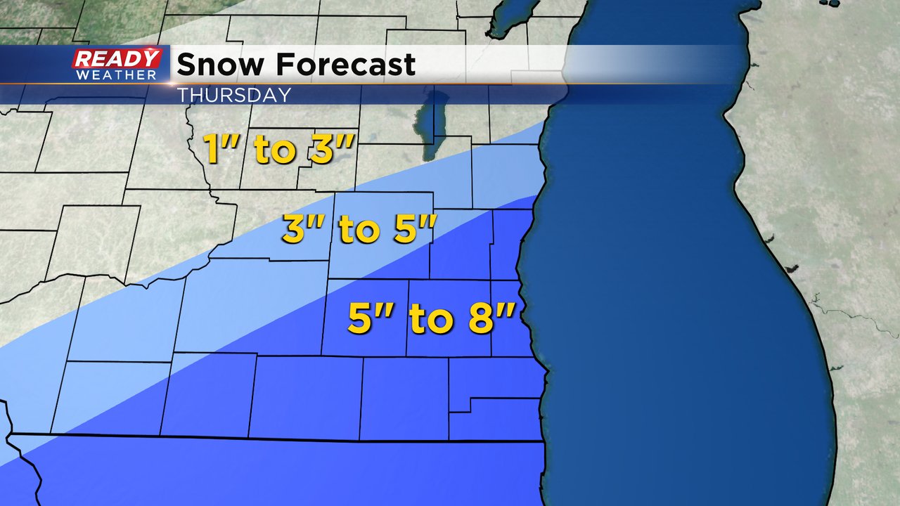
Overall only minor changes to the snow forecast we showed you on Wednesday. 5-8" of snow is expected for most of southeast Wisconsin especially those in the winter storm warning. In most of the counties under the winter weather advisory you can expect 3-5" of snow with 1-3" expected to our northwest.
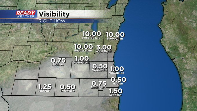
The threats for this winter storm are fairly high. The rate of the snow during the afternoon and evening will be very heavy with rates of 1" or 2" per hour at times, especially near the lakefront, where lake enhancement is possible. The morning commute won't be terrible with snow just starting to come down and roads overall in decent shape. But the afternoon and evening commute will be fairly awful with very heavy snow falling. The wind during the storm will stay elevated with wind gusts above 30 mph possible during the entire day. With a drier snowfall this will cause lots of blowing snow and reduced visibility.
Download the CBS 58 Ready Weather app to track the incoming snow.