Signs point to a cool second half of March

-
2:41

Storms into the afternoon then quieter
-
1:47

WisDOT updates CBS 58 on freeway projects across SE Wisconsin
-
5:12

Discussing latest health headlines with UW Health
-
4:17

Dairy Farmers of Wisconsin shares Easter recipes and candy-cheese...
-
2:38

Meet CBS 58’s Pet of the Week: Stella
-
3:01

Natalie’s Everyday Heroes: JCC disability inclusion programs...
-
2:05

Milwaukee Lyft driver held at gunpoint, carjacked by passengers
-
2:20

Milwaukee mayor criticizes Trump administration, pushes for housing...
-
0:20

Woman wanted in connection to Waukesha stabbing investigation...
-
0:27

Gov. Evers vetoes bill requiring state opt into private school...
-
2:41

14 arrested at Bayshore Mall on charges of disorderly conduct,...
-
0:50

Friendship Circle of Wisconsin president presented with FBI director’s...

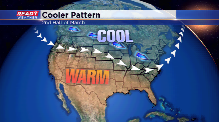
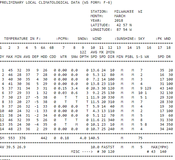
A buckle in the jet stream could keep the temperatures below average the rest of the month. The numbers have not been very mild to begin with; the average temperature has been around a degree above normal, but we have yet to have a 50 degree high this month.
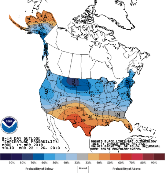
A very active jet stream could lead to several rounds of precipitation just to our south, and for the most part, this is keeping the warmer air to the south. Due to this, the CPC has highlighted most of the northern United States with a “probability of below” average temperatures the next 8-14 days, or essentially the rest of the month.
There will be a brief warming trend for the weekend with possibly a 50 degree high. Next week, the temperatures will be stuck in the 40s, some parts in the 30s.