Showers, drizzle, and fog Easter Sunday changes to slushy snow Monday


It sure was nice to see the sun throughout the morning and early afternoon today, but clouds have moved back into the area ahead of some rain.
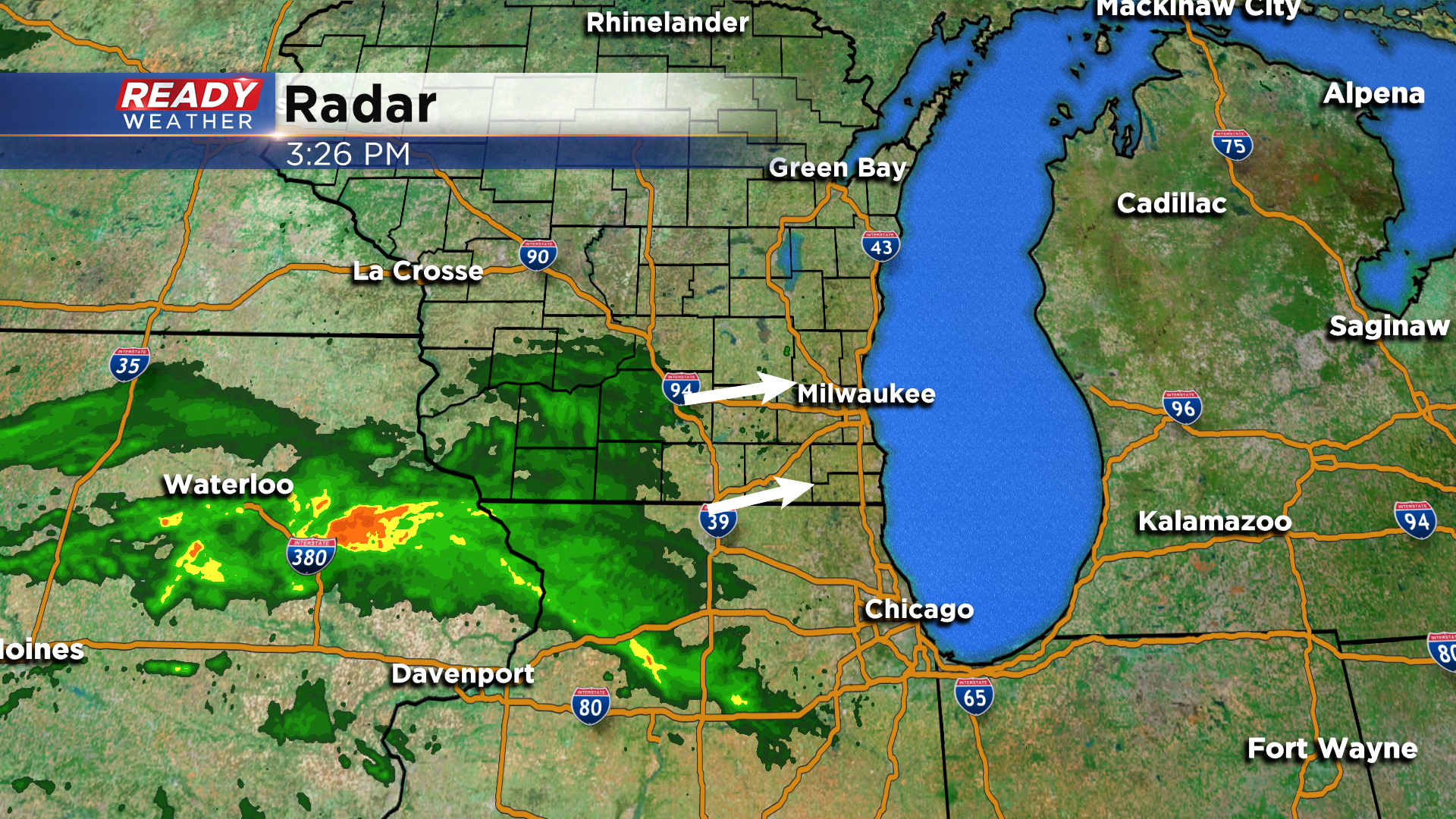
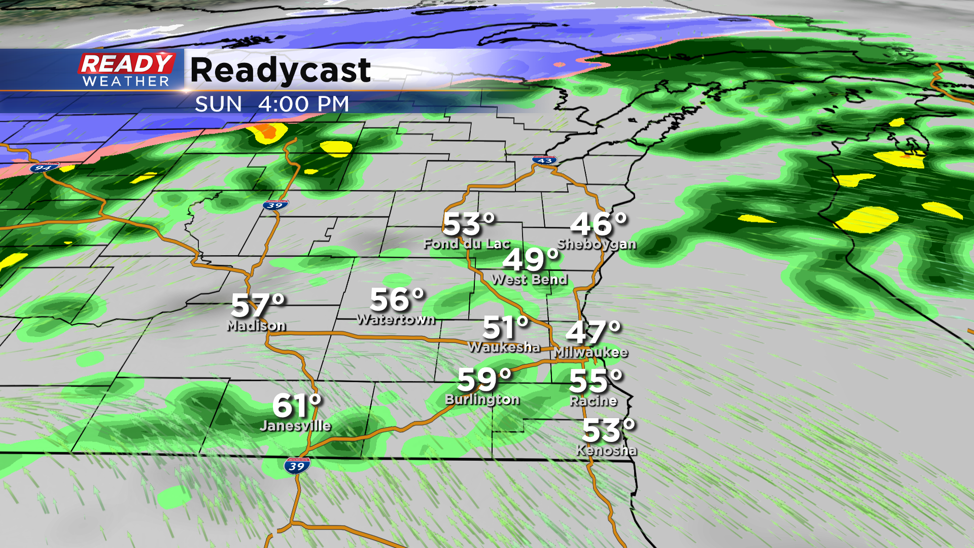
Rain will move into SE Wisconsin after 4 p.m. and continue throughout the evening.
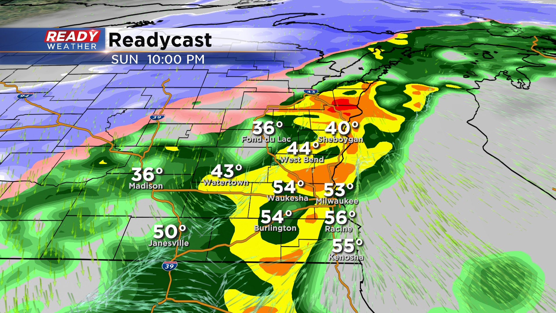
The steadier rain will taper off after midnight, but fog and drizzle will stick around through the night.
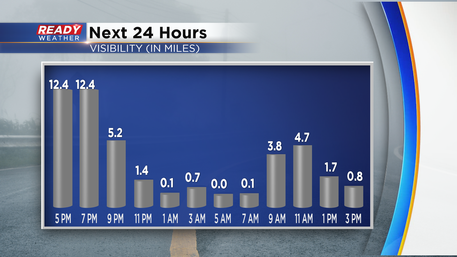
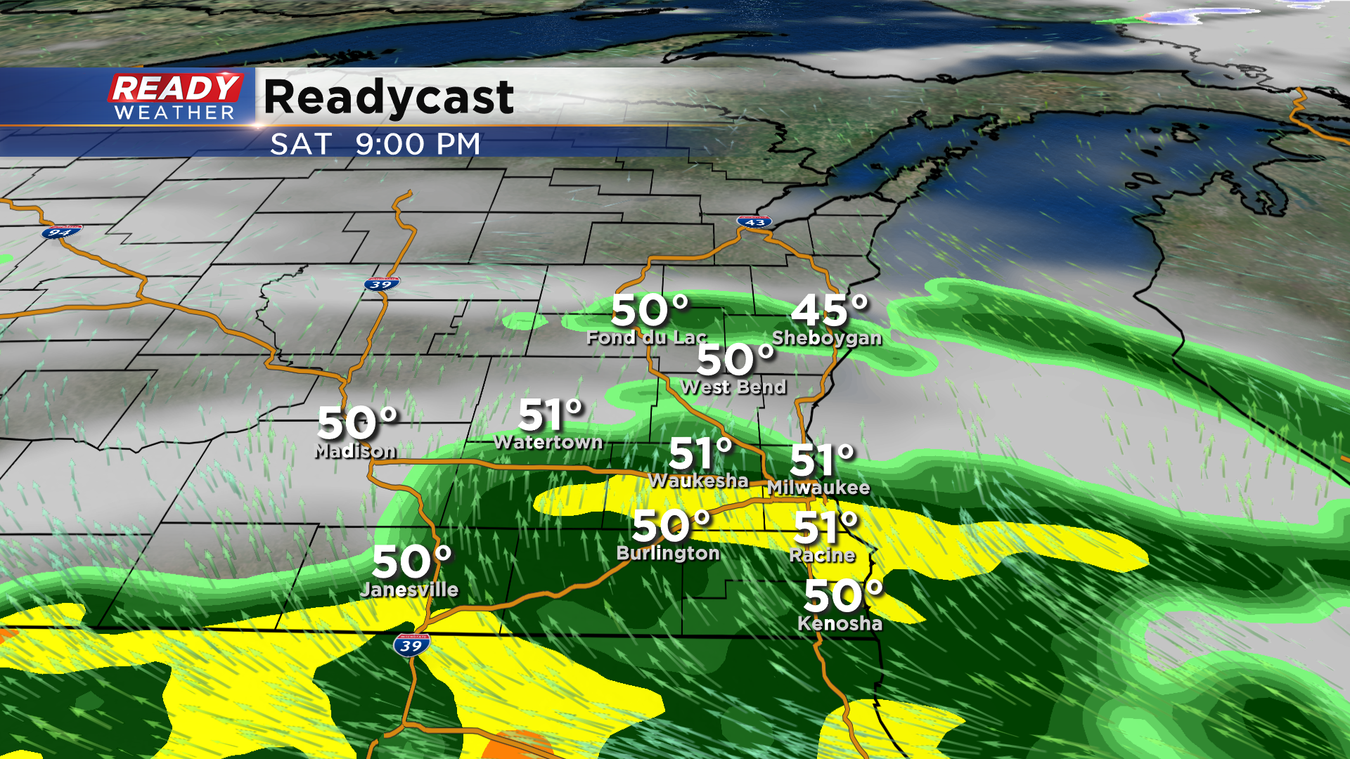
Fog, drizzle, and isolated light showers will be possible Easter morning through early afternoon. More showers will start to develop later in the afternoon with more widespread rain moving in later Sunday evening.
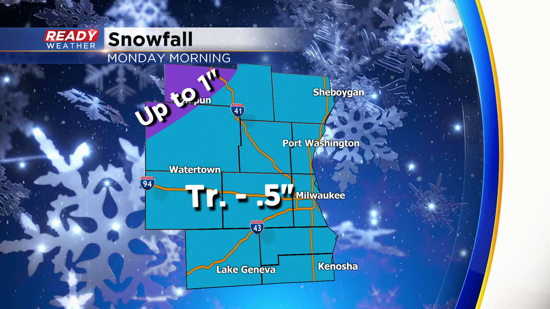
As the low tracks into lower Michigan early Monday morning, colder air will wrap around into southeast Wisconsin and change the rain to wet snow. Wet snow will taper off by late Monday morning as the low tracks NE into Canada, but a few spotty snow showers can’t be ruled out in the afternoon.

Before the rain changes to snow, .50-1" of rain could fall with locally higher amounts far northwest of Milwaukee. Not much more than a dusting is expected around Milwaukee and southward with up to half inch of wet slushy snow northwest of Milwaukee. Best chance at up to 1" of slush will be north and west of Fond du Lac.
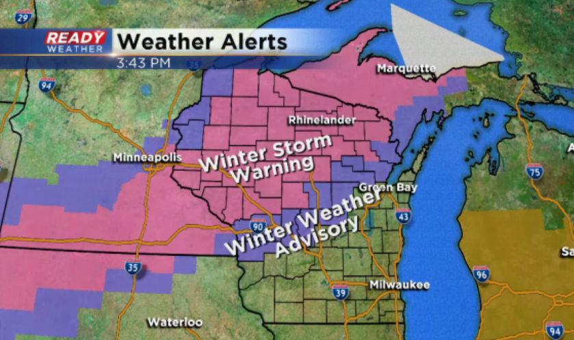
Meanwhile, up to a foot of heavy wet snow is expected across northern and central Wisconsin from this system where a Winter Storm Warning is in place.
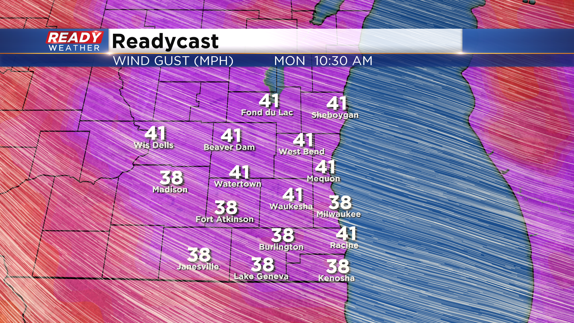
Winds will turn strong throughout the day Monday with gusts between 40-50 mph possible. A Wind Advisory will likely be issued for Monday.