Overnight showers and storms will continue. Flooding possible.
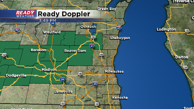
While scattered showers and storms will continue, the heaviest rain overnight into tomorrow morning will be confined across our northern counties. The flood watch will continue for Dodge and Fond du Lac counties until noon Friday.
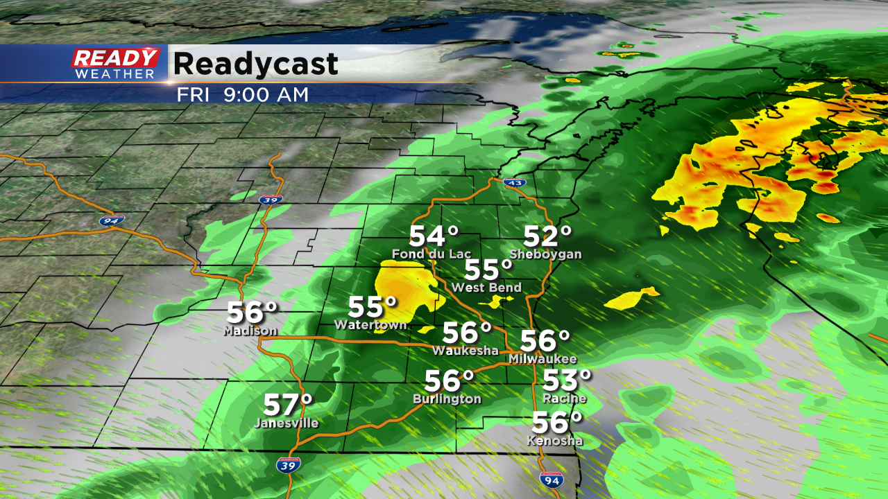
Additional showers and storms will persist through 10 am, before finally clearing out for Friday afternoon.
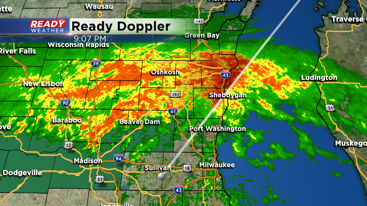
9:00 PM
Heavy rainfall is really impacting the northern part of our area tonight. Flooding is a real possibility across Sheboygan, Fond du Lac, and Dodge counties. Sheboygan isn't in the flood watch, but that could change if heavy rain continues to fall.
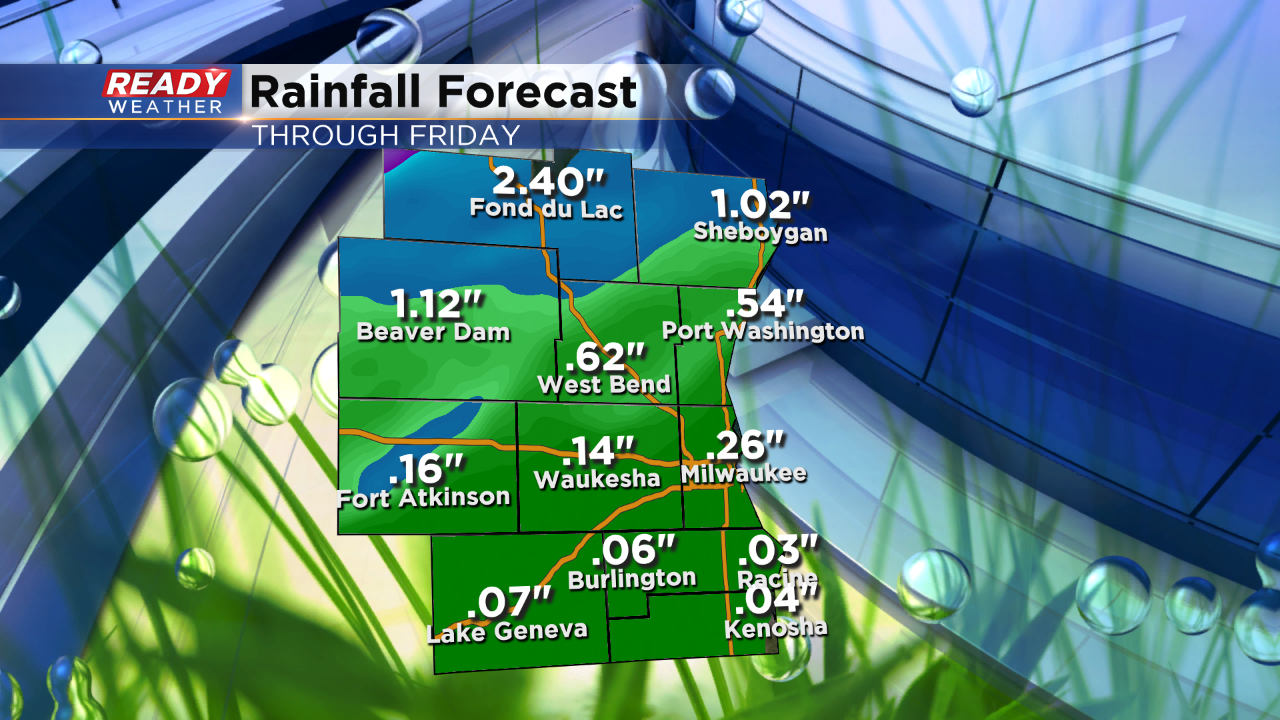
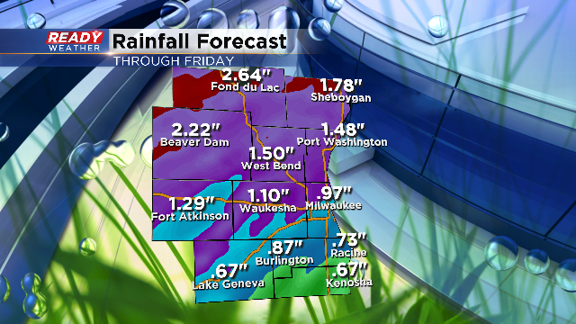
Most areas north of 94 will pick up 1" to 2" of additional rain. The Milwaukee metro will pick up close to an additional inch of rain.
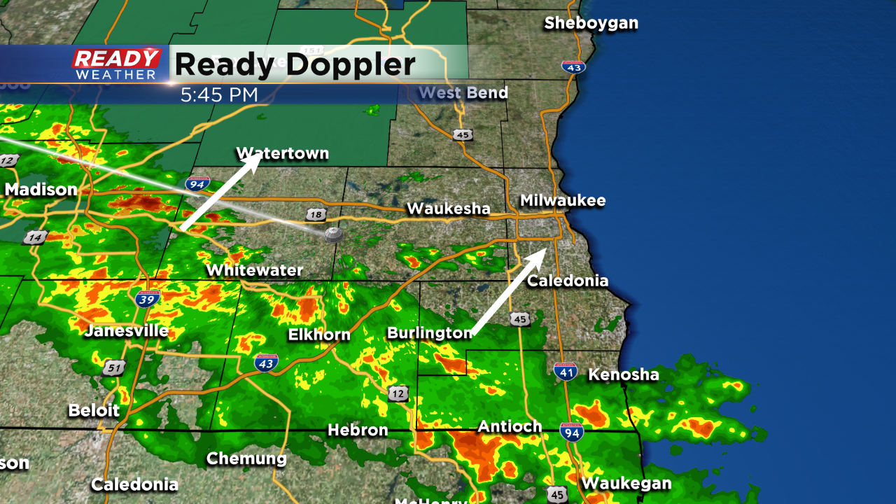
6:00 PM
A line of scattered showers and a few rumbles of thunder will move across the area through 8 PM. Additional rain and storms will develop overnight all across the area. While severe weather is not expected, some storms will contain small hail and locally heavy rainfall.
Rain will continue for the Friday morning commute. The rain will move out around 10 am with sunshine and 70s returning by the late afternoon.
4:00 PM
While the overall severe weather threat is lower compared to last night, the possibility for heavy rain and flooding is going up. A new flood watch has been issued for Dodge and Fond du lac counties. Those counties will be in a favorable area for an additional 1" to 2" of rainfall. Keep in mind those areas have already picked up a few inches of rain over the last 24 hours.
Most areas will pick up an inch of rain tonight; however, our northwestern counties could see heavy training storms overnight. Lingering showers are expected for Friday morning with clearing expected by the afternoon. Some storms could contain some small hail and gusty winds.
1:30pm Update: We are in between rounds of rain this afternoon. The rain last night was more widespread, take a look at some of the totals below:
We also had storm gusts around 60mph in places like Jackson, Mequon and Waukesha. Additionally, a handful of hail reports came in with 1" to 2" diameter hailstones.
As we start to see the clouds thin out some this afternoon, the sun will try and destabilize again for late today bringing the potential of more storms near a front that is hanging out near the WI/IL border. While the dynamics still appear best for severe weather south of us, it will be another evening and night similar to last night.
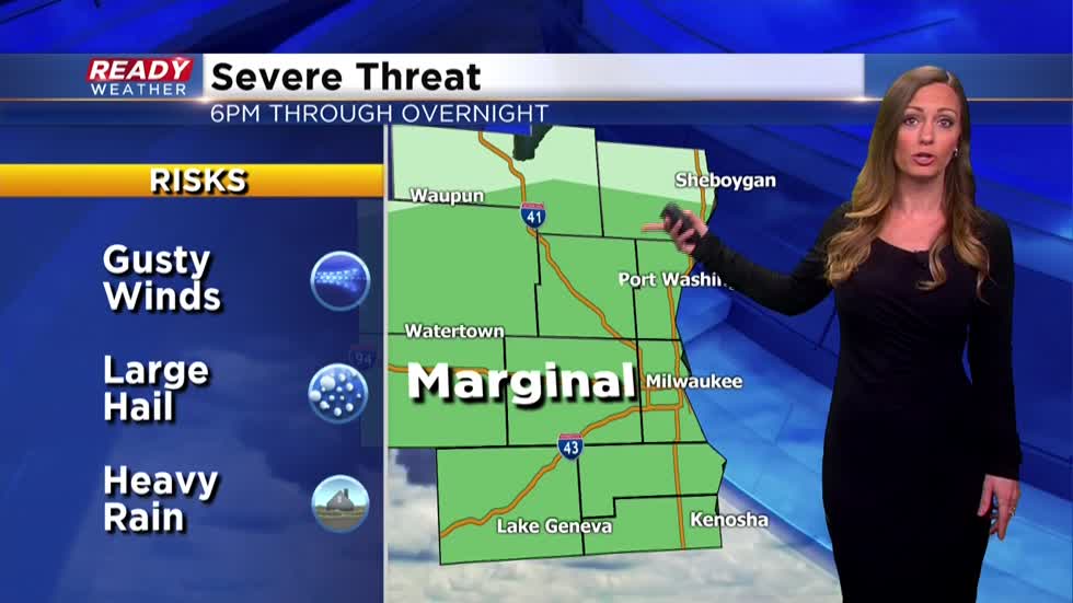
As of this afternoon we are still in a risk for marginally strong to severe storms. The timing is from 6pm through the overnight.--------------------------------------------------------------------------------------------------------------------------------------------------
After going 12 out of 13 days without any precipitation, Mother Nature is giving us a dose of rain, and at times, a lot of it! The stage is set for more showers and thunderstorms later today and tonight.
The precipitation will come to an end this morning with a break in the action; once the lull occurs, some clearing will take place and will help the atmosphere recover. The computer models are having a hard time deciphering where the boundary will setup, aka where the warm front is stationed. It does look like it will rear its head into parts of southeastern Wisconsin. There’s a good chance there will be a big difference in temps from the lakeshore to the southwestern part of the area.
With these dynamics in place, showers and storms will begin to fire late this afternoon into tonight. The main threats will be large hail, damaging winds, and heavy downpours. As any severe weather potential sets up, a tornado is also possible. The strongest storms will take place before midnight, and then lose its intensity.
By Friday morning, the precipitation tapers off and the weather looks calmer until late Saturday night. Both Friday and Saturday will be mild with highs in the 70s.


