Scattered storms return Monday after a pleasant Father's Day


The sunshine and lower humidity was a perfect way to end Father's Day weekend! Most spots were able to rise into the upper 70s to low 80s with a nice breeze. Clear skies will continue for this evening, but more clouds will move into the area overnight ahead of a cold front. That cold front will produce a line of storms overnight in Minnesota, Iowa, and western Wisconsin, but will be falling apart by the time it moves into southeast Wisconsin Monday morning.
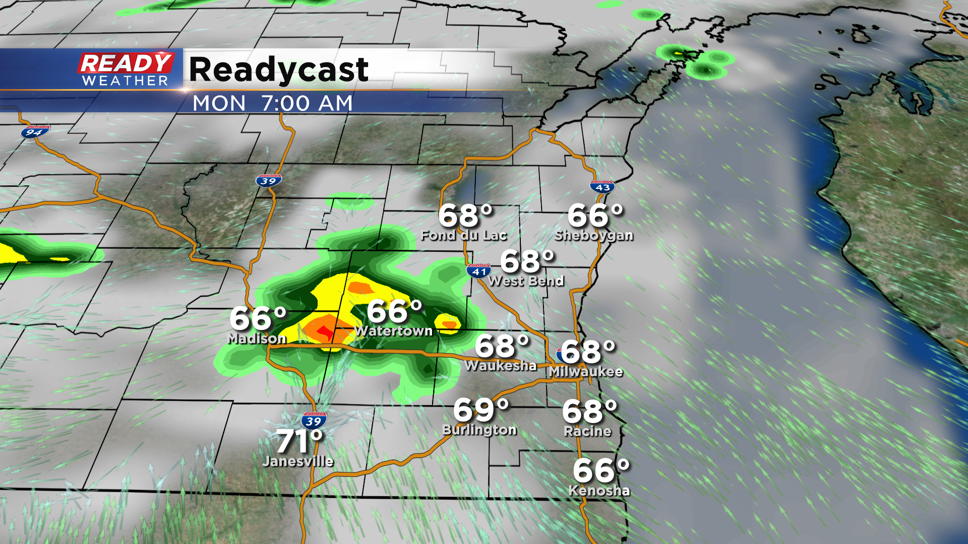
As the cold front moves into the area by late morning, scattered rain and storms will become more numerous.
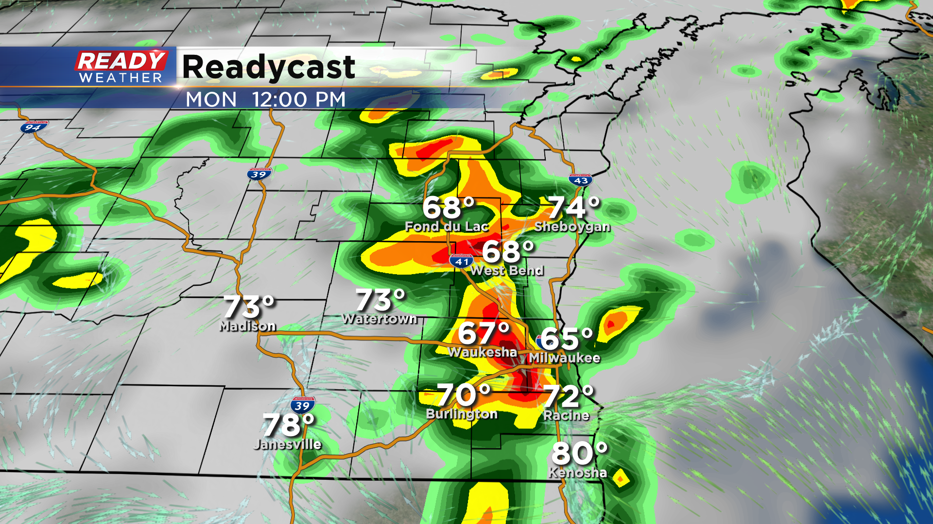
Scattered storms will continue throughout the afternoon, and will begin to taper off in the evening.
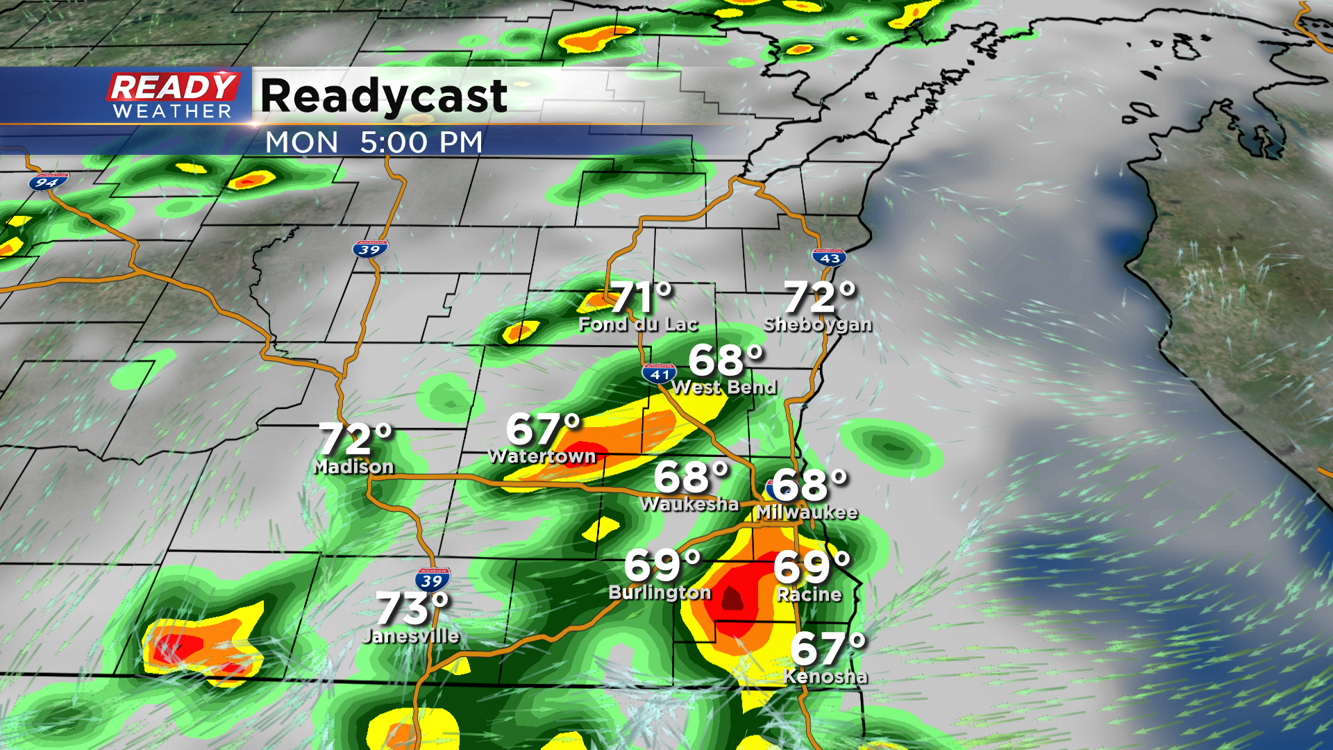
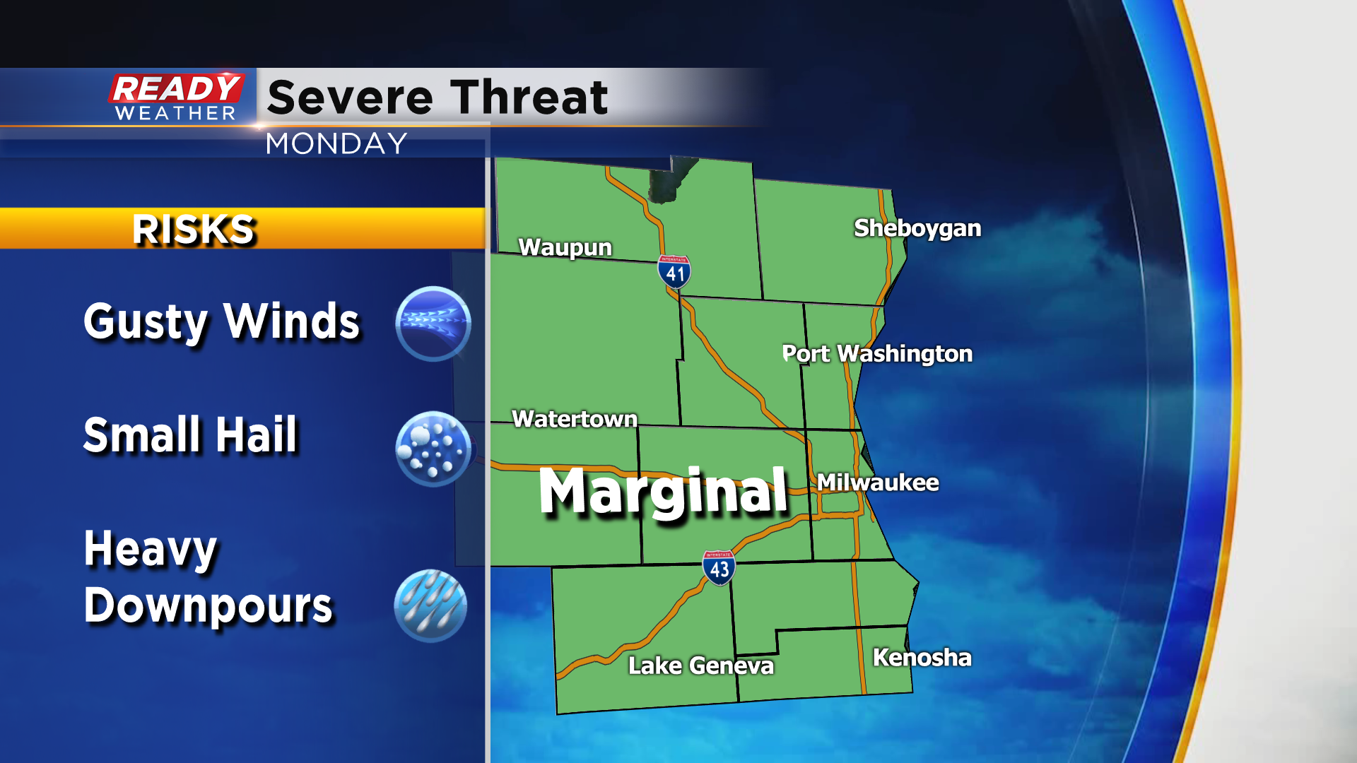
Some of the storms could be strong to severe between 10 am and 7 pm with the main threats being gusty winds, small hail, and torrential downpours. There's a level 1, Marginal Risk, for severe storms in place for all of southeast Wisconsin for Monday.
Generally, .25-.75" of rain is expected through Monday night, but any place that sees multiple thunderstorms could pick up an inch or more of rain.

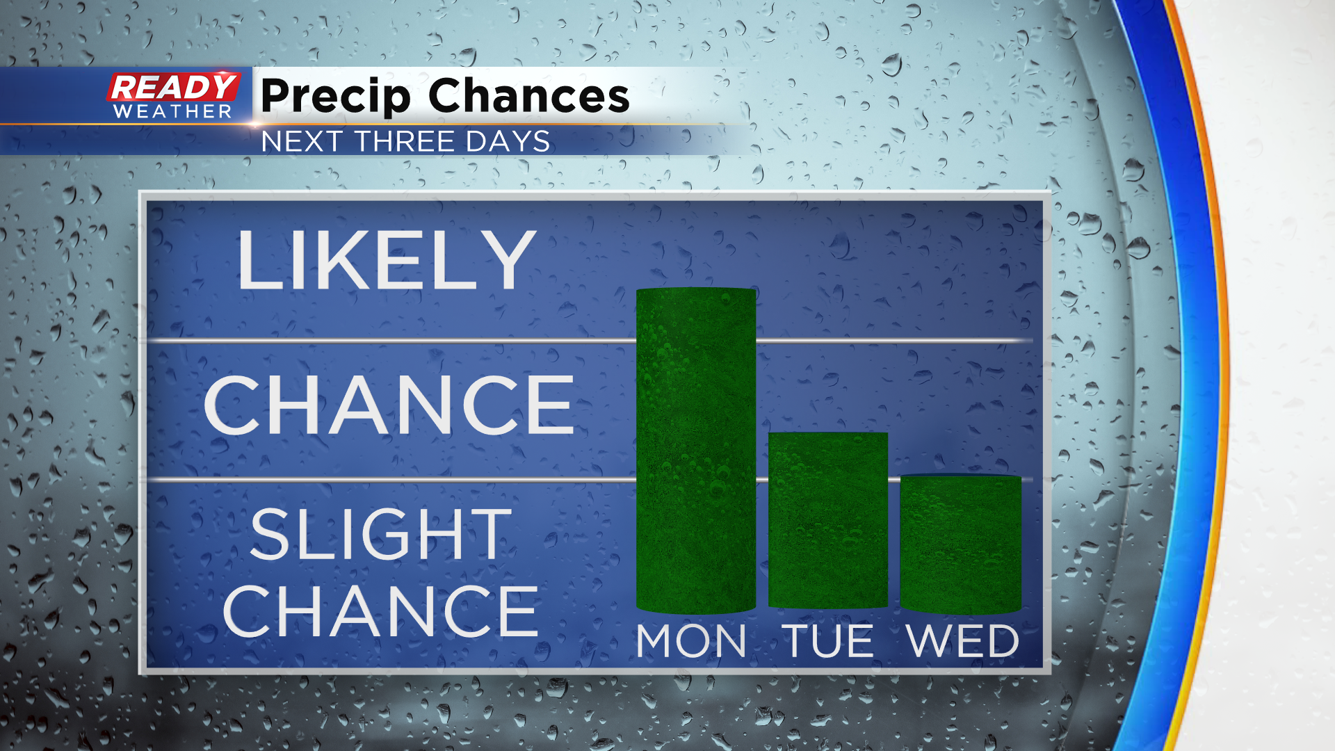
There's still some uncertainty whether or not showers may linger through Monday night, but additional spotty shower and storm chances will be possible Tuesday and Wednesday afternoons.
Download the CBS 58 Ready Weather App to be notified of any severe weather.