Scattered storms for your Saturday. Some could be strong to severe.
Saturday Afternoon Update...
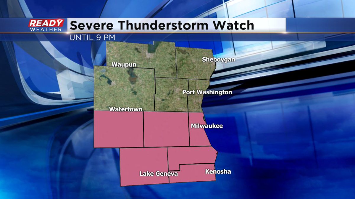
A Severe Thunderstorm Watch is in place until 9pm for the southern half of the viewing area, including Milwaukee and Waukesha. This is the same general area we have a "slight" risk for severe weather, such as damaging wind, large hail, frequent lightning, and heavy rain. If you see storms building, head inside. And whether you're inside or outside, make sure to have your free CBS58 weather app downloaded. The CBS 58 Ready Weather team is here to monitor the situation throughout the day.
______________________________________________________________________________________________________________
Saturday Morning Update...
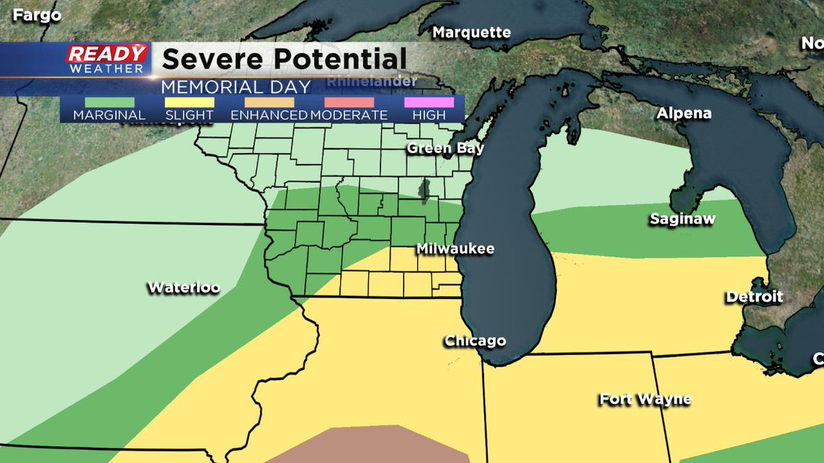
Say goodbye to all the nice summerlike weather we saw on Friday. Today look for scattered showers and storms, some strong to severe. In fact the Storm Prediction Center says we could see a "Slight" risk of severe weather this afternoon and early evening, mainly south of I-94. It's a "Marginal" risk elsewhere. The biggest threats are large hail, damaging wind, and heavy rain. If you're outside, head indoors if those storms fire. Temperatures will be much cooler, in the 60s primarily.
_______________________________________________________________________________________________________________
Hope you enjoyed Friday with highs in the 80s because Saturday is shaping up to be completely different. We will likely have several rounds of showers and storms move across southeastern Wisconsin with cooler highs in the 60s to near 70.
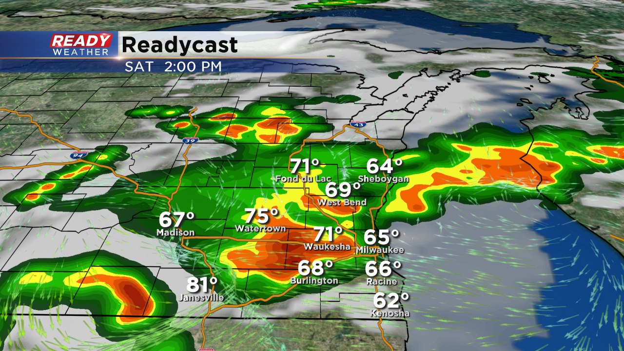
Scattered storms will develop late tonight into Saturday morning. Most of those will fall apart overnight into Saturday morning. After a small break, a stronger round of showers and storms will arrive by the afternoon and evening.
While widespread severe weather is not expected, some storms along and south of 94 could contain hail and gusty winds. An isolated strong to severe storm will be possible.
Sunday will be clear and cooler with highs in the low to middle 60s.
