


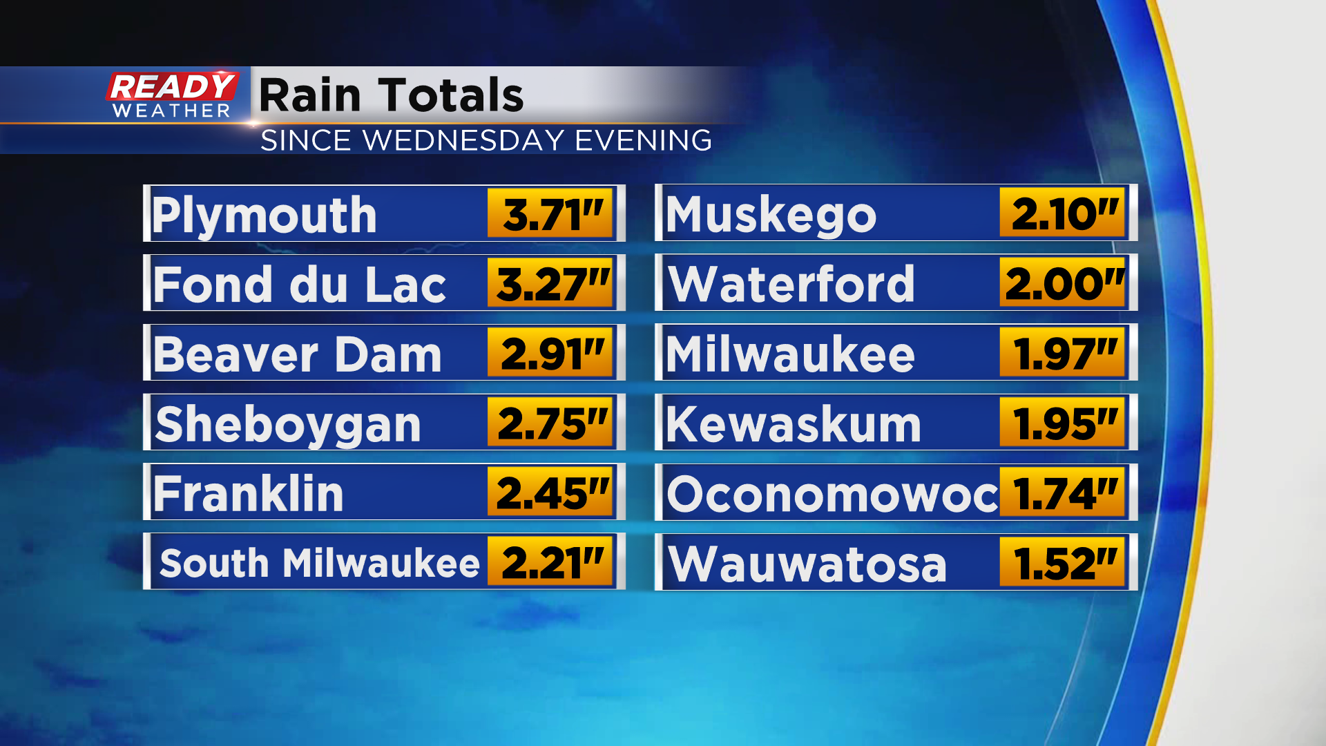
It has been a soggy 36 hours across southeast Wisconsin with most of the area picking up 1-2.5" of rain. However a majority of Fond du Lac, Sheboygan, and western Dodge counties picked up 2.5-3.5".
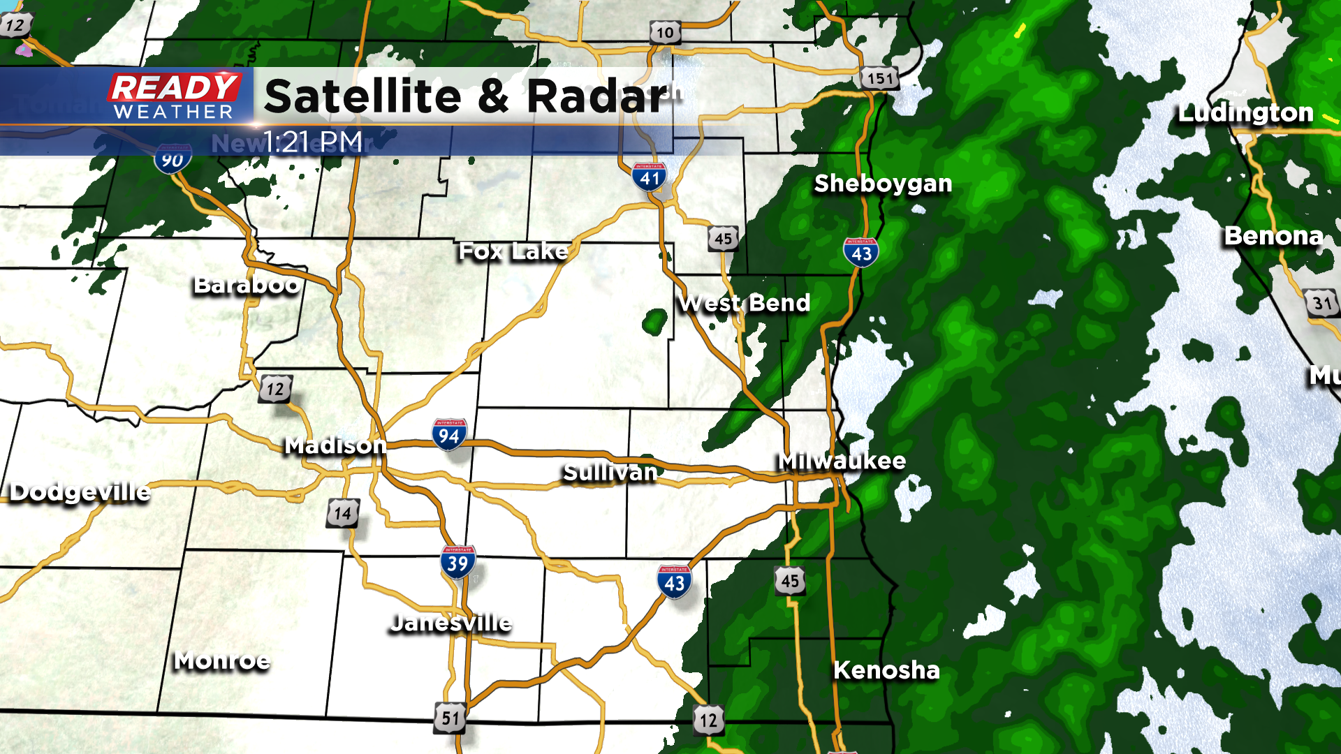
The last of the showers are pivoting through the area early this afternoon. Once these exit, we'll likely see drizzle linger through the afternoon.
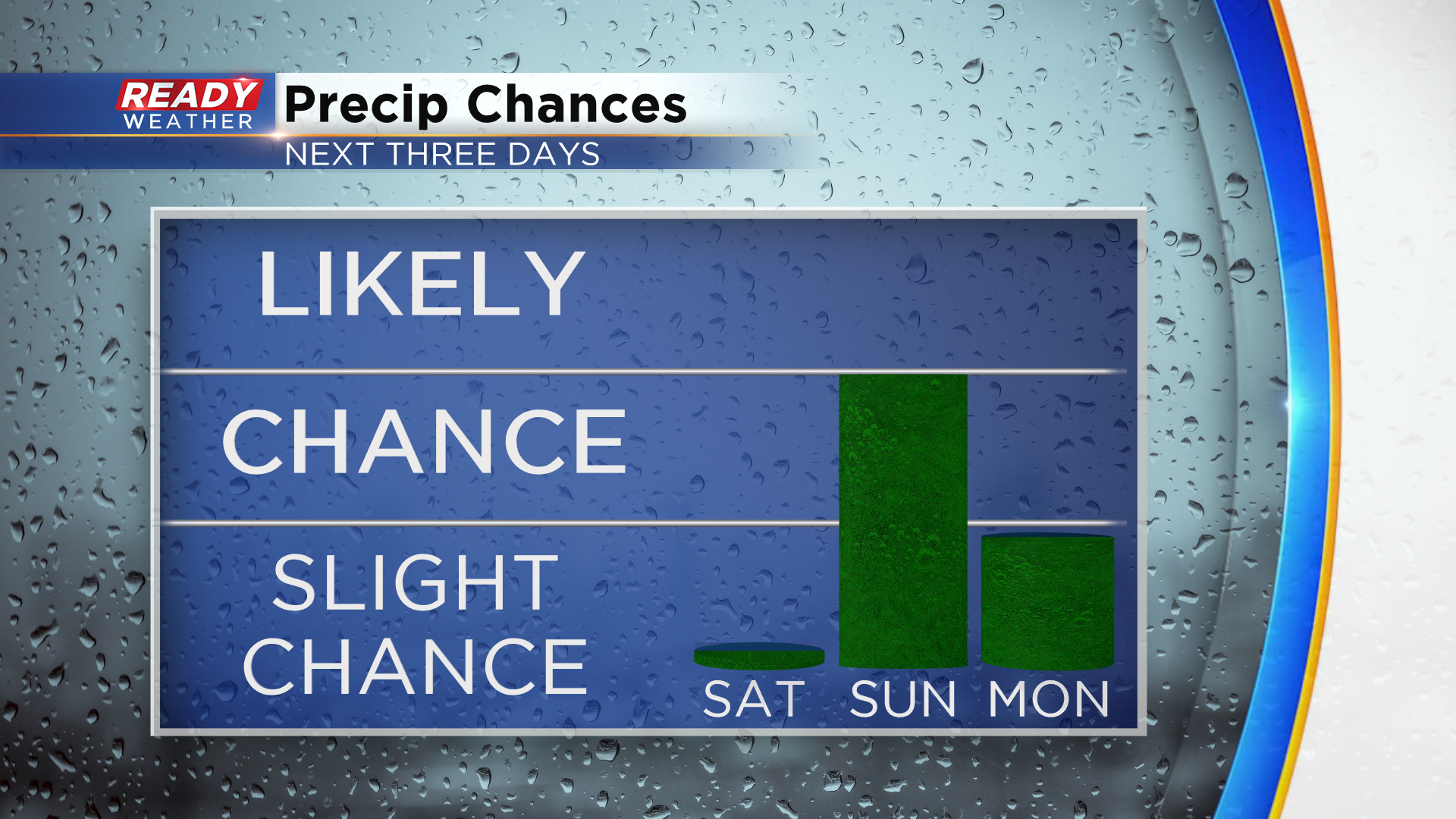
After 8 straight days with rain, drier weather will finally move in this evening and continue through Saturday. By the time we get to Sunday afternoon, a light rain/snow mix may be working into the area. There's some uncertainty as to if the mix will last into early Monday, but the brunt of this system will primarily track to our south, so whatever falls will be light.
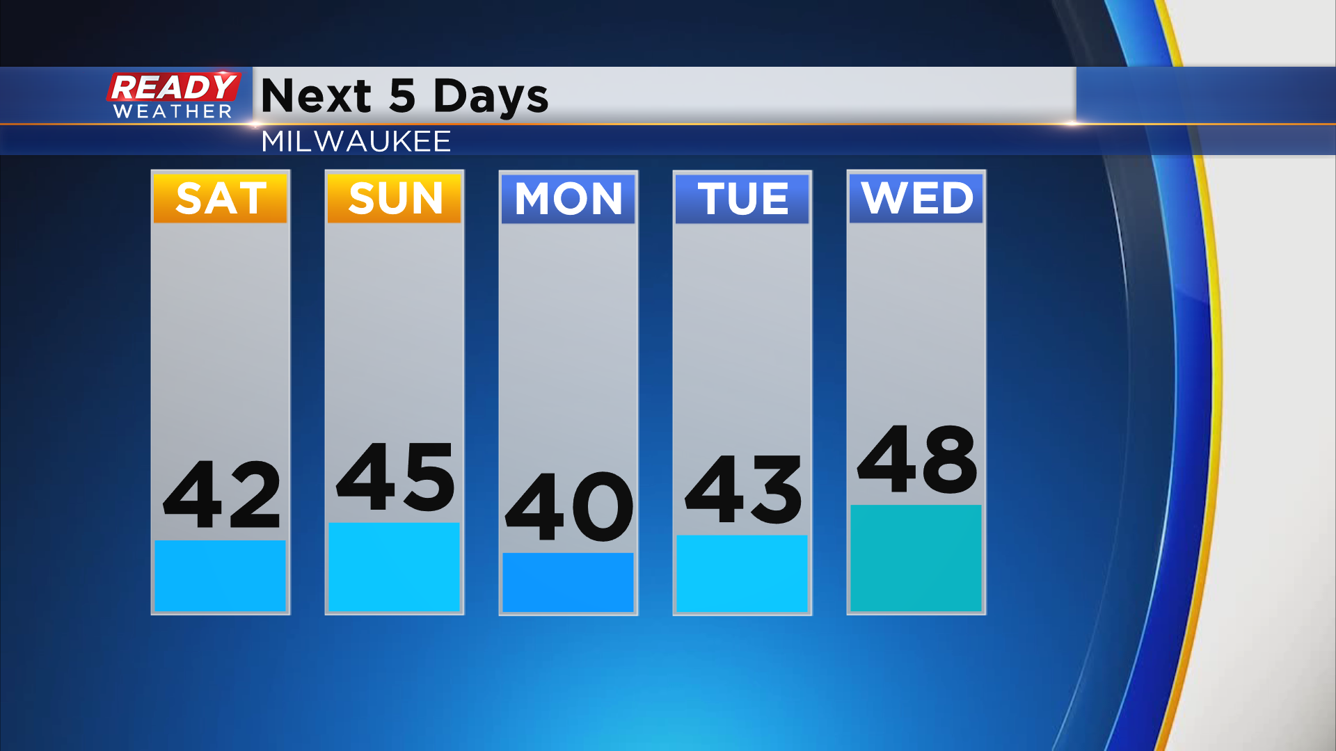
Once that system pulls away Monday afternoon, dry weather will return and last through a majority of the work week. Temps will remain on the cold side with highs in the 40s. This is around 10 degrees below normal for the end of October.
Find out if temps will warm up for Halloween by downloading the CBS 58 Ready Weather App.