Relief from the heat for some today, but it returns for Thursday and Friday
It's been a wild day in the temperature department today, especially near the lake. A pneumonia front raced down the lake this morning, quickly dropping temps from the mid 80s into the low 60s.
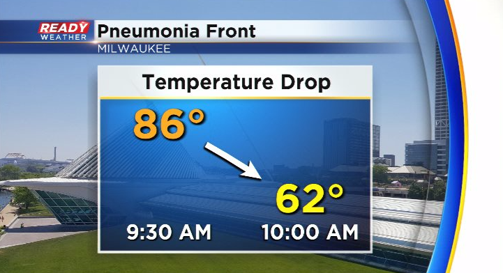
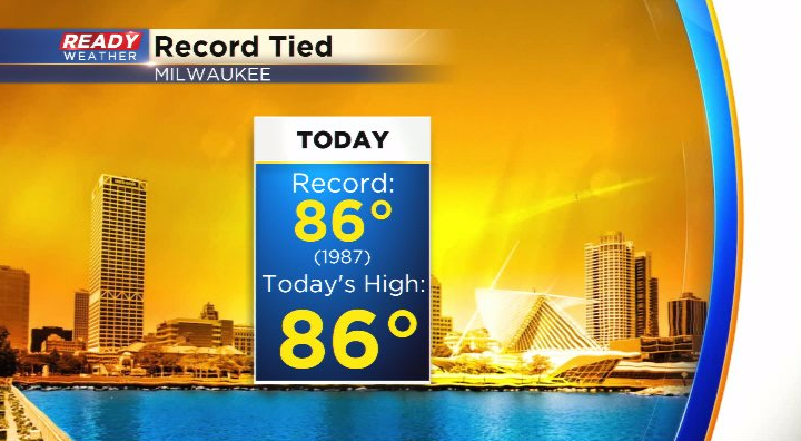
Milwaukee hit 86° before the front came through, which ties today's record high that was set in 1987.
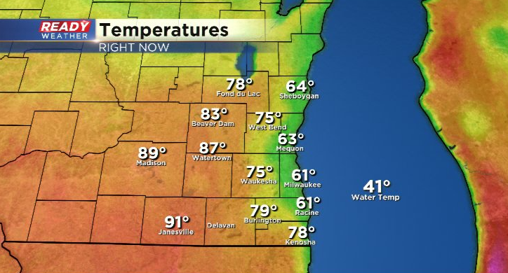
The strong lake breeze has slowly been pushing inland. Behind the lake breeze, temps are in the 60s and 70s while they remain in the upper 80s to low 90s out ahead of it.
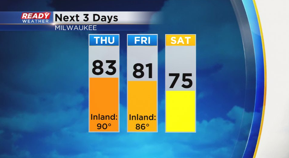
We'll stay on the comfortable side into tonight, but the warm front will lift back northward on Thursday, turning our winds back to the SSE and boosting temps back in the low 80s lakeside and near 90° inland. We'll stay mild on Friday with highs in the low to mid 80s before we drop back into the 70s this weekend behind a cold front.
That front will bring our best chance for showers and storms for the remainder of the week, but we are keeping an eye on a cluster of storms that's currently back building across Lake Michigan.
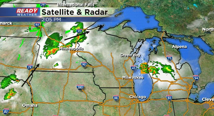
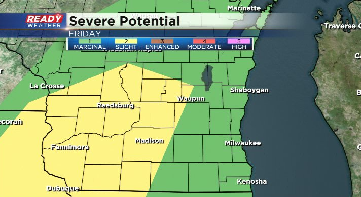
Can't rule out a storm popping closer to Sheboygan, but we'll largely be dry today and Thursday. We'll be warm and humid ahead of the cold front on Friday, which could lead to a few strong to severe storms. Most of SE WI is under a level 1 of 5, Marginal Risk, for severe storms with the higher risk to our west away from any lake breeze that develops.
Download the CBS 58 Ready Weather App to get any alerts sent to your phone.
