


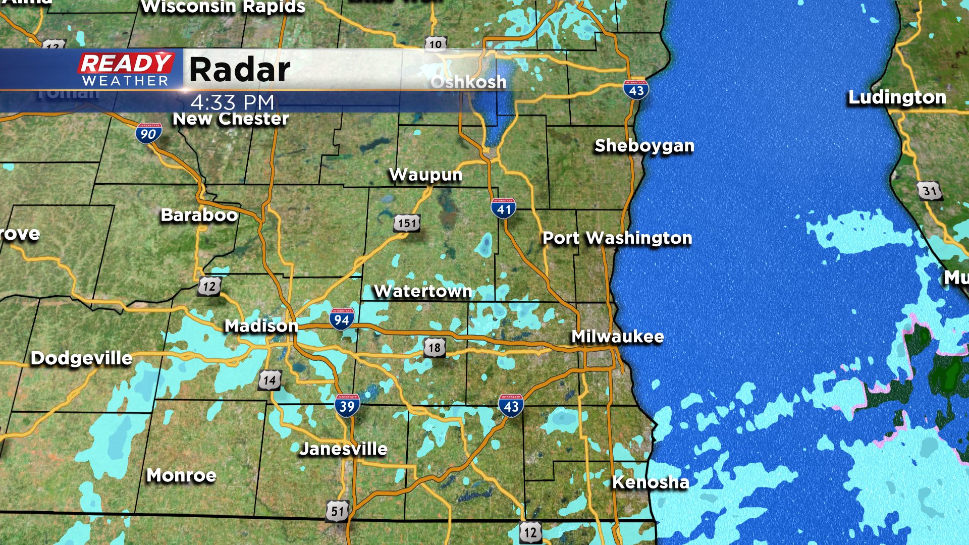
We've had off and on flurries and light snow showers throughout the day today, and a few flurries will linger into tonight. However, no accumulation is expected.
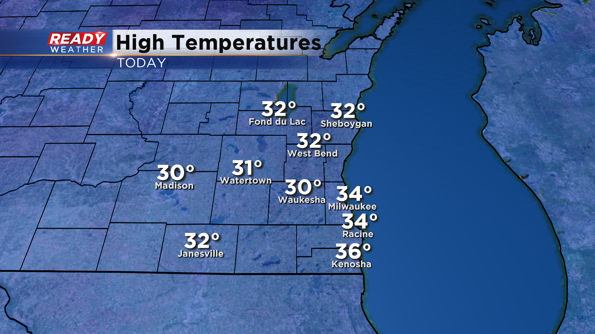
There's another chance for flurries or light snow showers Tuesday evening, but that'll be our best chance for precipitation through the work week. Despite the clouds and flurries around the area today, temperatures were still able to rise into the low to mid 30s today.
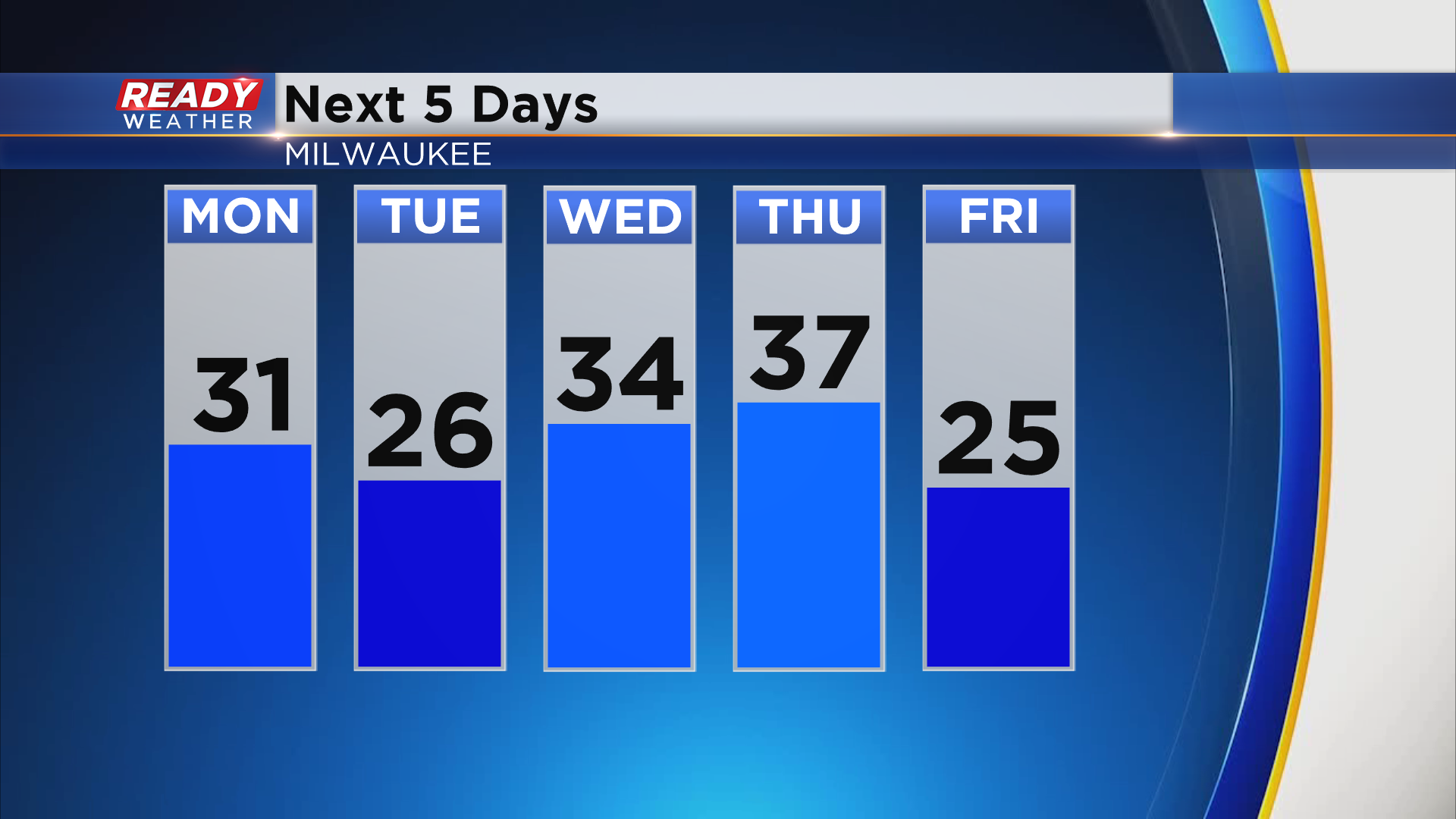
Temperatures will be a touch cooler Monday and Tuesday but will warm back into the mid 30s during the middle of the week thanks to breezy southerly winds. A cold front looks to track through the state on Thursday which will cool temps back into the 20s for highs to end the week, but nothing brutally cold.
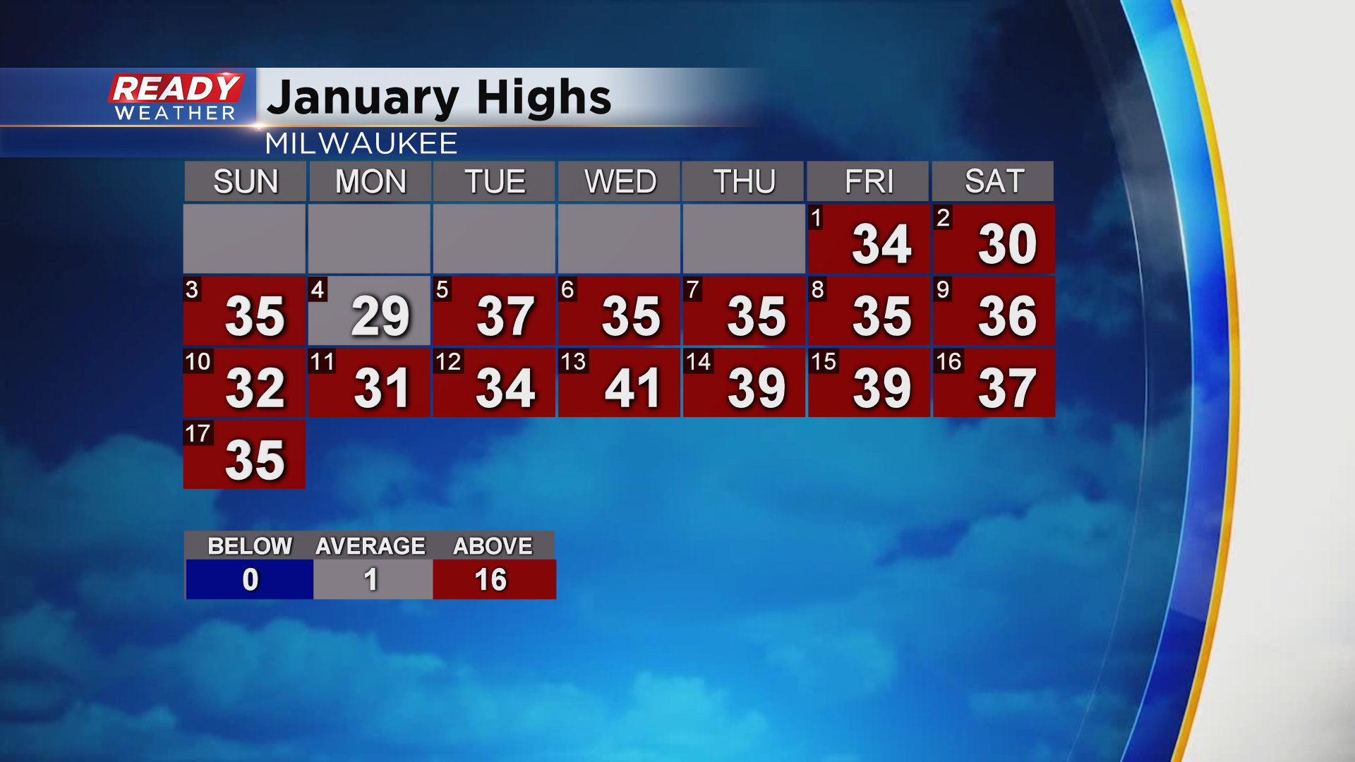
Normal high temps in January are around 29° in Milwaukee, so every day so far this month has been at or above normal. In fact, Milwaukee has only had 6 days with below normal highs since the beginning of meteorological winter (December 1st).
Download the CBS 58 Ready Weather App to see the full 10 day forecast.