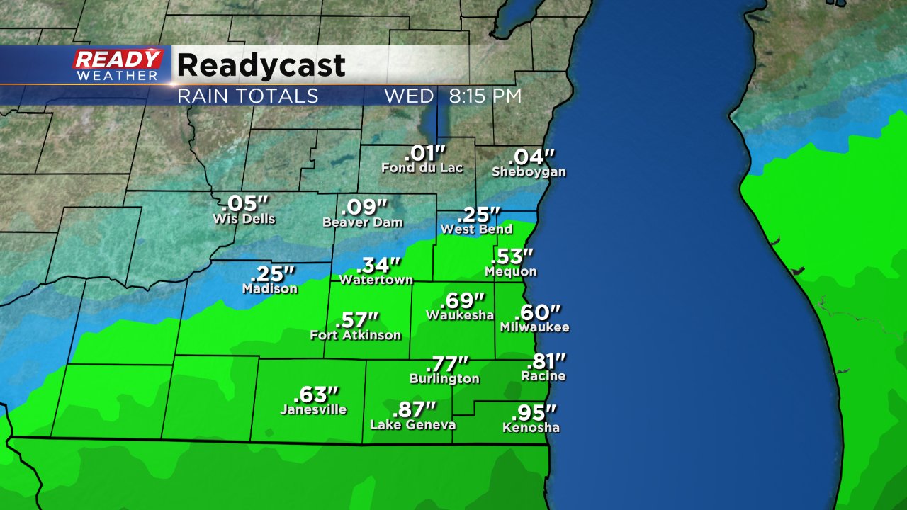
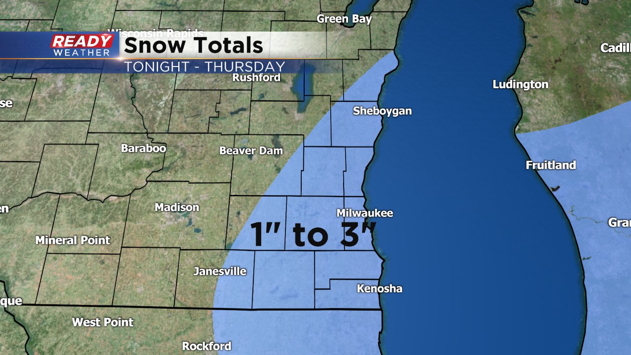
After starting dry, rain has moved into southeast Wisconsin and will continue to fall through the majority of the day. Expect the Wednesday evening commute to be on the wetter side as scattered showers continue. Shortly after the commute as the rain cools the air, some of the rain drops could fall as snowflakes causing a wintry mix across parts of the area. The best chance for wintry mix lies across our southeastern communities of Milwaukee, Racine and Kenosha. Total rain should by Thursday morning should be around a half inch with up to 1" in local areas. Some northern communities will only pick up a tenth or two.
If rain changes over to snow and falls fast enough the snow will be able to accumulate, especially on grassy surfaces, but may be enough to cover some roadways with slushy snow briefly. With warmer pavement temperatures and air temps staying in the upper half of the 30s once the snow stops falling it will melt fairly quickly. Up to 3" of slushy snow will be possible, especially in lakeside areas, but most of that will accumulate on grassy surfaces and will likely all melt within a few hours.
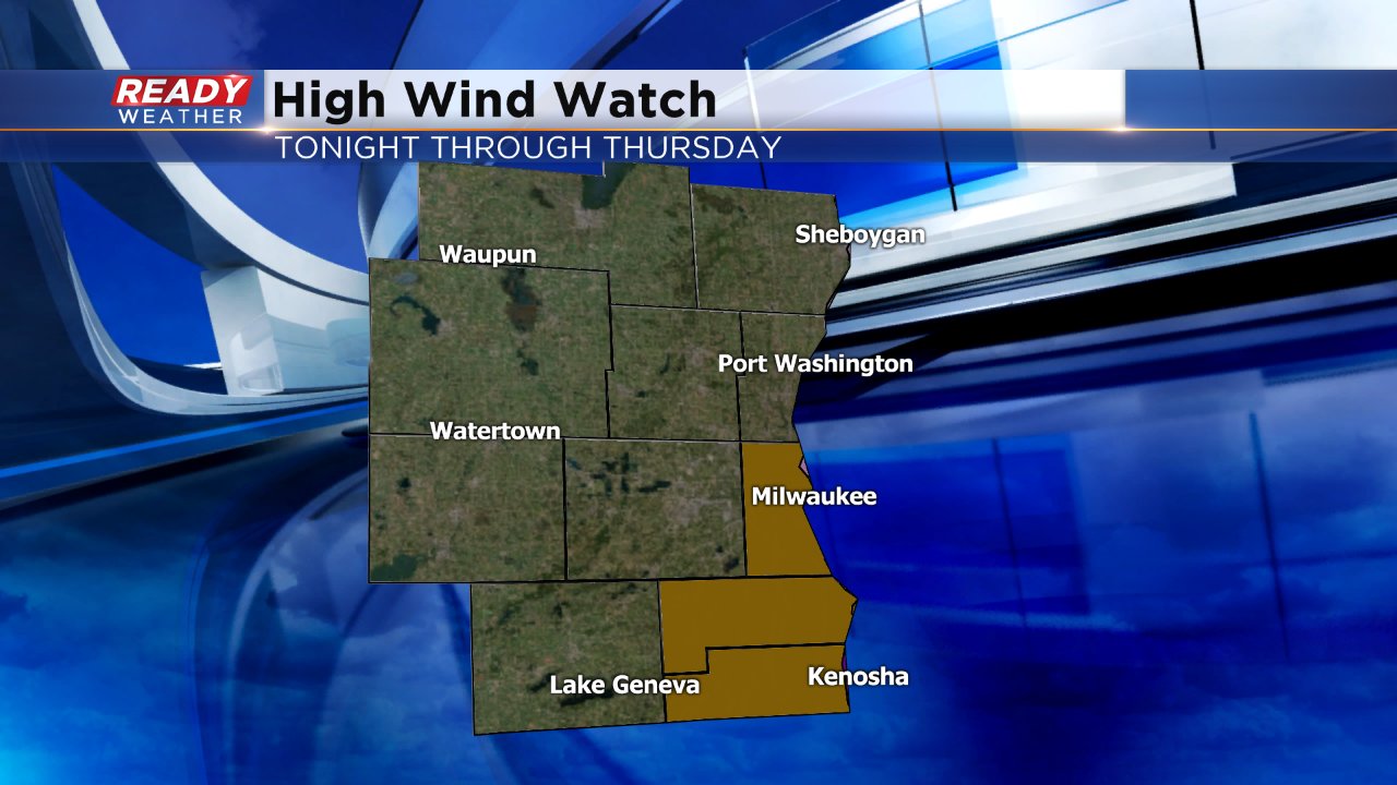
The other big story will be the wind. The wind will really pick up Wednesday afternoon gusting to 40 mph and by Wednesday night into Thursday gusts to 50 mph will be possible. A high wind watch has been issued for lakeside counties of Milwaukee, Racine and Kenosha for Wednesday night into Thursday, but that watch will likely be upgraded to a wind advisory or high wind warning by Wednesday evening.
Download the CBS 58 Ready Weather App to stay up to date on the latest warning and advisory information and to track the rain switching to snow across the area.
