Rain and snow move in Tuesday, very strong wind arrives Wednesday


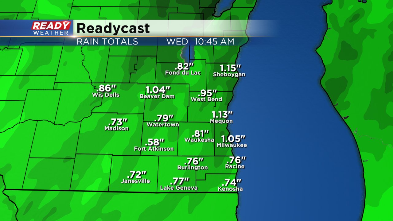
Our well advertised pre-Thanksgiving is finally moving in. Snow is currently falling across Nebraska as of Tuesday morning and the storm system is moving east. There's been little to no change locally to this storm with us still staying on the warm side with just rain. The rain will start by late afternoon on Tuesday with pockets of heavy rain during the evening and early overnight before wrapping up Wednesday morning.

Expect a soaking rain with a half to full inch possible here.
It's a much different story to our north with a dusting of snow possible from Green Bay to La Crosse and plenty of moderate and heavy snow north of there. Parts of northern Wisconsin and Minnesota could get 6-12" of snow.
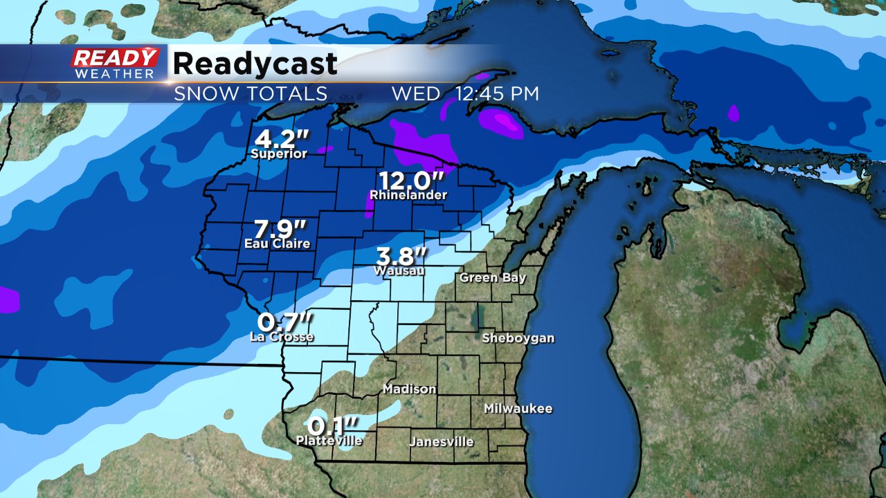
A winter storm warning has been issued for many of the locations expecting to get the heavy snow. Those warning stretch from northern Wisconsin all the way into Colorado. If you are traveling north or west after work on Tuesday or Wednesday morning expect some slow travel. Travel should get better throughout Wednesday.

Here locally we aren't under any winter weather warnings but a wind advisory has been issued which could also impact travel. Wind gusts could reach 40-50 mph which will force drivers to use two hands. Also make sure your outdoor decorations are secured or even bring them inside.

The wind will start to die down Wednesday night and expect a cooler and sunny, but dry Thanksgiving with highs in the upper 30s. Our next storm system starts moving in Friday with a wintry mix possible switching over to rain on Saturday and then back to light snow Sunday. Travel will likely be tricky at times for the weekend.

Download the CBS 58 Ready Weather app to stay up to date on the latest 10-day forecast.