Pre-Thanksgiving storm brings rain to southern Wisconsin, heavy snow for northern Wisconsin


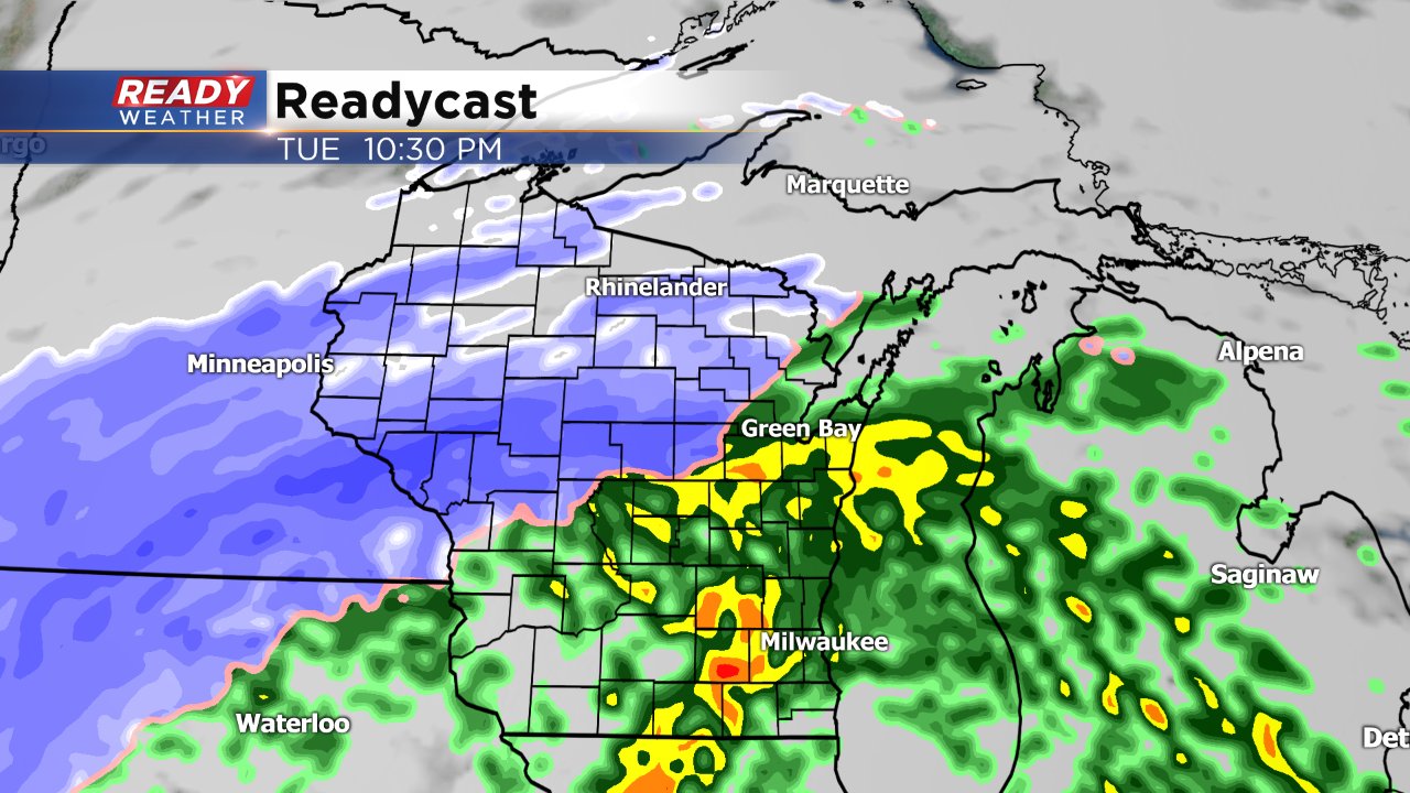
There's been a lot of talk about some storms in and around Thanksgiving for a week or more. Now that the holiday week is here we have a much clearer picture of the path of these storms, especially for earlier in the week. For our first storm that moves in Tuesday and leaves Wednesday, southeast Wisconsin will stay on the warmer side with mainly rain but snow is expected across northern Wisconsin and for the southern half of Minnesota.
A winter storm watch has been posted for the areas most likely to see snow. Expect this watch to get upgraded to a warning sometime on Monday. A few of our NW spots like Fond du Lac or Beaver Dam could see some light snow or wintry mix but accumulation will stick to rain.
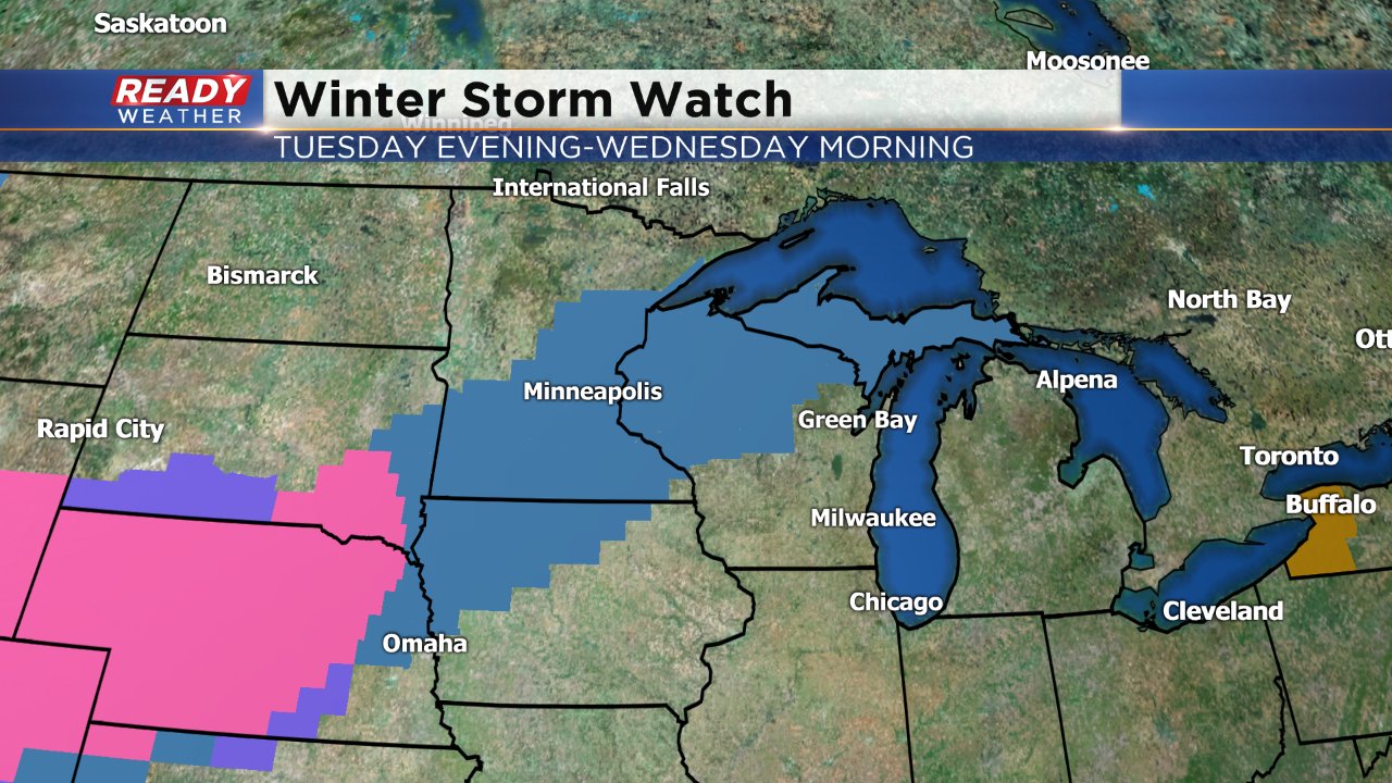
The heaviest of the snow is expected to fall in the area under a winter storm watch. These spots could get as much as 6-12" of new snow. Green Bay and areas to its southwest could see some light snow with just rain for southeast Wisconsin. Up to a full inch of rain could fall here.

Thanksgiving will be our dry day with some quick sunshine. As we go into Black Friday and the shopping weekend another large and slow moving storm system arrives. Some light wintry mix and rain is once again expected.
Download the CBS 58 Ready Weather App to track the changes on these approaching storm systems.