


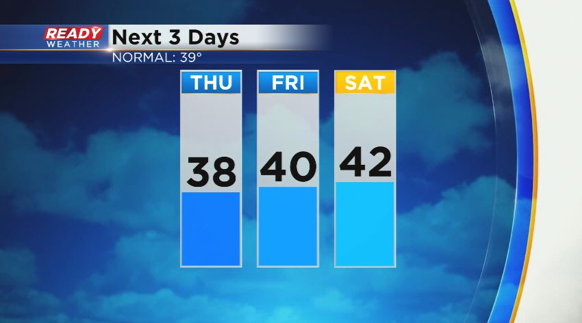
It was a gorgeous first day of March with temps warming into the low 50s in Milwaukee. Thursday won't be quite as warm as winds turn to the northeast and clouds increase ahead of the next area of low pressure that'll arrive on Friday.
There is still quite a bit of uncertainty in the track of this low pressure system, which will ultimately determine whether or not we get snow and how much we'll see. Scenario 1 is a more northerly track through north central Indiana. This track would bring heavy wet snow to SE WI with several inches of accumulation possible.
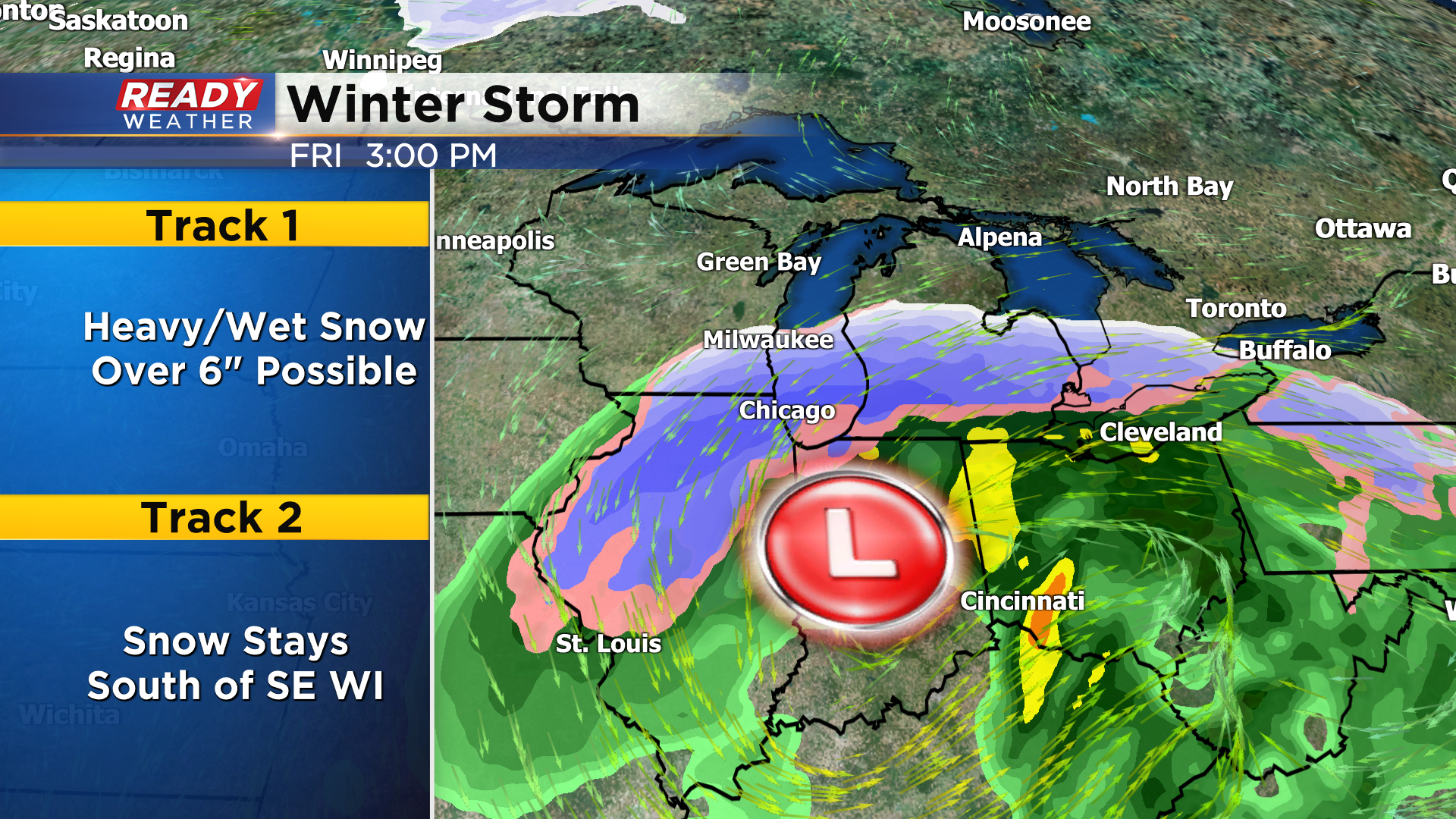
Scenario 2 is more of a southerly track, which would keep a majority of the snow south of our area with Chicago in the bullseye. This track may still bring a bit of snow to far SE WI, but it wouldn't add up to much.
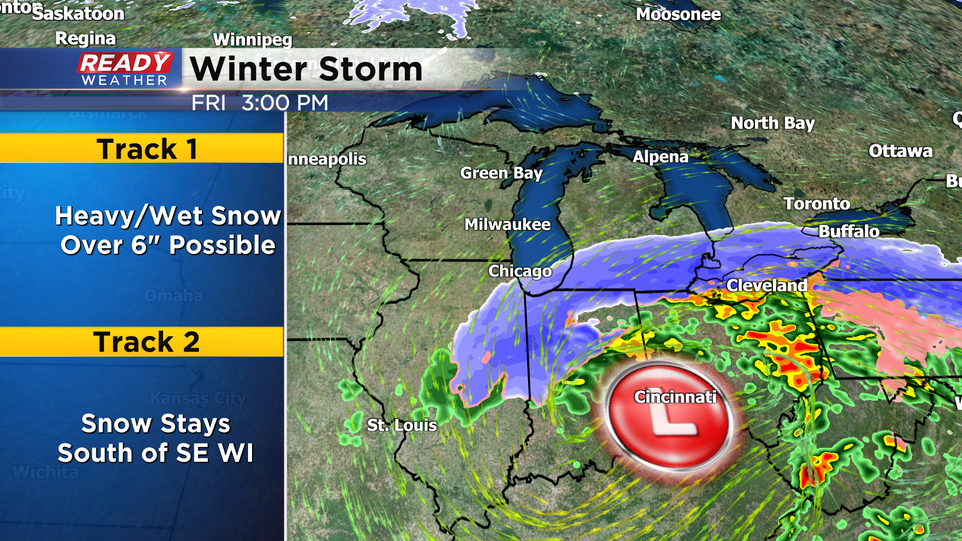
Our hope is that models will come into a better consensus over the next 12 hours so we can feel more confident with a snow total forecast. Stay tuned for updates!