Pleasant today, but heat and storms return to end the work week
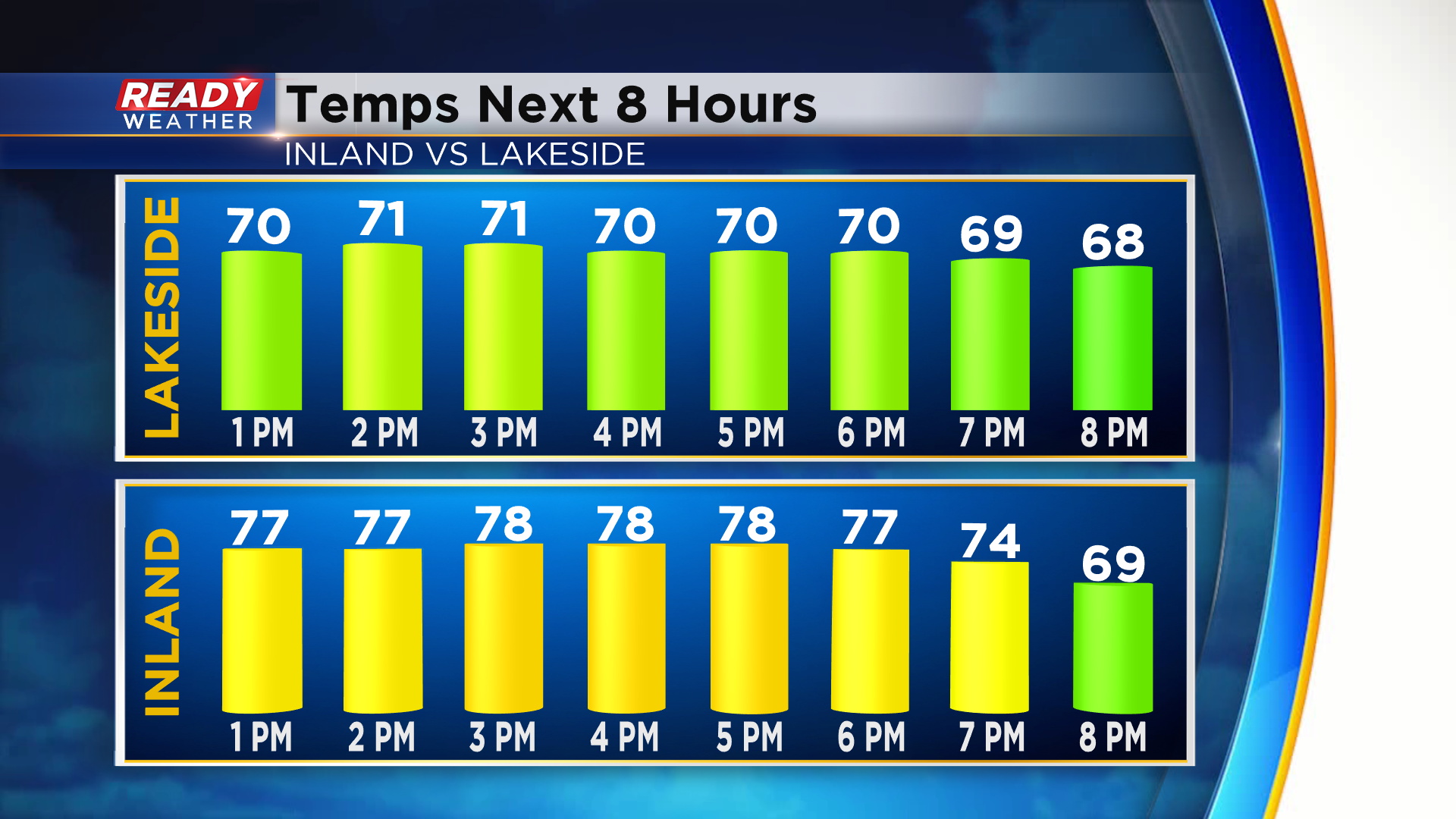
High pressure remains in control across southeast Wisconsin providing us with abundant sunshine! Expect highs to be similar to yesterday, reaching the low 70s lakeside and upper 70s to near 80° inland.
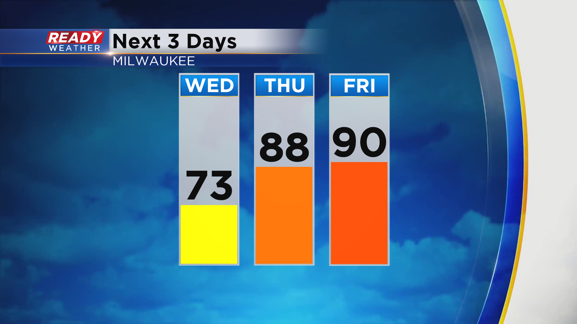
After another comfortable night in the 50s tonight, the heat will start to build back in on Thursday with mid to upper 80s expected for most. Temps will be even warmer on Friday, soaring back into the upper 80s to low 90s.
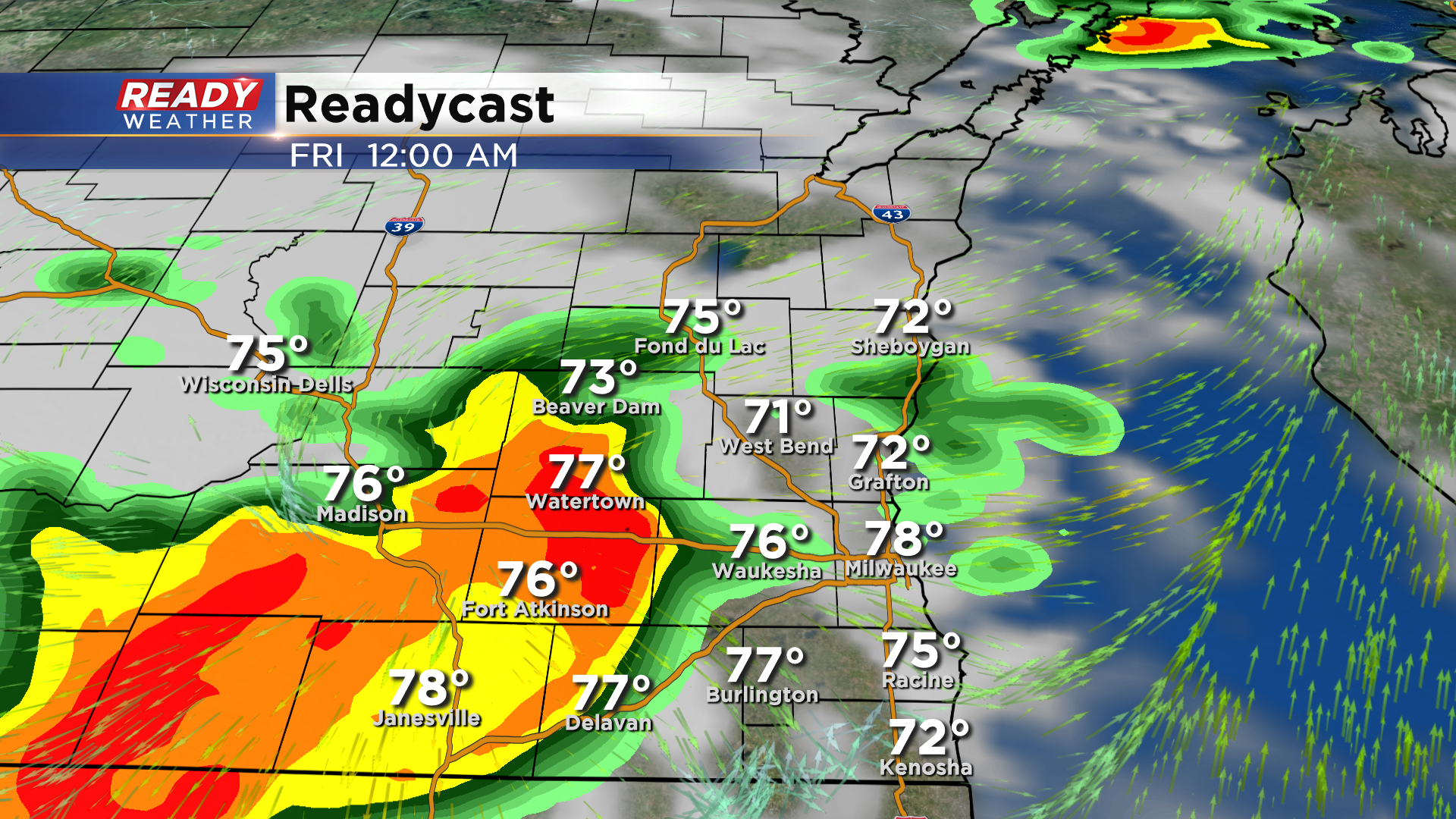
While the heat builds in for Thursday, dew points will stay comfortable during the day. By Thursday evening and night, humidity will try to work back into the area ahead of a low pressure system. There's some uncertainty with the track of this system and how far north the warm front will get, which will determine the exact path and strength of a complex of storm for Thursday night. These storms are expected to fire near the Mississippi River in Minnesota and Iowa late afternoon-early evening Thursday. This line of storms will initially track east Thursday evening, but may dive southeast as it reaches southeast Wisconsin. SE WI's window for storms being between 9pm - 3am.
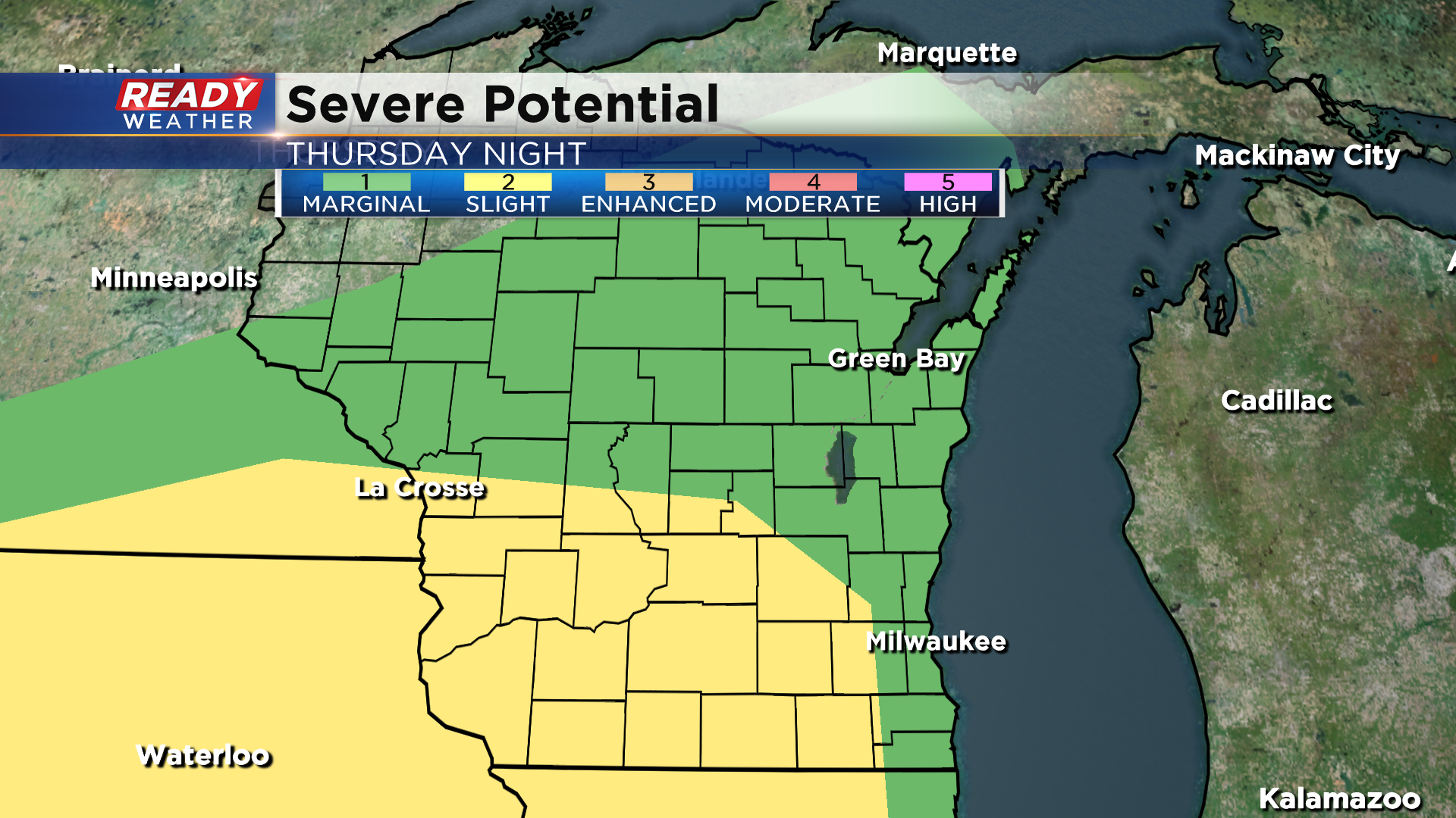
Folks closer to south central Wisconsin have the best chance at seeing strong to severe storms Thursday night, with a Level 2, Slight Risk, in place west of Waukesha. A level 1, Marginal Risk, covers lakeside and northern locations.
Damaging winds will be the primary threat with the complex of storms, along with small hail. Torrential downpours in storms may also lead to localized flooding since the ground is so hard due to our ongoing drought.
Any storms should push east by sunrise Friday, but we may have a few more isolated storms pop up Friday afternoon as the cold front moves through. Pop up afternoon storms on Friday would be more likely if the Thursday night round misses a good chunk of the area. Download the CBS 58 Ready Weather App to get any warnings sent to your phone.
