Persistent showers this week with a chance for snow up north


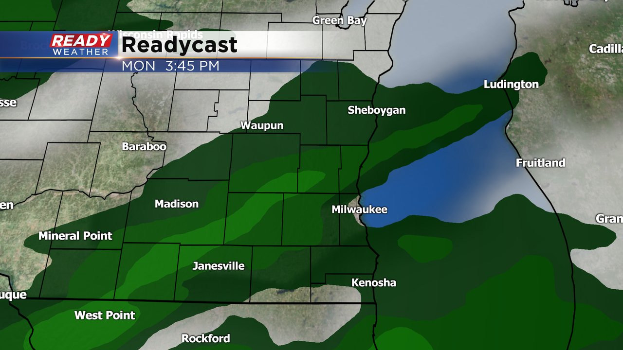
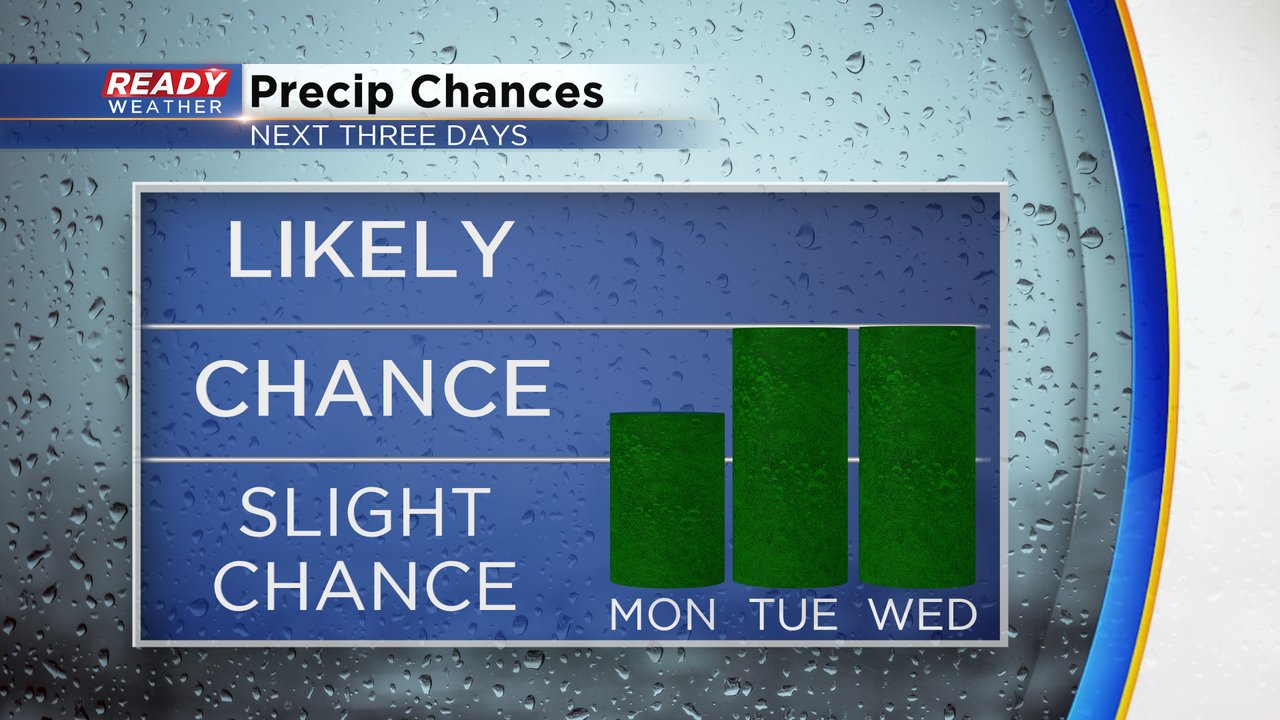
Persistent showers are expected in southeast Wisconsin the next few days. Almost every day this week has a chance for rain at least during part of the day. Those chances start Monday afternoon and early evening with some light scattered rain showers that could mix with a few snowflakes. Rain accumulation looks very light with less than a tenth of an inch for everyone and some staying dry. The best timing chance looks to be from 2-7 p.m.
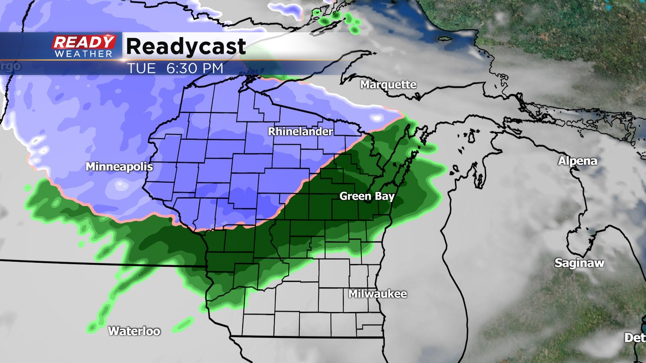
There's another chance for scattered showers in southeast Wisconsin Tuesday afternoon and evening. The precipitation should stay all rain here, but northern Wisconsin has a good chance at a few inches of snow.
We do it all again Wednesday with a chance for showers during the evening that lasts into Thursday morning. There's another rain chance on Friday.
Download the CBS 58 Ready Weather app to track the rain with the interactive radar.