One of the wettest months on record only has light rain chances the next week


So much focus this month has been on the rainfall. It's hard to believe that the first week of this August was bone dry and then we saw historic flooding. Rain totals for the month of August sit at 8.86" after another soaking rain this past Monday. Not only is that the second wettest August on record but it is also the nine wettest month on record in Milwaukee. The current wettest month is June 2008 when we had over a foot of rain that month. A few other recent years that saw flooding are on the list as well like July, 2010 and June, 1997.

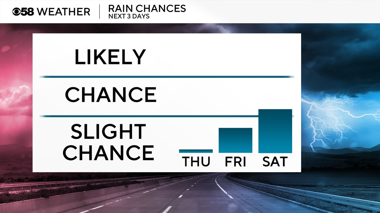
The rain chances stay fairly light and limited over the next week. The only real chance for rain we have right now is Friday night into Saturday morning when a few light showers will be possible.
A lot of the focus this August has been on the rainfall but it's also been a bit of a warm month. Through the first three weeks of August the average temperature is 73.1 degrees which is warm enough to go down as tied for the 26th warmest August to date.

We will likely fall in the rankings over the next week as we get a blast of cooler air, especially next week when highs struggle to get out of the 60s in some areas.
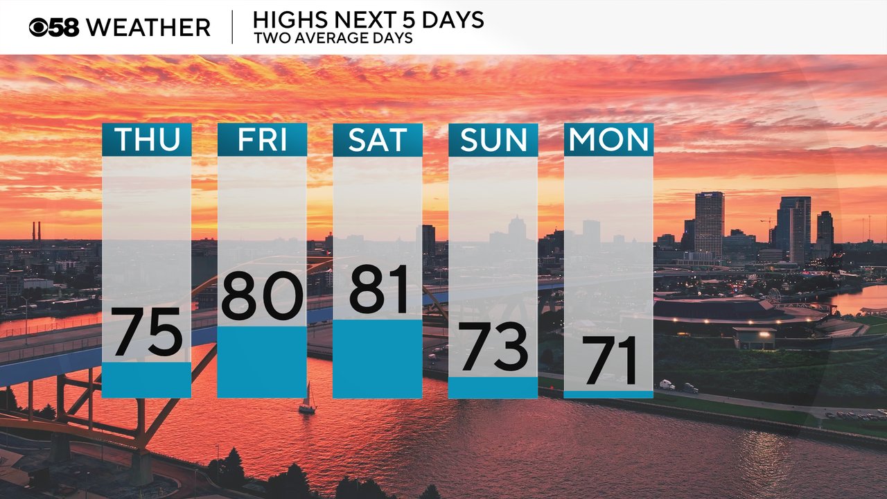
Even though the temps are around or below average over the next few days, the humidity levels stay elevated. At least some noticeable humidity is expected Thursday, Friday and Saturday with dew points hanging out in the lower half of the 60s. A drop in humidity is expected starting Sunday.

Download the CBS 58 Weather app to track the temps and rain chances for the next week and see how long we stay cool.