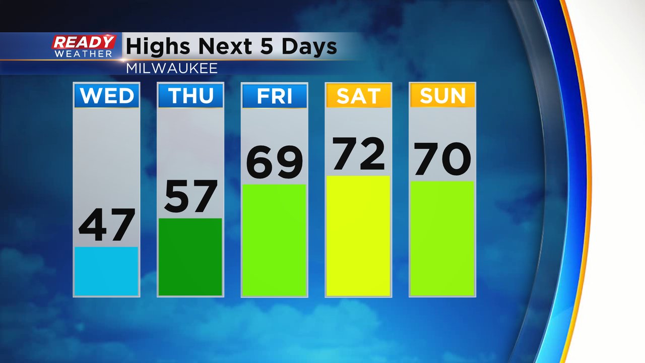
One more chilly day this week before temps go on a warming trend


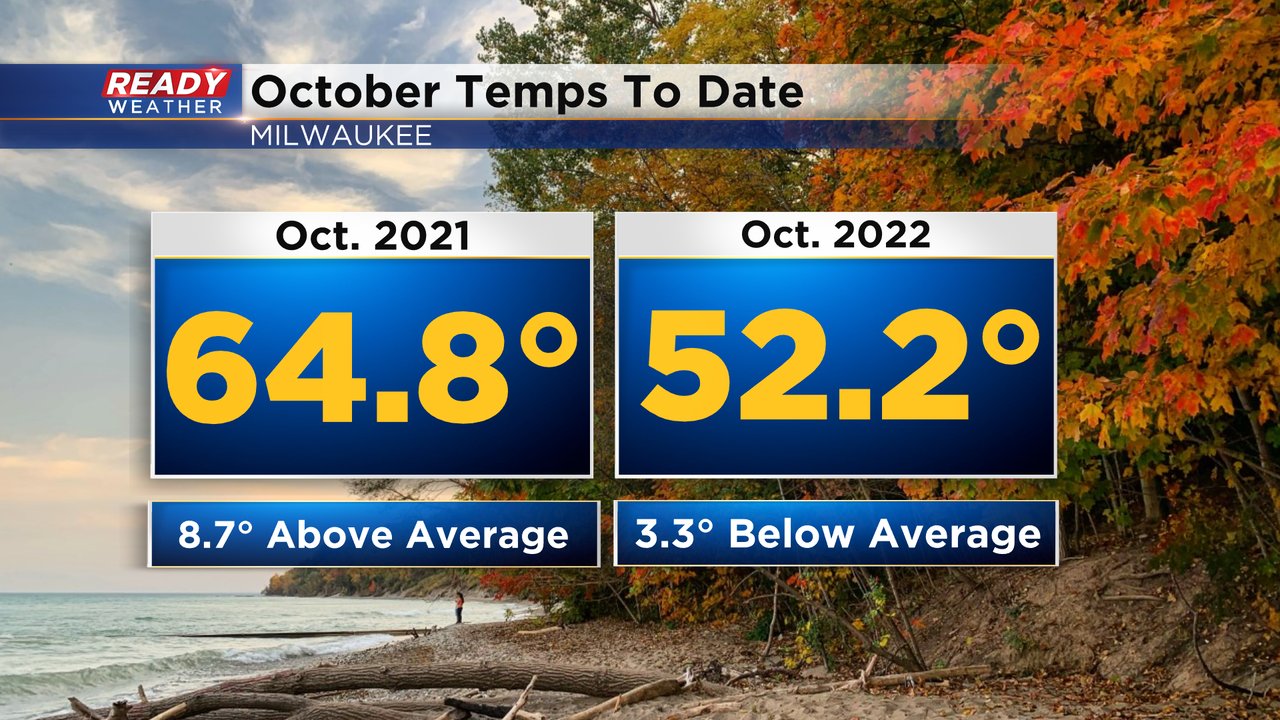
It's been a chilly week and overall cool month in southeast Wisconsin. Temps at this point in October have been running 3.3° below normal, which is a big change from last year when temps were nearly 9° above normal! You may remember last October was our warmest on record.
It'll still be on the cooler side today, but we'll have a lot more sunshine than earlier this week and the wind won't be as strong. Thursday is the transition day before temps return to the upper 60s to low 70 Friday and into the weekend!
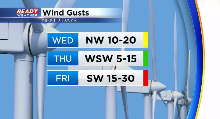
NW wind will still gust to 20 mph from time to time today but will be much lighter on Thursday. Wind becomes breezy again on Friday, but that will help boost temps close to 70.
Dry weather will continue for the rest of the week, so a good stretch to get outside and do yardwork or your favorite fall activities! Download the CBS 58 Ready Weather App to see when we'll have our next chance of rain.