One more chilly day before temps go on a warming trend


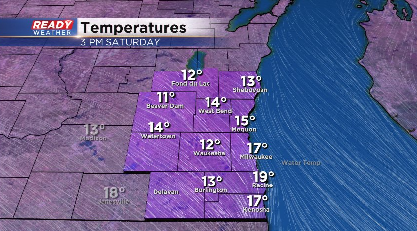
After a relatively warmer week with highs in the 40s 4 days this week, it's been a rather chilly day with temps only in the single digits to teens.
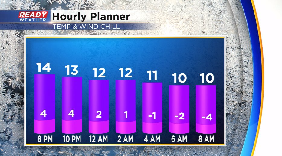
It'll be another chilly night tonight with lows dropping into the single digits, but the wind won't be as breezy as last night so wind chills only drop into the single digits below zero by Sunday morning.
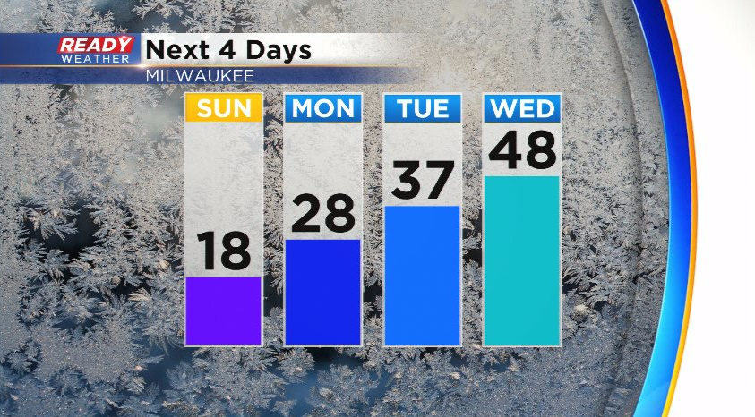
Temps will remain chilly again on Sunday, only topping out in the teens, but we'll warm back into the 20s on Monday, mid 30s Tuesday, and well into the 40s on Wednesday thanks to breezy southerly winds
Before we get to enjoy some warmth, we'll have a couple of flurry and light snow shower chances over the next 36 hours. More clouds roll in late tonight with a chance for a few flurries early Sunday morning.
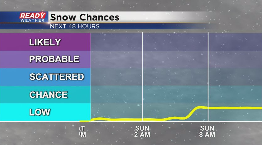
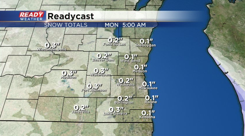
More sunshine will develop Sunday afternoon, but another clipper will track through Sunday night into Monday morning, bringing a slightly better chance for a few snow showers.
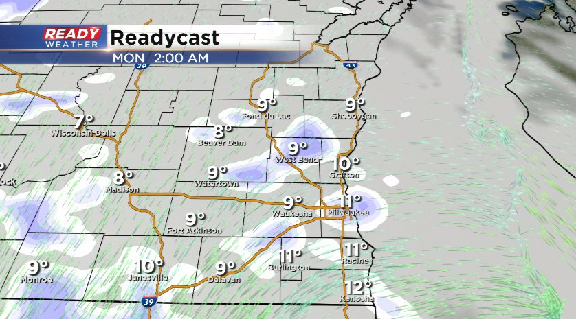
This snow will be falling apart as it moves into SE WI thanks to dry air, so no more than a dusting is expected here or there, but it could make for some patchy slick spots Monday morning.
We're keeping our eye on a potentially stronger system for Wednesday - Thursday, but there is a ton of uncertainty in strength and track of the system. Right snow it looks like we could have a period of rain on Wednesday, changing to snow Wednesday night into Thursday. Download the CBS 58 Ready Weather app to keep up with the forecast.