One more chance for rain and snow before weekend warm-up


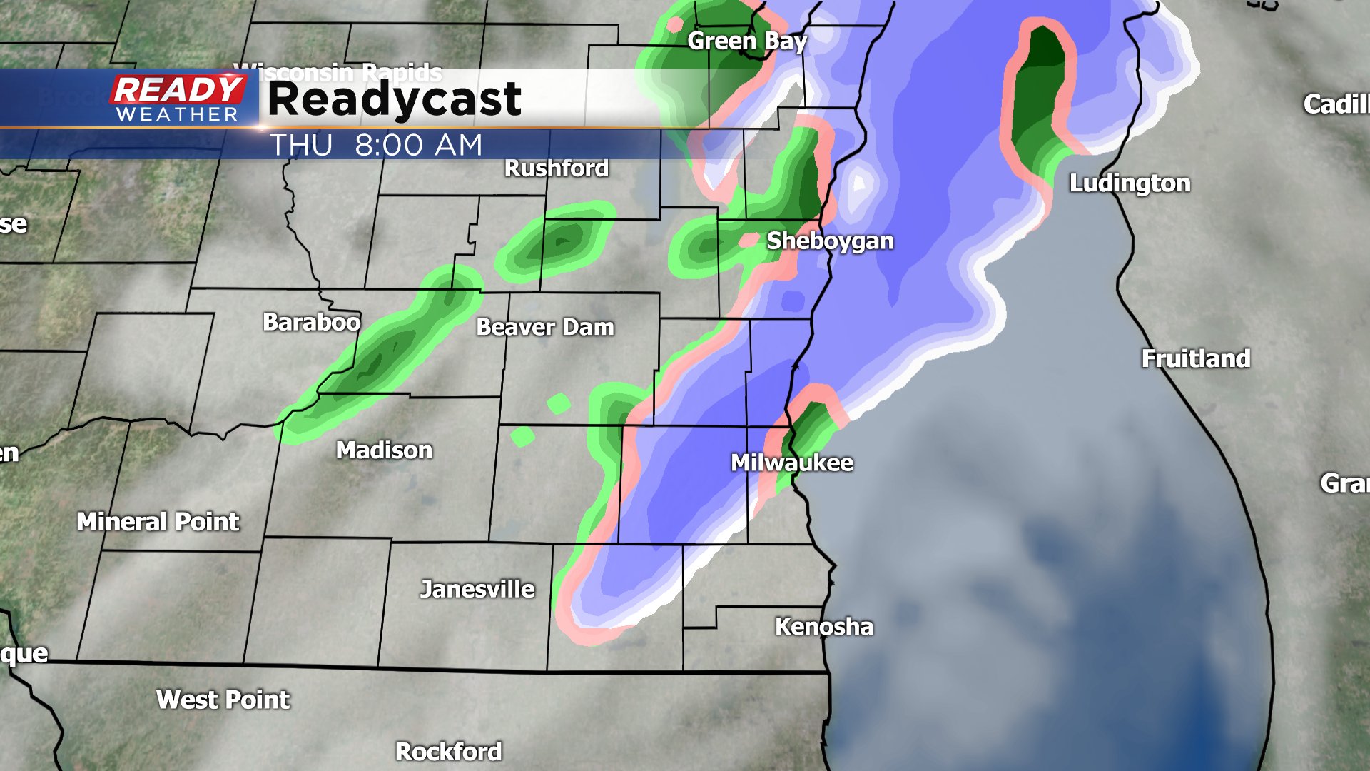
If you live in our southern communities like Lake Geneva, Racine, and Kenosha you may have seen a little light snow and rain early Wednesday morning but that ended by 6 a.m. Expect some really nice sunshine the rest of Wednesday but clouds return Wednesday night ahead of another mix chance Thursday. Some light rain and snow showers will be possible off and on Thursday in the morning, afternoon and evening.
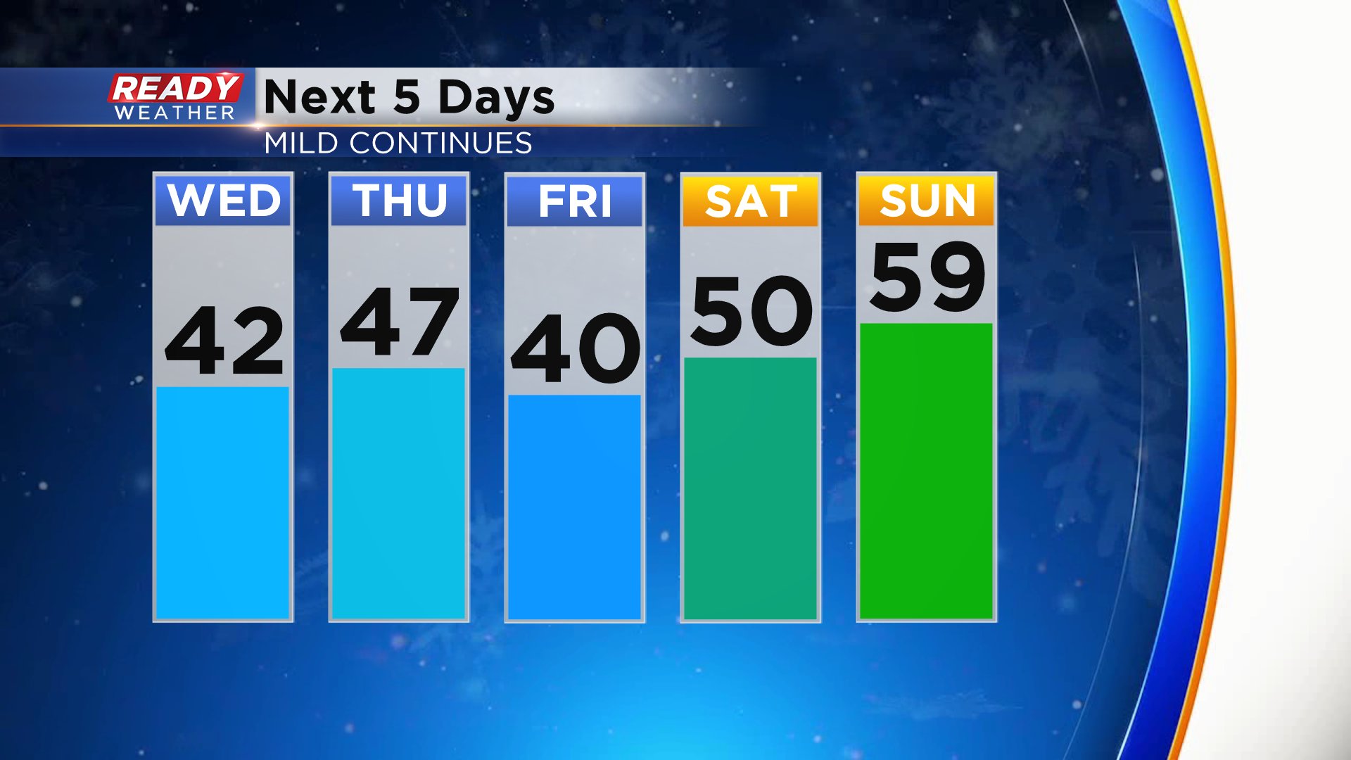
Despite some wintry mix we stay above average in the 40s through the end of the work week but then we are in store for a really nice warm up. Temperatures start at 40° Friday then warm to 50° and near 60° on Sunday which would make it even warmer than last Sunday which was glorious.
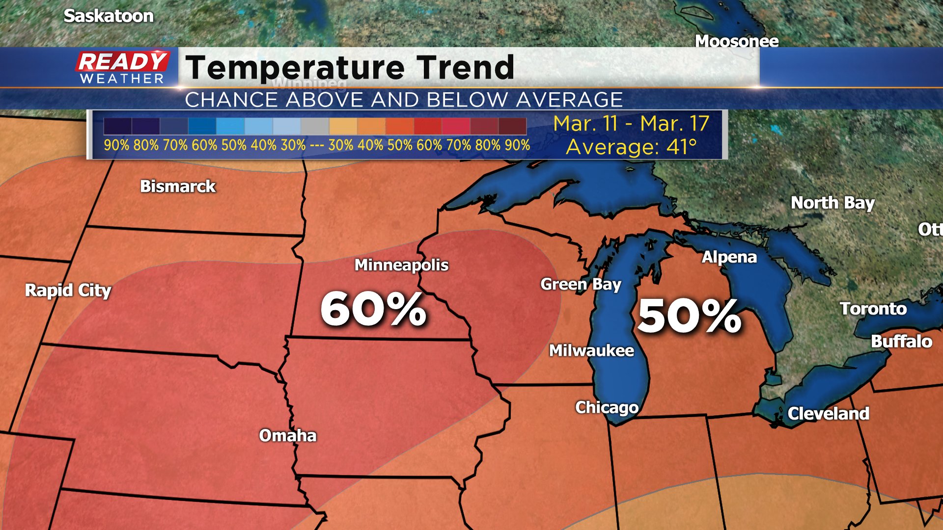
If you've enjoyed our mild stretch of weather then good because it looks to continue through at least the middle of March with a 50-60% chance for above-average temperatures through March 17.
Download the CBS 58 Ready Weather app to track the temperatures in the 10-day.