One day of relief before the heat and humidity return; storm chances continue


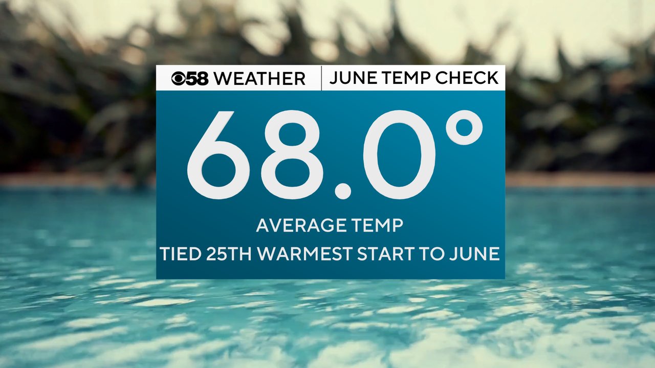
It's not surprise that this June is one of the warmest starts to the month on record after seeing three days in a row hit 94. Right now the average temperature for the month is 68 degrees which is tied for the 25th warmest start to June on record.
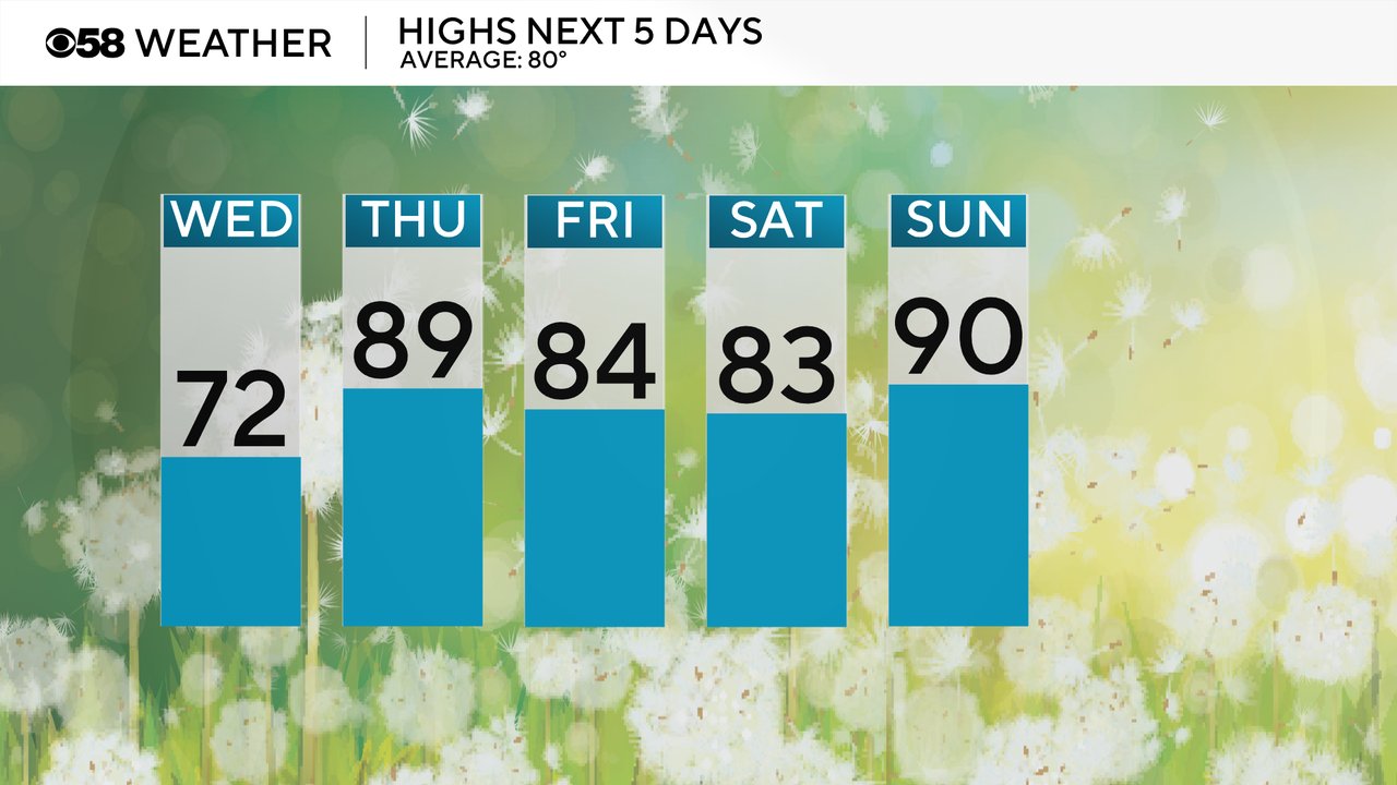
Wednesday is your day of relief! Thanks to cooler air that's been rolling in, a lake breeze and clouds with some rain showers, highs will struggle to hit 70 in some lakeside communities and inland areas will stay cool in the mid 70s. The heat returns the rest of the week into the weekend with Thursday and Sunday potentially reaching 90!
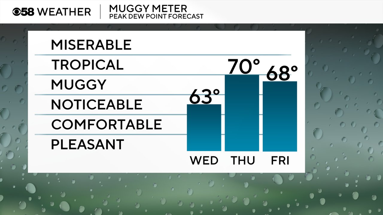
Humidity is similar with very low dew points in the low 60s and barely noticeable humidity Wednesday then becoming much more muggy with near tropical-level humidity returning for the end of the work week into the weekend.
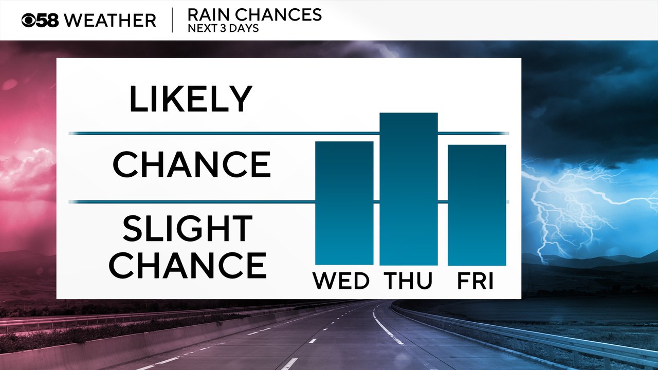
When it comes to rain chances. There is still the possibility for showers and storms on Wednesday, but some areas could stay totally dry. We already had a few downpours across parts of the Milwaukee Metro early Wednesday with a few more isolated showers or storms the rest of the day. Thursday has a better chance for rain, especially in the afternoon and evening, and a few more showers and storms are possible Friday.
Download the CBS 58 Weather app to track any rain on Wednesday and get outside and enjoy the cool air!