Off and on light rain and snow showers continue through Friday


After a warmer day with peeks of sunshine on Wednesday, the cool and cloudy conditions have returned along with a mix sleet, graupel (snow pellets), and rain showers.
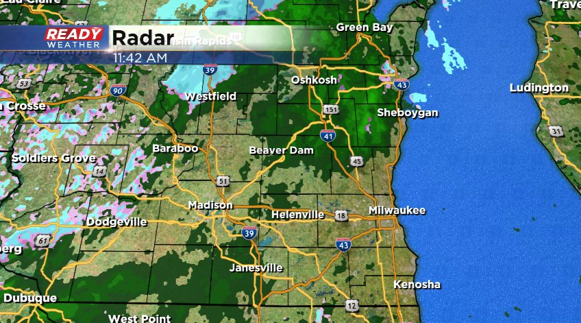
This mix will transition to primarily rain showers through this afternoon and become more numerous. The showers will remain light and be an annoyance more than anything.
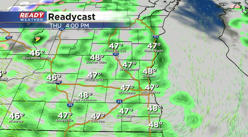
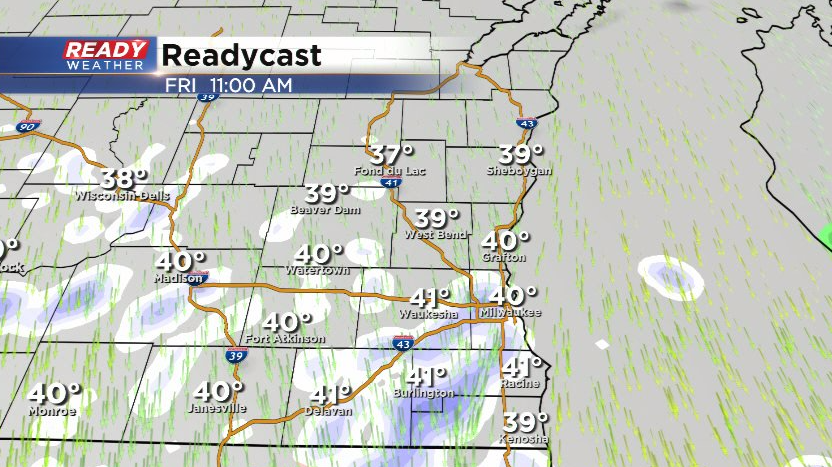
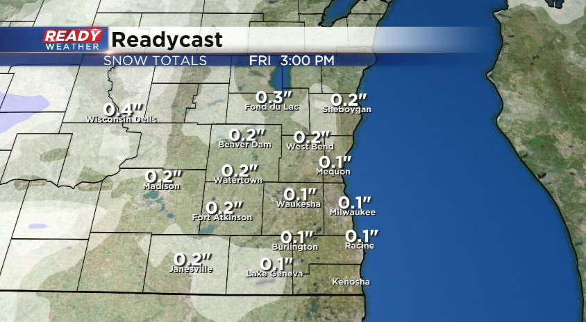
Showers will decrease in coverage this evening and become more isolated into tonight. Colder air will wrap in tonight into Friday, leading to wet snow showers on Friday. Some rain will mix with the snow at times as temps rise well above freezing.
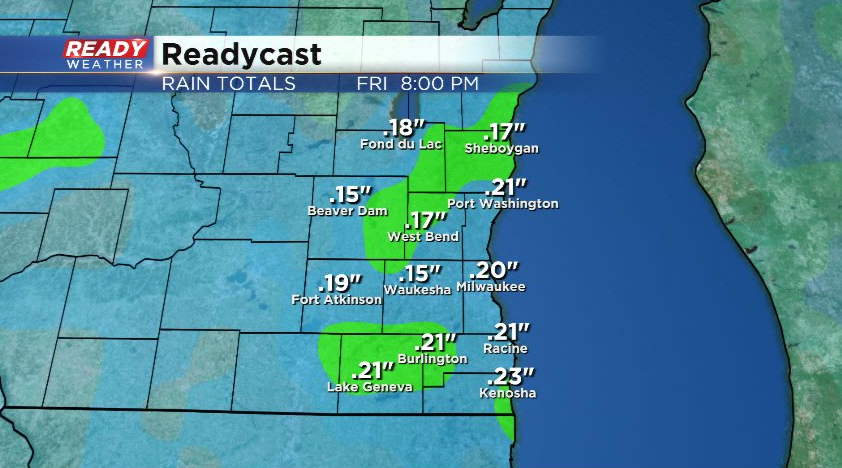
Rain and snow showers taper off Friday evening with dry weather moving in for most of the weekend. An additional .10-.25" of precipitation is expected through Friday evening, so nothing heavy.
There also could be a coating of wet snow on the grass in spots on Friday. This will only create wet roads as temps will be either side of 40 degrees. Any snow that is able to accumulate will melt pretty quickly.
While we're all sick of this cloudy, soggy weather pattern we've been stuck in the last few weeks, it's brought us beneficial rainfall! The latest drought update shows that Racine and Kenosha are no longer under a severe drought for the first time since last May!
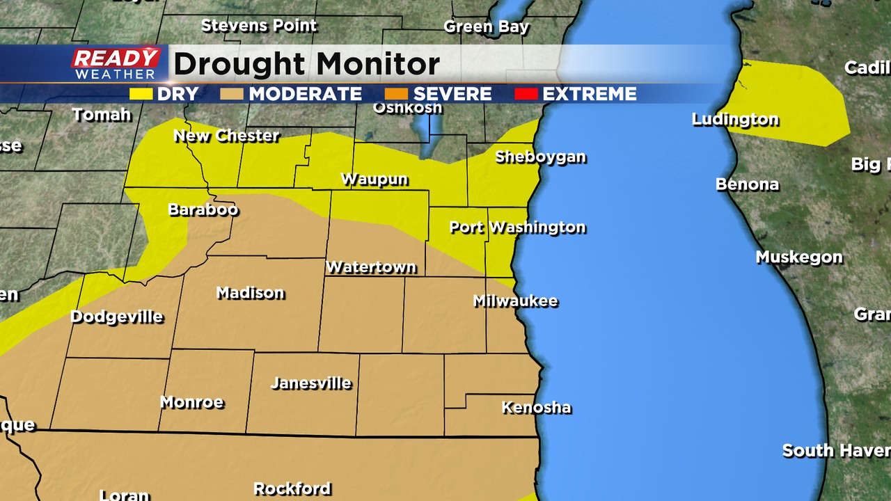
The soggy weather has also eliminated the moderate drought in Fond du Lac, Sheboygan, Ozaukee, Washington, and northern Dodge counties. While we dry out for most of the weekend, a few showers and storms are possible next week. Download the CBS 58 Ready Weather App to see the full 7 day forecast.