


Thursday is our one completely dry day this week and it comes with plenty of sun and cold temperatures. The sunshine quickly turns to clouds Friday morning and those clouds bring our next chance for snow by Friday evening.
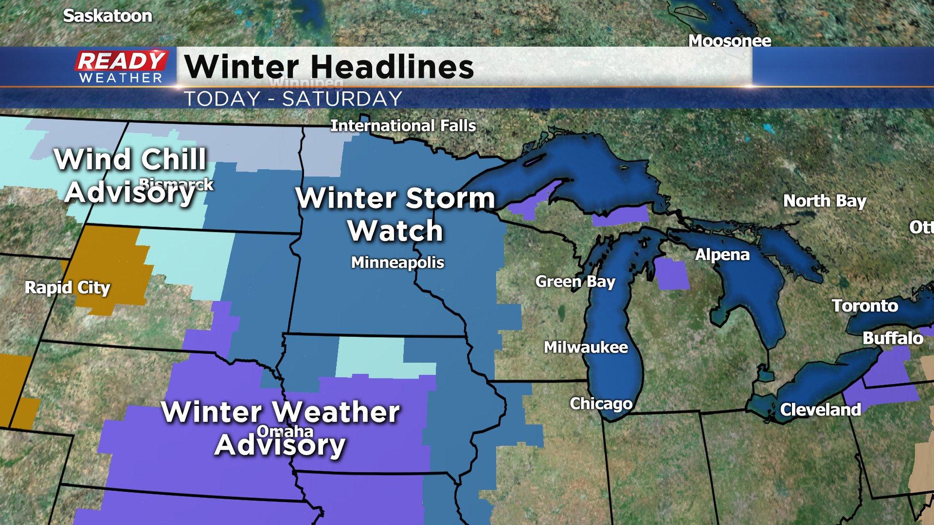
Winter storm watches and winter weather advisories have been issued to our west for the upcoming storm but southeast Wisconsin is not currently under any weather headlines. An advisory is looking likely for most of the area and will likely be issued Thursday afternoon.
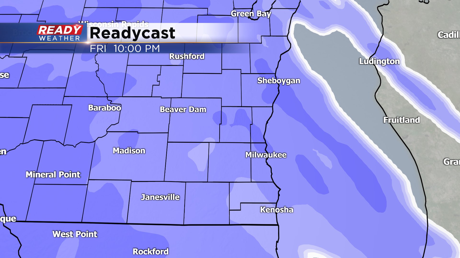
The Friday evening commute may be mostly spared but some snow flakes could start falling as early as 3 p.m. The heaviest of the snow and the bulk of the accumulating snow will fall Friday evening through early Saturday morning. The one question is the forecast is how much mix we see Saturday morning. Some may switch over to all rain, others could have a mix of rain, snow and freezing rain.
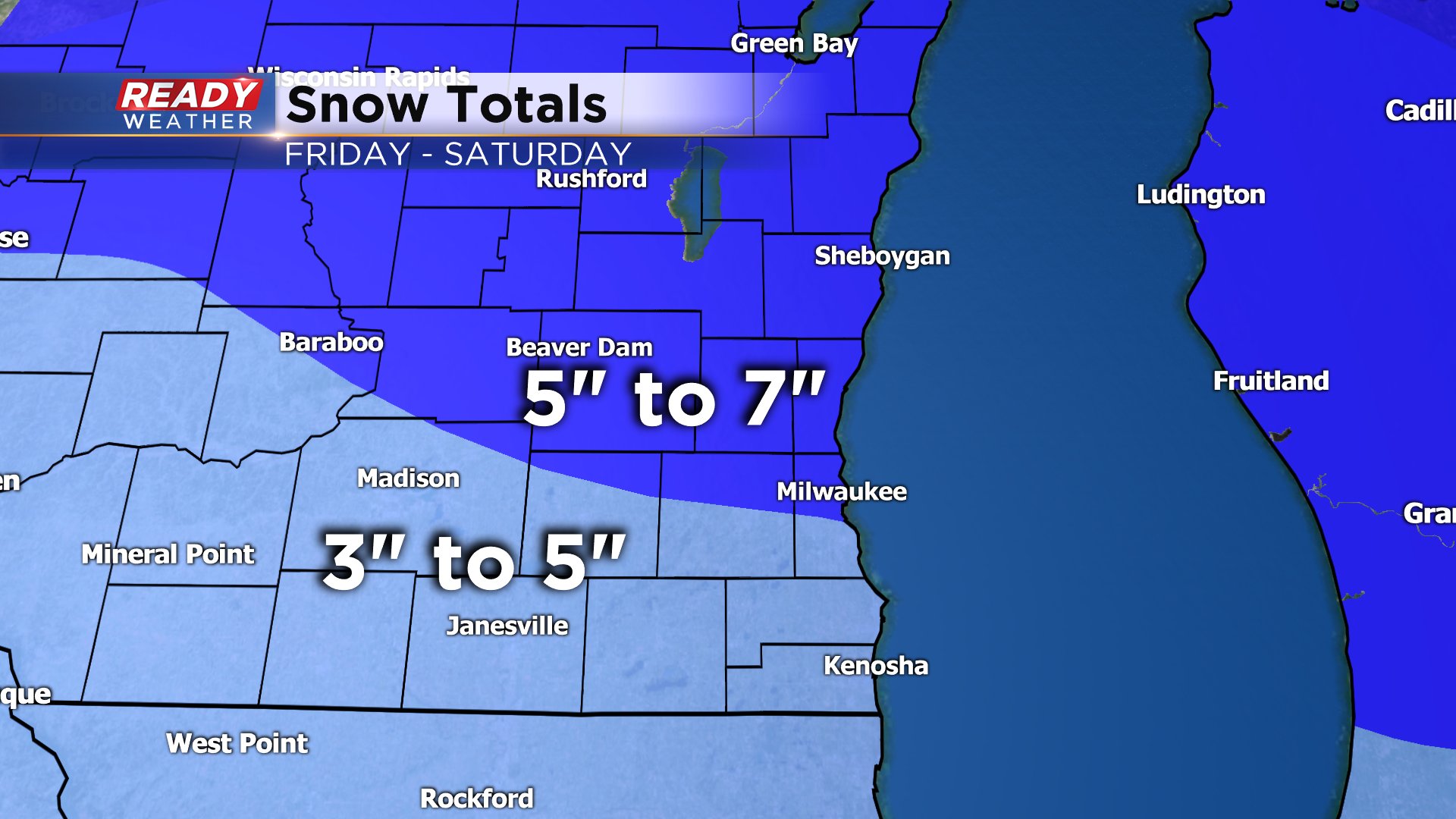
By late Saturday morning into the afternoon the mix switches back to light snow with some additional light accumulation. All in all there is pretty good agreement among weather models on how much snow we are expecting. There's not a wide range with most of the area seeing 4-6". A few southern spots may get a touch less and northern areas could see a bit more.
Download the CBS 58 Ready Weather app to track the upcoming storm.